HOT Tech Product Suite
We develop open-source products, to address ecosystem gaps in the use of geospatial technology in humanitarian projects.
.jpg)
Tasking Manager
The HOT Tasking Manager is a mapping tool designed and built for the Humanitarian OpenStreetMap Team’s collaborative mapping process in OpenStreetMap. Contribute to OSM collaboratively with the global open mapping community using the Tasking Manager.
Learn More
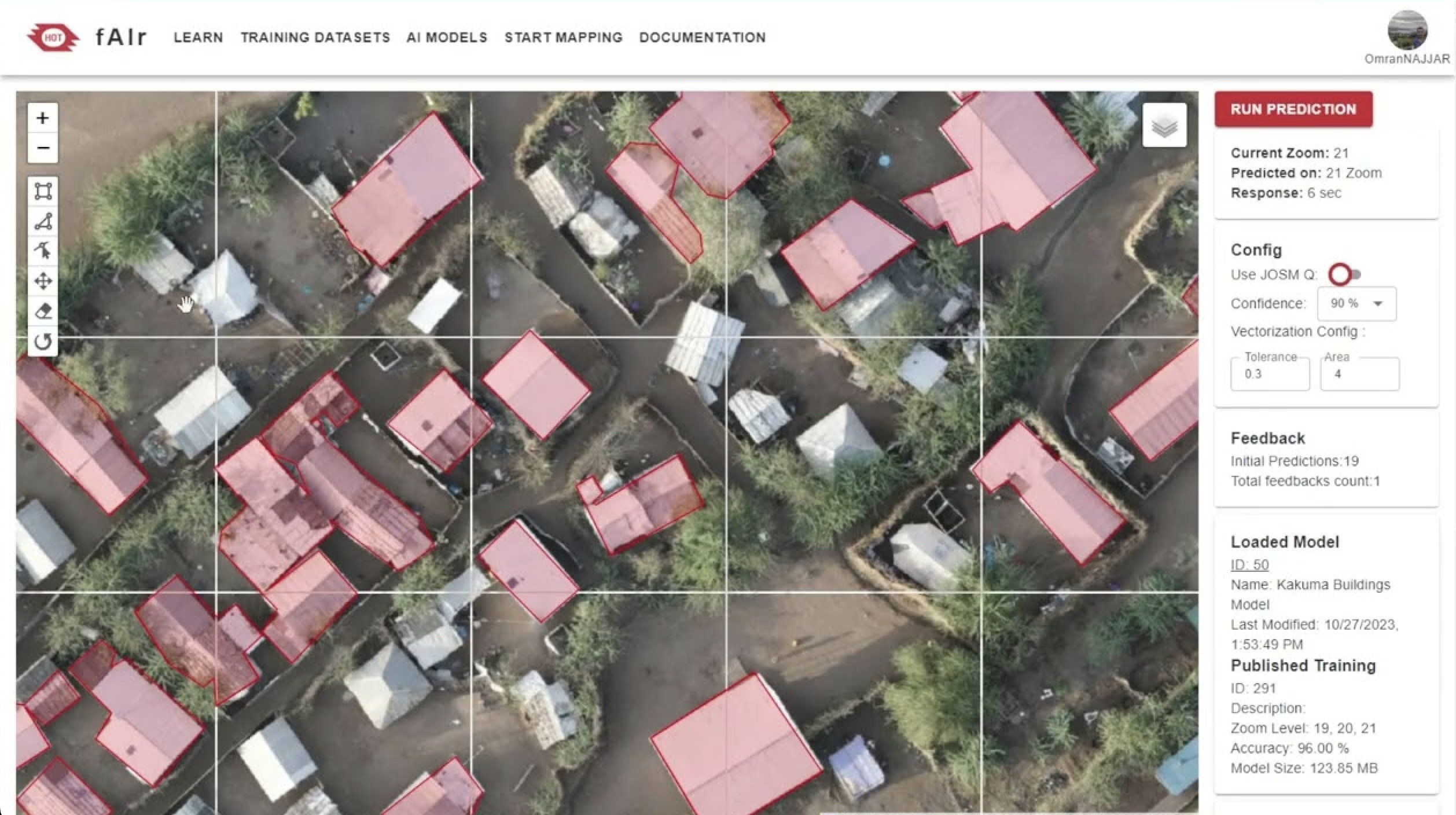
fAIr
fAIr is an open AI-assisted mapping service developed by the Humanitarian OpenStreetMap Team (HOT) that aims to improve the efficiency and accuracy of mapping efforts for humanitarian purposes.
Learn More
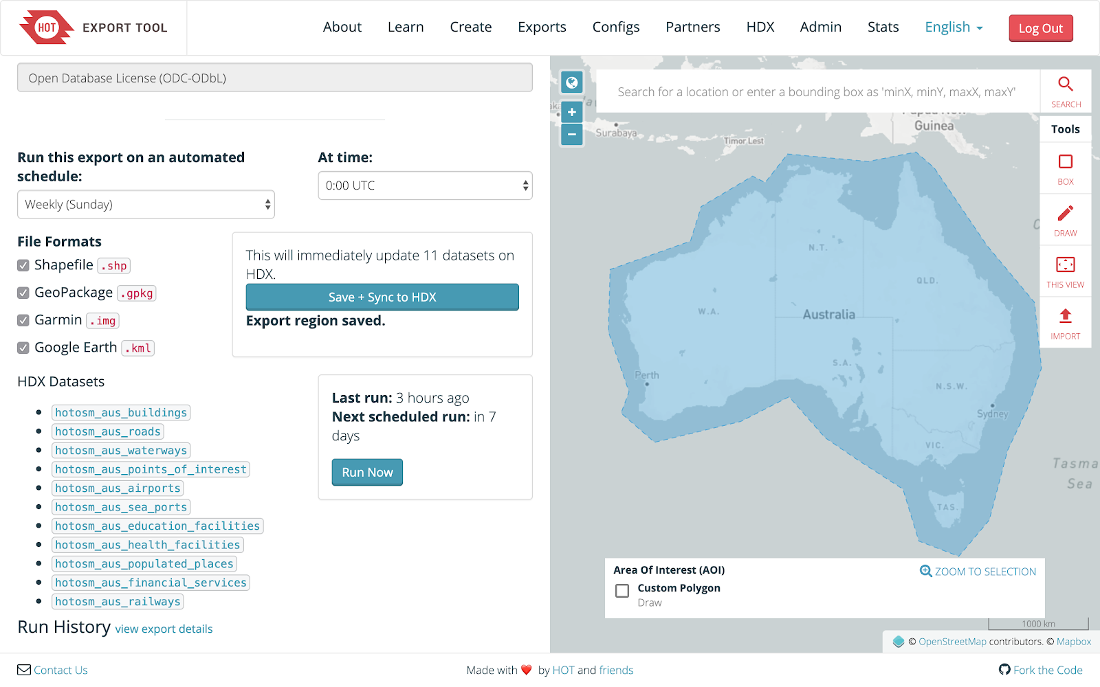
HOT Export Tool
The HOT Export Tool is an open service that creates customized extracts of up-to-date OSM data in various file formats, such as ESRI shapefiles (.shapefile), google KML (.kml), GeoPackage (.gpkg) dan MBTiles (.mbtiles).
Learn More

Open Aerial Map (OAM)
OpenAerialMap is an open service to provide access to a commons of openly licensed imagery and map layer services. Download or contribute imagery to the growing commons of openly licensed imagery.
Learn More
Field Mapping Tasking Manager (FMTM)
The FMTM is a standalone mobile and web application that works using OpenDataKit (ODK), a powerful data collection platform that leverages commonly-available mobile Android devices to enable people to input information including geospatial data in the field.