



Regional Macro-Mapathon in Latin America 2026
June 24, 2026, 3 a.m. UTC – July 31, 2026, 10:59 a.m. UTC
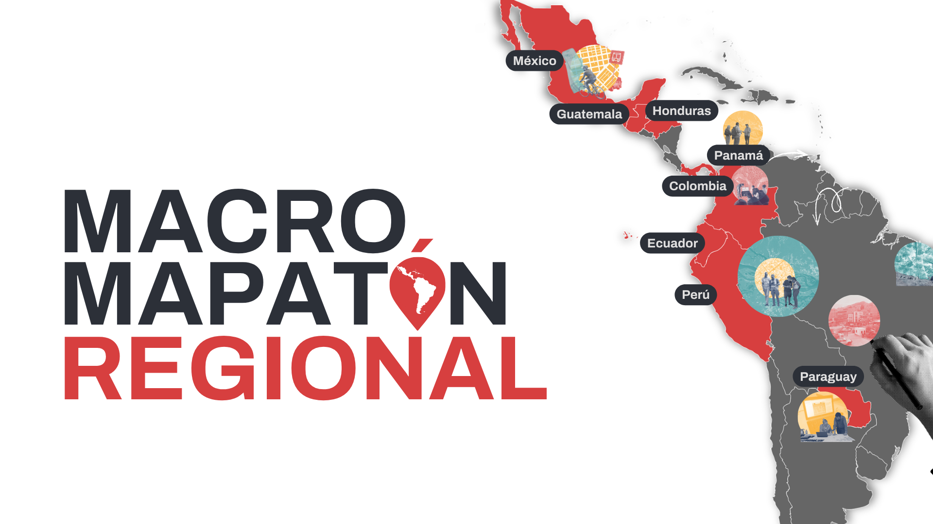
8 countries. One map. A more resilient region.
For decades, millions of people across Latin America have lived in invisible territories -- settlements with no name on official maps, unmapped watersheds, critical infrastructure that exists nowhere in any database. When disaster strikes, that invisibility costs lives.
The 2026 Regional Macro-Mapathon is the collective response to that gap. Built on four years of Anticipatory National Mapathons (MANA) led by HOT's Latin America and the Caribbean Hub, this edition scales the model to a continental level: eight countries, one shared mapping window, a growing network of communities, institutions, and volunteers placing data where there was none before.
The challenge
Colombia, Ecuador, Guatemala, Honduras, Mexico, Panama, Paraguay, and Peru share a common reality: vast rural areas and marginalized urban communities remain absent from detailed maps. That absence isn't a technical problem, it's a political one. It perpetuates exclusion from basic services, delays humanitarian assistance, and leaves local governments without the evidence they need to plan.
The 2026 Macro-Mapathon targets that gap directly.
How it works
From June 23 to July 31, 2026, mapping communities, universities, youth collectives, and disaster risk management institutions across the eight countries will organize around coordinated tasks in OpenStreetMap. Using proven methodologies that combine satellite imagery, Earth observation, and community fieldwork, every contribution feeds an open, freely accessible, and reusable cartographic base. No prior experience needed. Just the will to map.
You can participate in two tracks: beginner mapper or intermediate/advanced mapper.
There is an open registration link for each of the eight participating countries. If you are from Colombia, Ecuador, Guatemala, Honduras, Mexico, Panama, Paraguay, or Peru, join your country's team. If you are anywhere else in the world, there is still a spot for you on the pitch: sign up for the Rest of the World team.
Beginner mapper
If this is your first time or you have basic OSM experience, this is your entry point. You will learn to digitize roads and buildings from satellite imagery in live sessions, and contribute directly to projects across all eight countries: 🇨🇴 Colombia, 🇪🇨 Ecuador, 🇬🇹 Guatemala, 🇭🇳 Honduras, 🇲🇽 Mexico, 🇵🇦 Panama, 🇵🇾 Paraguay, 🇵🇪 Peru, and 🌎 Rest of the World (open to any country not listed).
Find the registration link for your country or for the Rest of the World team below.
Intermediate/Advanced mapper
If you already have solid OSM experience and are comfortable with tools like JOSM or iD Editor, your role goes further: mapping special projects, guiding beginners, and ensuring data meets the quality standards that humanitarian teams need. Contribute directly by registering for your country: 🇨🇴 Colombia, 🇪🇨 Ecuador, 🇬🇹 Guatemala, 🇭🇳 Honduras, 🇲🇽 Mexico, 🇵🇦 Panama, 🇵🇾 Paraguay, 🇵🇪 Peru, and 🌎 Rest of the World.
Find the registration link for your country or for the Rest of the World team below.
The game we have to win
The World Cup is just around the corner, and so is your chance to play for your country's team. This mapathon runs in that same spirit: eight national squads, one regional goal, and a leaderboard that tracks every building mapped, every road confirmed, every neighborhood added to the open map.
Can't find your country on the list? No problem. There's also a Rest of the World squad open to mappers from everywhere else who want to join the effort and compete alongside the Latin American teams.
Weekly challenges, quality recognitions, and live sessions twice a week will keep the competition alive, but the real prize is collective. Latin America is building the data infrastructure it needs to anticipate climate disasters, and every contribution moves that goal forward.
Put on your jersey. The region needs you on the field.
Why it matters
The data generated through this mapathon doesn't go to an institutional repository to collect dust. It feeds directly into early warning systems, humanitarian response teams, and local governments making decisions about where to build, where to evacuate, who needs help first. Every building traced, every road confirmed, every neighborhood recorded in OpenStreetMap is a piece of public digital infrastructure that communities build for themselves.What you'll earn
Earn a UN Volunteers participation certificate
Everyone who completes a contribution of 500 mapped elements will receive an official certificate co-signed by UN Volunteers and HOT, a credential that reflects your commitment to humanitarian action and open data. There will also be prizes for the highest-quality mappers!
The map of Latin America is being written by all of us. Join the 2026 Regional Macro-Mapathon and help ensure no territory stays invisible.
Resources
- LATAM Macro-Mapathon OSM Wiki
- Q&A (coming soon)
Partners
Co-organizers
Regional / International Partners
Colombia
Ecuador
Guatemala

Honduras
México
Paraguay
Peru

Incentive Sponsors

Share




