


Flying from Freetown to Waterloo - The increasing value of community drone mapping in Sierra Leone
Posted by Pete Masters, Melodee Okigbo • Nov. 6, 2026
Laying the foundation for a sustainable model
When the Humanitarian OpenStreetMap Team (HOT) and its partners set out to map Freetown using community-operated drones, we were attempting something unprecedented for our organisation: producing a single, consistent, five-centimetre-resolution aerial imagery layer covering an entire city.
The results were remarkable. Local drone pilots captured imagery covering 85 km² of Sierra Leone's capital, at a field acquisition cost of approximately $35,000, or $412 per km². The project, funded by BMZ, demonstrated that community mapping, using consumer-grade drones, could deliver high-quality, city-scale imagery and at a fraction of the cost it typically would.
Zooming out of the aerial map of Freetown city.
But Freetown was also an investment. It required equipment, training, experimentation, operational systems, and, critically, the deployment of specialists to develop a local team equipped to deliver the work.
The real test of that investment would come when the local team had to do it on their own and teach others how to do it as well.
Waterloo: the economics of flying a second city
In 2026, OpenStreetMap Sierra Leone, working with CODOHSAPA, the Federation of Urban and Rural Poor, and HOT, deployed that same capacity to Waterloo, a rapidly growing city near Freetown.
Umap of Waterloo's open drone imagery
This time, the team acquired imagery covering 43 km² for a total cost of just over $10,000.
The cost comparison
| Freetown | Waterloo | |
|---|---|---|
| Area mapped | 85 km² | 43 km² |
| Approx. cost | $35,000 | $10,030 |
| Cot per km² | $412 | ~$233 |
That's a reduction of roughly 40% in the cost per square kilometre.
What made Waterloo cheaper?
The most obvious saving was that the team didn't need to start from scratch. The drones and other equipment purchased for Freetown were already available. There was no need to deploy international personnel to teach, and the experienced local crew could begin flying immediately rather than undertaking another lengthy initial training programme.
But the improvements went further.
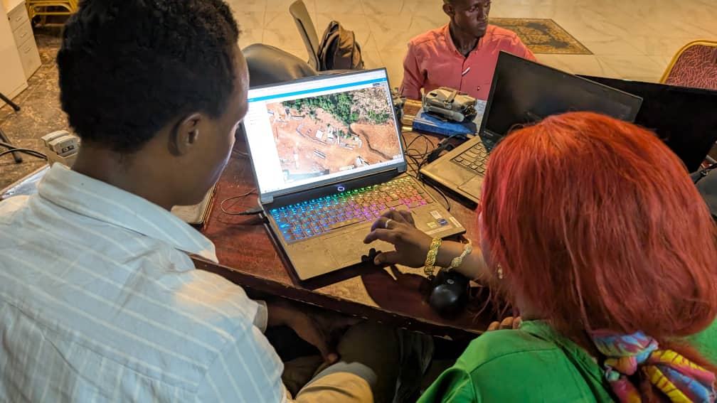
Training became part of delivery. Five members of the original Freetown crew helped train approximately ten new pilots, including personnel from Waterloo's security and disaster management institutions and four residents of informal settlements from Waterloo. Experienced operators worked alongside learners, building capacity without a separate, costly training phase.
The original Freetown Open Drone Crew
Flight operations became more efficient. Rather than allowing pilots to select flight areas independently, which can lead to duplication, a structured allocation system was introduced, with teams assigned consecutive grids and given maps that showed them where it covered. Members of the Freetown crew shared with the new pilots techniques for resuming interrupted flights from the last successfully completed waypoint, to avoid having to start from the beginning.
Infrastructure costs became more productive. In Freetown, the team had paid for temporary access to reliable internet to upload imagery. In Waterloo, a relatively modest investment in Starlink equipment and connectivity provided a reusable alternative.
Some savings also came from reduced project management costs. However, equipment still needs maintenance and eventual replacement. These are real costs that must be accounted for as the model scales.
Nevertheless, the overall picture is clear: the investment made in Freetown continued delivering value in Waterloo, without having to be repeated in full.
The next city should be cheaper still
With support from the Judith Neilson Foundation, HOT's Scaling Open Drone Crews project aims to take this model further, expanding community-led drone mapping capacity while continuing to reduce the costs of producing high-quality imagery.
Together with the CODOHSAPA team, we already have plans for the next deployment in Bo, Sierra Leone.
One priority is to reduce reliance on external surveyors by equipping local teams to collect their own ground control points. Another is to digitise flight planning, safety checklists, and reporting using tools such as the Field Mapping Tasking Manager and QField.
Better integration of quality assurance into field operations could also reduce the need for costly return visits and repeat flights. We want pilots to capture more consistent flight records, weather information, and quality-control data without making their work unnecessarily complicated.
These may sound like incremental improvements. But across thousands of flights, small efficiencies accumulate.
Freetown demonstrated that city-scale, community-led drone mapping was possible. Waterloo demonstrated that the second deployment could be substantially cheaper while building more local capacity.
The ambition now is to make each successive deployment more efficient than the last, and to turn an initial investment in a small group of people, equipment and expertise, into a sustainable local service that increasingly benefits all.
Share