



Open Data for Community-Based and Anticipatory Risk Management in Colombia
Posted by Thalía Alondra Peña Hernández • Oct. 2, 2026
Colombia is one of the most biodiverse countries on the planet. This geographic richness also exposes communities to hazards such as floods, landslides, and wildfires. In many rural and hard-to-reach areas, geospatial information is limited or nonexistent, which makes planning and anticipatory risk management more difficult.
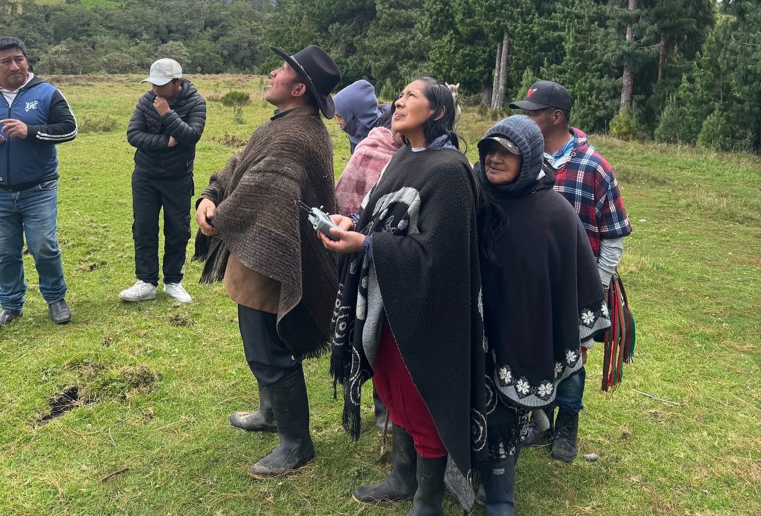
Community members gather in a highland meadow to follow a drone flight during a workshop. A participant holds the remote controller while others watch the drone overhead, learning how aerial imagery can help them identify risks in their territory. Credits: Humanitarian OpenStreetMap Team (HOT). Source: Flickr
In response to this situation, the Humanitarian OpenStreetMap Team (HOT), in partnership with the Sub-directorate for Risk Knowledge and the Community Maps Project of Colombia's National Unit for Disaster Risk Management (UNGRD), and with support from Twilio, implemented the project Open Data for Community-Based and Anticipatory Risk Management in Colombia, aimed at strengthening local capacities through open mapping and accessible technologies. The initiative built on previous joint work through mapathons and earlier experiences with ChatMap.
Between 2024 and 2026, the project prioritized nine territories: Tarapacá (Amazonas), San Juan del Cesar (La Guajira), Sonsón and Cáceres (Antioquia), El Castillo and Puerto Rico (Meta), Paletará (Cauca), Medio Atrato (Chocó), and Colón (Putumayo). Nine workshops were held with 145 participants from communities, local authorities, Indigenous organizations, educational institutions, fire departments, and civil society. Field implementation was led by Bryan Daza, Fabián Montejo, and Angie Trujillo.
Through participatory workshops, field walks, and hands-on activities, participants learned to use tools such as OpenStreetMap, ChatMap, uMap, Mapillary, OpenAerialMap, and Drone Tasking Manager to generate useful geospatial information about their own territories. Beyond producing maps, the project sought to strengthen local capacities so that communities can continue documenting, updating, and using open data to support their risk management processes.
From local knowledge to open data

A workshop participant examines a drone up close before planning flights with Drone Tasking Manager. Hands-on practice helps communities build confidence to capture their own aerial imagery for risk monitoring. Credits: Humanitarian OpenStreetMap Team (HOT). Source: Flickr
Each territory faces different challenges: in Tarapacá, rising waters of the Putumayo River; in Meta, recurrent flooding; in Cauca, the need for environmental monitoring; and in Medio Atrato and Colón, geographic conditions that hinder access to up-to-date information. Despite these differences, they all share the need for open geospatial information to make decisions before, during, and after an emergency.
Over four months, more than 35 institutions took part, including municipal governments, fire departments, Indigenous authorities, Community Action Boards (Juntas de Acción Comunal), educational institutions, and environmental organizations, helping to adapt the methodology to each community. The workshops applied HOT's End-to-End (E2E) methodology, using field walks for mapping in OpenStreetMap; drones and Drone Tasking Manager to plan flights and capture aerial imagery; OpenAerialMap to publish the resulting orthophotos; uMap to create visual thematic maps; Mapillary to document the territory at street level; and ChatMap to report real-time information from the community.
Isabella Yaguara, a resident of El Castillo, Meta, discovered during the drone flights how a branch of the river ran through her vereda (rural district).
Yesterday, thanks to the drones, I realized that a river channel runs through our vereda. With an image as wide as this one, we could better see where the overflow begins, which communities it affects, and where gabions could be built to stop the river from overflowing.

A participant reviews a thematic map created in uMap, with red markers placed over aerial imagery of her community. Visual maps like this help communities and local authorities identify priority areas before, during, and after an emergency. Credits: Humanitarian OpenStreetMap Team (HOT). Source: Flickr
Ongoing work after the workshops
HOT continues to provide support after the workshops through virtual meetings, WhatsApp, and technical assistance, so that the tools remain in use. In Tarapacá, the community monitors the Putumayo River with autonomous drone flights; in El Castillo, residents use ChatMap to record floods and at-risk households; in Puerto Rico, the Municipal Government and Fire Department continue practicing flights with Drone Tasking Manager; and in Paletará, the Indigenous Council (Cabildo Indígena) plans to use the tools to monitor the spectacled bear, bringing together mapping and conservation.

A participant explores ChatMap on her phone while taking notes on the tools covered in the workshop, including Mapillary and ChatMap. ChatMap allows communities to share real-time, geolocated reports directly from the field. Credits: Humanitarian OpenStreetMap Team (HOT). Source: Flickr
As Juan Melo from HOT summarizes, the real value lies in having an open, up-to-date database, accessible in real time, so that any actor, governmental or otherwise, can respond to the emergency when it is needed most.
The project's impact lies not in the maps themselves, but in communities' ability to keep generating useful information. Working across nine different territories showed that there is no one-size-fits-all formula: methodological flexibility and follow-up support are key for the tools to be adopted and owned locally. And when local knowledge is combined with open platforms, the result benefits both communities and risk management institutions.
Share




