



Technology, Open Data, and Ancestral Knowledge Transform Territorial Management in Bolivia, Colombia, and Guatemala
Posted by Juan Arellano Valdivia • Sept. 2, 2026
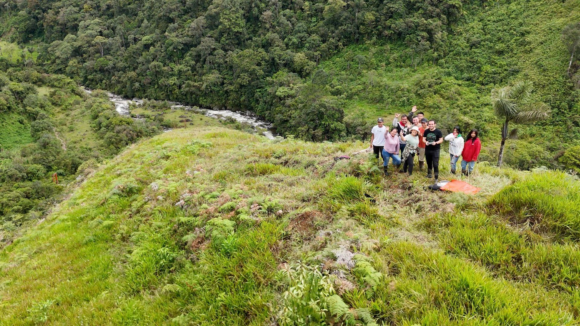
In the Andean-Amazonian and Mesoamerican regions, official maps have historically held deep silences: information gaps where water sources, sacred sites, and the real dynamics of land use do not appear.
This cartographic gap is not merely a technical shortcoming, but a critical constraint that restricts the autonomy of Indigenous peoples and prevents public institutions from designing effective responses to deforestation, fire prevention, and climate change adaptation.
To transform this reality, the project Participatory Mapping for a Sustainable Amazon brought together academia, civil society, and ancestral authorities in a transdisciplinary initiative funded by the Inter-American Institute for Global Change Research (IAI) through its Seed Fund (Fondo Semilla). Combining a dialogue of knowledges with freely accessible technologies such as OpenStreetMap, drones, and messaging-platform tools, communities have moved from being mere data providers to becoming the true protagonists and architects of their territorial cartography.
Fieldwork was led by Patricia Llanos of UMSA in Bolivia, Carlos Duarte of URL in Guatemala, and Leonardo Jimenez of UNAULA in Colombia, who also served as principal investigator. These three sites span diverse geographic and institutional realities, demonstrating the versatility of open cartography.
Bolivia (Sapecho, Palos Blancos Municipality)
Through joint work between the Indigenous Council of the Tacana People (CIPTA), the Universidad Mayor de San Andrés (UMSA), Mosetén and Tacana community members, SERNAP park rangers, and the Antofagasta firefighters of La Paz for emergencies, a comprehensive technical training process and fieldwork were carried out. After training and integration sessions among faculty, students, and local stakeholders, participants applied collaborative mapping tools and monitoring technologies in the field (such as DJI drones, OpenStreetMap, and ChatMap).
This made it possible to:
- Fill information gaps, by building a participatory fire-risk map that locates firebreaks, water sources, and critical areas absent from official cartography.
- Strengthen rapid response: it gives communities and fire brigades accessible digital tools to alert on and georeference heat sources in real time.
- Protect natural resources: it enables preventive planning to safeguard strategic water sources, biodiversity, and Indigenous peoples' territory against the threat of forest fires.

Participatory mapping for a sustainable Amazon (Bolivia)
Colombia (Wairari Atún Sacha Indigenous Council, Santa Rosa, Cauca)
In the Bota Caucana, gateway to the Andean Amazon, the team from Universidad Autónoma Latinoamericana (UNAULA) and the Humanitarian OpenStreetMap Team (HOT) accompanied the Inga people in the La Tarabita village.
Through territorial walkthroughs, mingas de la palabra (community word-gatherings), and drone flights, the community captured orthophotos and mapped community infrastructure, water sources, and areas threatened by illegal logging and mining. This process not only fed into OpenStreetMap and Mapillary but also gave the territory back a tool for visibility and enabled political positioning vis-à-vis the State.
The concrete result speaks for itself: more than 50 km of roads and trails added to OpenStreetMap, more than 100 points of interest georeferenced, and 15 young people trained as mappers, now able to sustain the process autonomously. But the most significant achievement was methodological: the community established a policy of differentiated information circulation, collectively deciding what gets published, what remains for internal use, and what is withheld entirely, sacred sites, watch points, and strategic routes never made it onto the public map.
With this foundation, the maps stopped being merely a technical record and became evidence for concrete territorial actions, including the land-titling request submitted to the National Land Agency.

The Wairari Atún Sacha Indigenous Council in Santa Rosa, Cauca, learning to fly a drone and use the Drone Tasking Manager to produce aerial imagery.
Guatemala (San José Poaquil, Chimaltenango)
Building on the trajectory of the earlier Open Cities project, Universidad Rafael Landívar and the firm Geotecnológica, in strategic alliance with the Sotzil Foundation, relaunched participatory mapping with the Indigenous Mayor's Office (Alcaldía Indígena) and the Ancestral Cofradía. Focusing on the management of the communal forest in the northern part of the municipality and on identifying more than 50 sites of tourism and cultural value, the experience strengthened local youth in the use of digital tools to consolidate communal governance of their natural assets.
Throughout its implementation, the project faced structural and methodological challenges that yielded valuable lessons for designing future projects in the region. The first challenge was the digital and technological divide present in rural Andean-Amazonian areas, which called for adaptive responses such as the use of offline applications, shared provision of devices, and the printing of analog maps for collective validation.
On the political and organizational front, the project showed that building trust and strictly respecting community timelines and rhythms are not mere administrative steps but essential requirements; in Guatemala, for example, the team spent the first few months in a careful dialogue process to overcome tensions between local organizations before beginning technical fieldwork. Language barriers also emerged, requiring the translation of educational materials and interpretation into the Kaqchikel language.

Community Forest Monitoring Project in San José Poaquil, Chimaltenango, Guatemala, using open geographic data to strengthen community forest conservation, building on the OpenCities Project as a model for other indigenous communities.
Achievements and Impact: Results that Transcend the Challenges
Despite these challenges, the achievements and impacts are substantial and open new avenues for international cooperation and sustainable development funding:
- Local capacity and intergenerational roots: More than 60 representatives from the three communities were trained in drone operation and open geotechnologies. Notably, Indigenous youth took on key technical roles (such as drone pilots and data managers), which discouraged migration to cities and strengthened generational continuity in defending the territory.
- Direct influence on public management: In Bolivia, the risk map produced in Sapecho drew the interest of the Municipality of Palos Blancos and SERNAP for incorporation into the update of the municipal Fire Contingency Plan. In Colombia, the georeferenced inputs helped support the Inga Council's dialogue with the Santa Rosa Municipality, the Regional Autonomous Corporation of Cauca (CRC), National Parks, and the National Land Agency in land-restitution and watershed-monitoring processes.
- Governance and open science: The cartography produced was uploaded to open-source platforms such as OpenStreetMap and public repositories (Dataverse, OpenAerialMap, uMap), ensuring the data does not sit in private files or depend on outside consultants, but remains alive and available for autonomous community planning.
- Consolidation of an Open Mapping Network in Latin America: The methodologies developed and the links forged with international networks such as the Sotzil Foundation and the Indigenous Peoples Dedicated Grant Mechanism (Dedicated Mechanism) open up a fully scalable and replicable model for the Amazon basin and Mesoamerica.
Another achievement of the project was the publication of the downloadable book “Cartography in Motion 2. Participatory Mapping Experiences for a Sustainable Amazon”, documenting the participatory cartography experiences carried out between 2025 and 2026, which brought together Participatory Action Research (PAR), open technologies, and dialogue of knowledges. A cross-cutting chapter describes the tools used: OpenStreetMap as the central platform, satellite imagery and drones, 360° photography with Mapillary, mobile GPS applications, HOT's Tasking Manager for coordinating remote mapping, and uMap for generating interactive thematic maps.
In conclusion, the main lesson from this experience is that bringing technological innovation to Indigenous communities — and achieving genuine, lasting impact — requires sustaining a dialogue of knowledges and working in step with community autonomy. An open map is not merely a file of geographic coordinates; above all, it is a political device for reaffirming identity and an indispensable tool for Indigenous peoples to continue protecting the continent's tropical forests.
This publication draws on the project's final reports, prepared by Leonardo Jimenez, the project's principal investigator.
This project was carried out with a grant from the Inter-American Institute for Global Change Research (IAI) Seed Fund, Tropical Forests in the Americas: Transdisciplinary Approaches to Environmental Transformations, SG-TF-2024.
Share




