MAPS & MEDIA ARCHIVE

Affected Structures for Bangladesh Flood 2022
The following map is an analysis to estimatimate the number of structures affected during the floods in Bangladesh in June 2022 using OSM data and InaSafe.
North-eastern Flood in Bangladesh 2022

Affected Buildings of Afghanistan in June 2022
The following map is an analysis to estimatimate the number of structures affected using OSM data and InaSafe.
M 5.9 in Afghanistan on 21 Jun 2022

Road network Gap in Afghanistan Using Facebooks AI Datasets
These visuals were created to explore activating for the South/Central Asia Population Movement that took place in August.
South/Central Asia Population Movement

OSM Gaps TC Grace-21 by KONTUR
KONTUR’s analysis overlay disaster and building quantity data gaps to help the OSM communities and DST focus their attention of the affected areas that potentially need most mapping. For more information visit Disaster Ninja
Tropical Cyclone GRACE-21

Haiti 2021 Earthquake: Urban Sprawl Maps and Buildings Count
Series of maps requested by IFRC for their operation in three Haitian cities in the provinces of Grand’Anse, Sud and Sud-est.
Haiti Earthquake 2021

OSM Gaps TC Elsa by KONTUR
KONTUR’s analysis overlay disaster and building quantity data gaps to help the OSM communities and DST focus their attention of the affected areas that potentially need most mapping. For more information visit Disaster Ninja
Tropical Cyclone Elsa

Canchaque Mapping Sample
Report/presentation for AmeriGEO’s summit. The image shows key facts for the activation and some details of the mapped area against satellite imagery.
Canchaque Landslides

La Soufriere Volcano Datasets Available
Image used to promote the OSM data available for Siant Vincent and the Grenadines at the time of the Soufriere Volcano eruption.

Nyiragongo Volcano Lava Extent
Map showing the extent of the lava flows of Nyiragongo volcano during the 22 of May explosion. The map uses data from buildings and roads (OSM) and extent of lava flows (OSM DRC).
Nyiragongo Volcano Eruption

COVID-19 Epidemic Projects Map
Interactive map showing most of the 500+ mapping projects related to COVID-19. It shows the location, leading organization and the purpose of each project.
COVID-19 Epidemic

Tropical Cyclone Eta Disaster Response
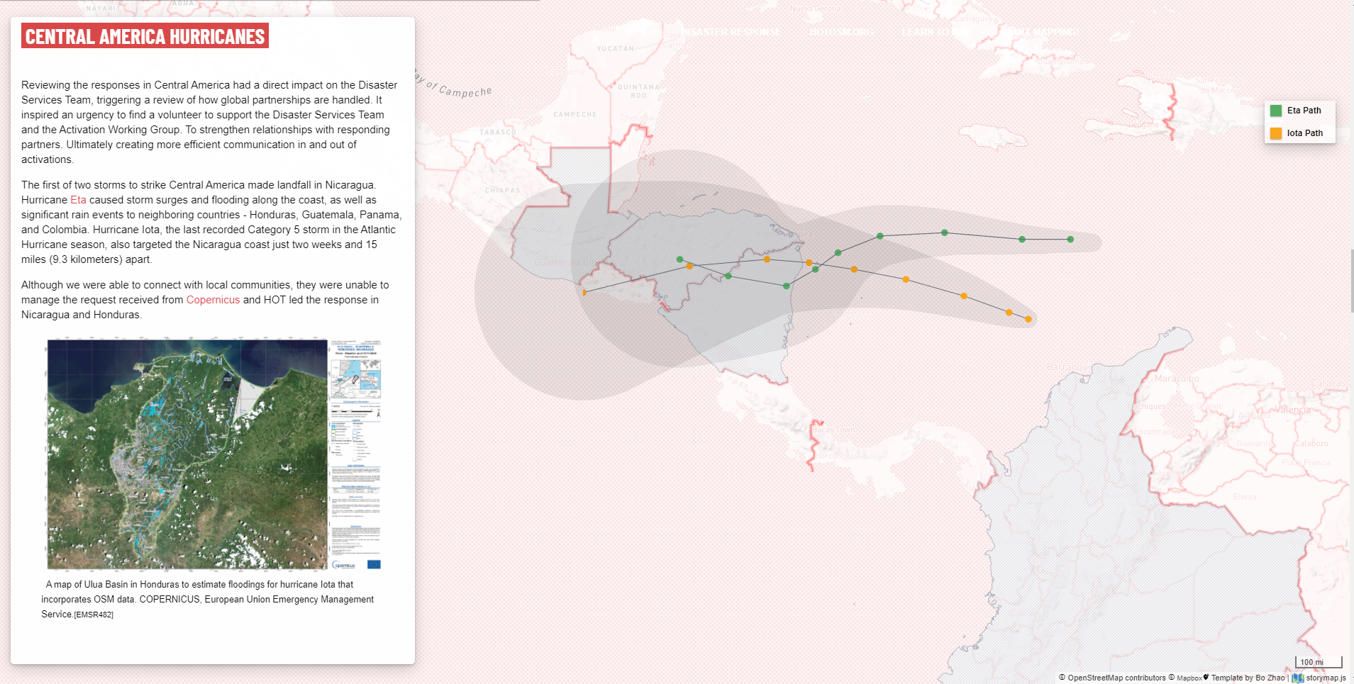
Section on the Eta & Iota that was part of the 2020 Disaster Services lessons learned report. It shows the area that was affected by the tropical cyclones and how the data was used for disaster response.
Tropical Cyclone Eta

2020 Aegean Sea earthquake Report
Section on the Aegan Sea Earthquake that was part of the 2020 Disaster Services lessons learned report. The report focuses on the work done by Yer Çizenler, a local organization.
2020 Aegean Sea earthquake