



Eight Countries, One Map: Takeaways from the 2026 LATAM Regional Anticipatory Macro Mapathon
Posted by Mar Marín Villagrana, Céline Jacquin • Sept. 17, 2026
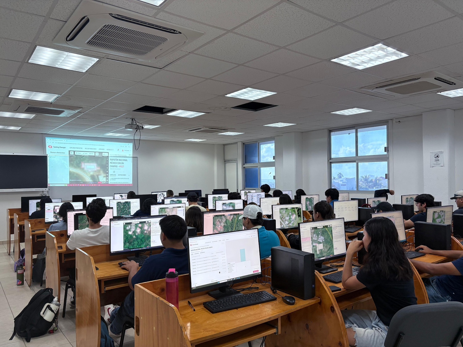
Latin America and the Caribbean is one of the regions most exposed to the effects of climate change on the planet. Paradoxically, it is also one of the most under-mapped. In countries like Peru, Ecuador, Colombia, Mexico, Panama, Honduras, Guatemala, and Paraguay, thousands of vulnerable settlements and rural areas remain outside detailed cartography. When information is missing, early warnings are delayed and humanitarian aid arrives blind.
No territory should remain invisible when the next crisis strikes. Facing this gap, the Macro Mapatón Regional Anticipatorio LATAM (MARE) 2026 demonstrated that disaster response doesn't begin when the emergency occurs, but long before.
Mapping before the chaos: the bet on anticipatory action
At the Humanitarian OpenStreetMap Team (HOT), we hold a vision born from direct experience: we know the work of volunteers on the ground, but we also know the helplessness of local authorities making vital decisions without the data they need.
That's why we drive anticipatory mapping. Mapping known risk areas in peacetime, identifying every building and every road, allows data to be integrated into public prevention and mitigation policies, while also enabling local development.
From a human development perspective, citizen science makes it possible to reach where State capacities often fall short due to lack of time or resources, and to achieve potentially greater scope in shorter timeframes, as long as the work is framed within solid methodologies. As Enrique Crespo, UNDP digital specialist for Latin America and the Caribbean, notes:
We share with HOT the perspective of leaving no one behind, in line with our mandate to build resilience oriented toward human development.
Likewise, Dr. Cecilia Izcapa, Director of Risk Analysis and Management at Mexico's National Center for Disaster Prevention (CENAPRED), highlights the operational and preventive value of this approach:
For us, this information is very important: incorporating it into the National Risk Atlas and having precise data on the different areas that could be affected by a natural phenomenon is fundamental to protecting the population.
An idea echoed by Ana Prada (National Unit for Risk Management) from Colombia, in the context of regional risk management:
Disasters don't recognize borders, and preparedness always begins long before an emergency occurs.
MARE 2026: Scaling collaboration to a continental level
After four years of successful national experiences in Peru, Colombia, Ecuador, and Mexico, we took the regional leap this past June and July 2026. Under a single methodology, eight countries came together to map risks that know no borders: shared river basins, climate corridors, coastal areas exposed to the El Niño phenomenon, and volcanic risk zones.
Using the Tasking Manager platform to divide satellite imagery into microtasks, the initiative coordinated efforts among HOT, UN Volunteers, AmeriGEO, and multiple regional universities and organizations. With the backdrop of the World Cup, the mapatón adopted a festive "friendly competition" dynamic, though the underlying purpose was strictly one of solidarity.
On this note, Alejandro Román, of the Paraguayan Space Agency, summed up the spirit of the effort:
We're not competing against each other, but as a single team against the adversities our region faces. May no territory and no person be left off our maps.
Explore the map by moving it around to see the impact of the Regional Mapatón 2026.
The strength of digital volunteering and the voice of the territories
The soul of MARE 2026 lay in the thousands of people who, from their computers anywhere in the world, contributed minutes of their time to turn satellite images into precise geographic data.
Rocío Vergara, of the United Nations Volunteers (UNV) Regional Office, highlights the evolution of this commitment:
Volunteering is very versatile and doesn't happen only in the field. Being a volunteer today also means contributing from a distance, turning data into decisions and those decisions into impact. Even though each individual contribution may seem small, together they build something much bigger.
This remote collaboration takes on its true value when it lands in local reality. In Tegucigalpa, Honduras, a city with more than 700 vulnerable neighborhoods and 600,000 exposed residents, Julio César Quiñones (Municipal Risk Management System) captures the ultimate purpose of the initiative:
I no longer want us to just count how many people have died. I want us to change that number for the number of people we managed to save.
The impact, moreover, extends beyond natural disasters. On Colombia's Pacific coast, professor Vladimir Corredor Espinel (National University of Colombia) glimpsed the reach of base cartography in public health, another less visible dimension of climate change, one that requires action grounded in precise maps of population and risk:
With this information, Colombia could build one of the largest georeferenced community malaria surveillance networks in Latin America.
The numbers behind the regional effort
The collective effort of MARE 2026 translates into unprecedented figures for community cartography in the region:
- 8 participating countries: Paraguay, Peru, Colombia, Ecuador, Honduras, Panama, Guatemala, and Mexico.
- +4,000 registered volunteers.
- 1,606,553 buildings mapped.
- 245 mapping projects scoped and completed.
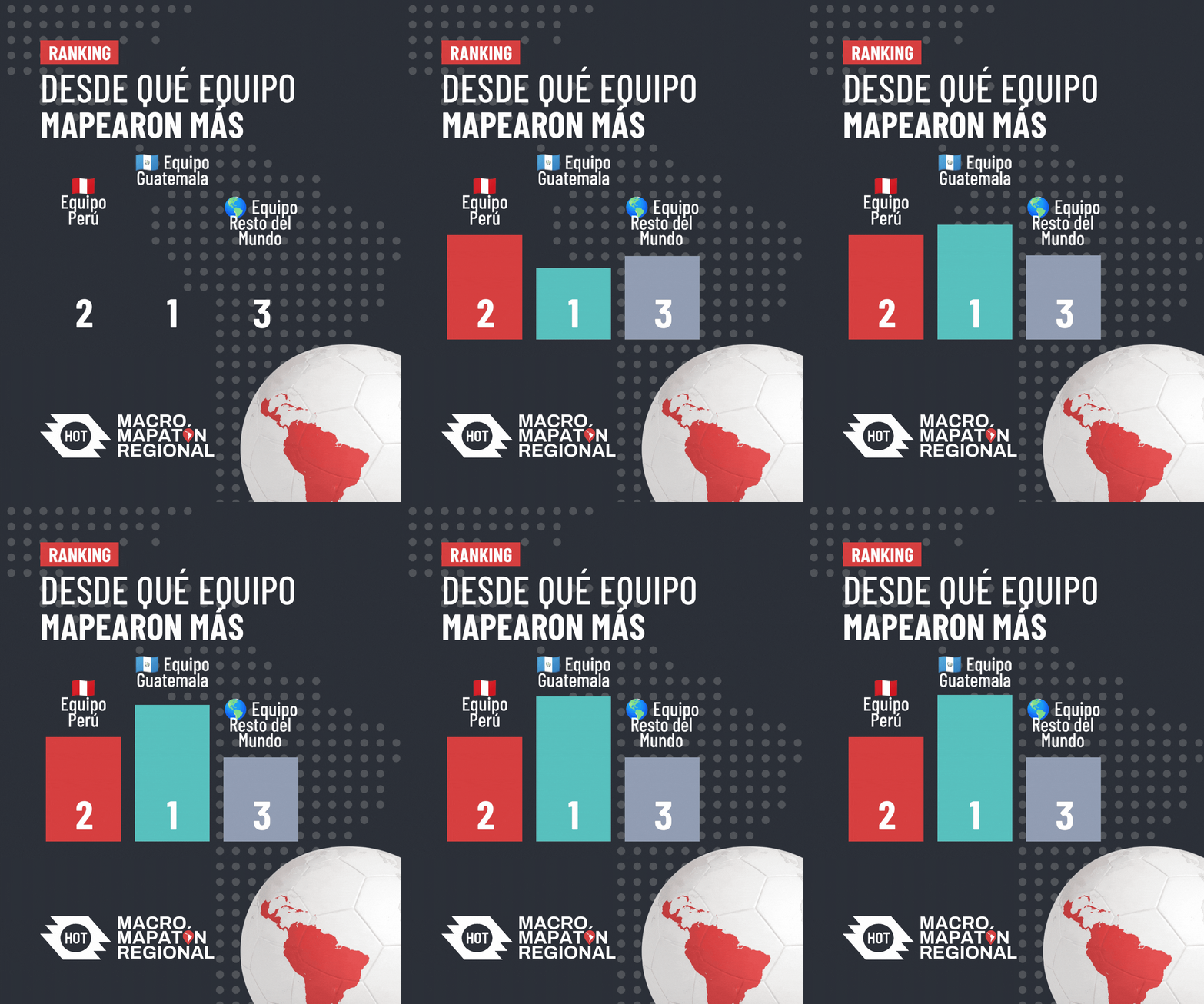
Who stood out in this "cup"? Colombia's team led total mapping volume with 274,218 edits, closely followed by contributions from mappers outside the eight participating countries, who together logged 227,817 edits. Guatemala led average participation per participant, with 1,721 edits per person.
A pedagogical laboratory: quality as a shared responsibility
Beyond the numbers, this regional mapatón functioned as a laboratory for pedagogical innovation in volunteering. Mapatones are a historic format in the OpenStreetMap community; organizations, universities, and local groups have always used them to build community, welcome new participants, or sharpen technical skills. HOT, for its part, has traditionally used this format to respond to disaster or conflict emergencies. In this mapatón, however, we set out to address a classic dilemma of any collective event: how do you welcome beginners while ensuring the resulting map maintains its quality?
The answer was a pedagogical paradigm shift centered on quality from the very first moment, self-correction, and a culture of shared care.
Since the event ran over six weeks with multiple sessions, the format gave participants room to map, critically review their own earlier work against quality criteria learned repeatedly, and correct their own mistakes day by day. Beyond traditional object-by-object validation, the awarding of certificates and final validation were tied to demonstrated understanding of these quality principles and to accountability for one's own work.
The result was decisive: not only did we obtain significantly more accurate and reliable data, but a deep sense of technical responsibility and peer oversight took root. Quality stopped being an external filter and became a collective commitment: we check each other's work, comment, and learn together. It's a pedagogical strategy we now openly invite others to replicate elsewhere in the world.
From data to spatial justice
MARE 2026 has shown that mapping is not just a technical exercise; it's an act of equity. Giving cartographic visibility to those who have been ignored is the first step toward guaranteeing access to basic services, infrastructure, and protection.
As Céline Jacquin, HOT's senior manager for Latin America, concludes:
By contributing through citizen science, we strengthen territorial planning and a more equitable distribution of public services. In that sense, this work contributes directly to spatial justice, which is the heart of what we're driving through OpenStreetMap.
The Macro Mapatón Regional 2026 has come to an end, but the data it generated remains open and available forever. Thousands of hands have ensured that, from today on, the map of Latin America has far fewer blank spaces.
A network that makes the map possible
MARE 2026 would not have been possible without the coordination of government institutions, international organizations, universities, civil society organizations, and volunteer communities across the region. Each partner contributed what it does best: outreach, training, local knowledge, technical support, or resources to recognize the effort of volunteers. We are deeply grateful to every one of them.
Anticipatory action is a collective investment, and we want the next edition to reach more countries and more of the places that are still blank on the map. If your organization would like to join as a co-organizer, partner, or sponsor, write to us at hublac@hotosm.org.
Co-organizers
Regional / International Partners
Colombia
Ecuador
Guatemala
Honduras
México
Paraguay
Panama
Peru
Incentive Sponsors
We thank the partners whose support strengthened MARE 2026 and recognized the commitment of our volunteers: Ballard Center, whose financial contribution helped make the mapathon possible; TomTom, which provided incentives for volunteers; and QGIS Perú, which offered a special QGIS course open to all participants.
Share




