Advancing Local Preparedness: GIS Training for Disaster Management in Bali, Indonesia
Posted by Tony Liong • June 5, 2026
“Tangguh, tangguh, tangguh!”
The phrase echoed during the GIS training held from May 18-20, 2026 in Sanur, Bali, Indonesia. “Tangguh”, the Indonesian word for “resilient”, captured the shared spirit of the country’s disaster management teams in strengthening community resilience against disasters – a commitment that was clearly demonstrated throughout the three-day interactive training.
Organized by BPBD Bali (Bali Provincial Disaster Management Agency) and the Bali Provincial Government, in collaboration with the SIAP SIAGA Program (Australia-Indonesia Partnership on Disaster Risk Management) and HOT’s Open Mapping Hub - Asia-Pacific, the training brought together more than 40 participants for hands-on learning in open geospatial tools for disaster preparedness. This included staff from BPBD Bali, district-level disaster management agencies across Bali, local disaster forums, NGOs, and village representatives.
Navigating and Adapting to Disaster Risks in Bali
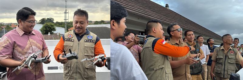
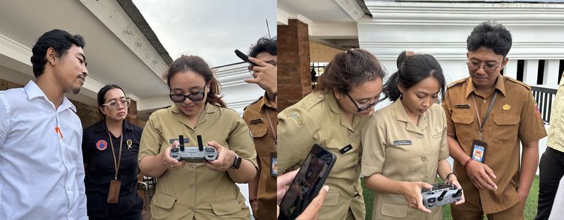
Snapshot from the drone training session | Photo: Diah Pramesti / SIAP SIAGA
Well known for its beautiful landscapes, Bali is also highly prone to disasters due to its geological characteristics and unique topography. According to the Bali Province Risk Analysis for 2025-2029, 9 out of 14 identified disaster categories are classified as high risk – from floods, earthquakes, forest fires, volcanic eruptions, landslides, to tsunamis.
Given these conditions, disaster mitigation and preparedness are essential, and both rely on accurate, timely, and actionable geospatial data.
“GIS offers data that is detailed and rigid, so it is very crucial for us to make quick, informed decisions. [This] includes better analysis on where to add sirens [for early warning systems]. If in the past we used estimates, now it is based on maps and drones.” – I Gede Agung Teja Bhusana Yadnya, Head of BPBD Bali
Adding to this, Deswanto Marbun, Head of Sub-National Programs at SIAP SIAGA, said:
“We would like to express our appreciation to HOT for their collaboration in this activity. This collaboration is very important, especially in strengthening participatory mapping and open geospatial data to support disaster management.
It is [also] important because the challenges in disaster management we face today are increasingly complex and require an approach that is more based on data, technology, and collaboration.”
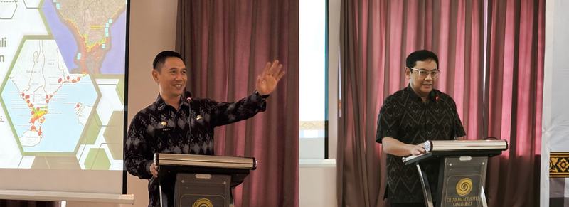
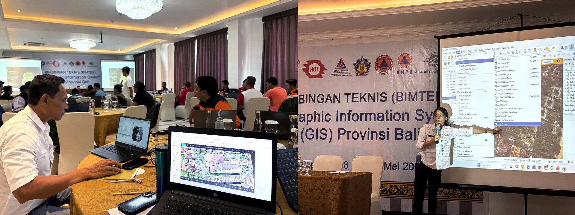
During the opening remarks, I Gede Agung Teja Bhusana Yadnya (BPBD Bali) and Deswanto Marbun (SIAP SIAGA) spoke about the importance of GIS and maps in disaster management. | Photo: Harry Mahardhika / Open Mapping Hub - Asia-Pacific, BPBD Bali
Drawing on successful past collaborations such as the End-to-End Mapping Solution Bali project, participants explored how local knowledge can be integrated with digital technology through participatory mapping to strengthen formal disaster planning workflows.
“Through a participatory approach, we can involve not only the government, but also communities and other institutions in the mapping process. Therefore, the maps, data, and information can be more credible and [better] support informed decision-making.” – Harry Mahardhika, Senior Program Manager at HOT’s Open Mapping Hub - Asia-Pacific
To achieve this, he emphasized that it is important for mapping tools to be inclusive – in the sense that they are accessible and easy for everyone to learn, including those without prior experience in GIS or geospatial data. These were the very tools explored during the training, which combined conceptual understanding with field practice to simulate real-world mapping experience.
Harry introduced participants to a range of accessible open mapping tools, through which communities can become active contributors – collecting information and data that strengthen disaster resilience and help protect lives in the future. | Photo: BPBD Bali, Diah Pramesti / SIAP SIAGA
Building Practical Knowledge Through Hands-On Practice
The training covered three core topics: drone-based aerial mapping, mobile field data collection and visualization, and digital map creation. Together, they formed an integrated understanding of the entire mapping process – from data to actionable maps for disaster planning and response.
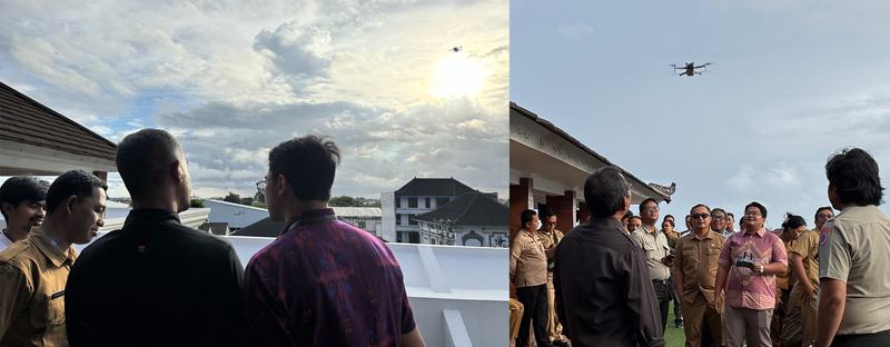
– DroneTM: Seeing Disaster Risks from Above
DroneTM practice session | Photo: Diah Pramesti / SIAP SIAGA
In disaster contexts, drone images provide a clearer view from above, helping us better understand ground conditions and assess potential or actual impacts that are difficult to capture through field observation alone.
I Wayan Pika Wiadnya (Pika), Disaster Analyst at BPBD Karangasem (Karangasem Disaster Management Agency), co-facilitated the session and guided participants through the full DroneTM workflow – from setting up automated flight plans to operating drones in the field.
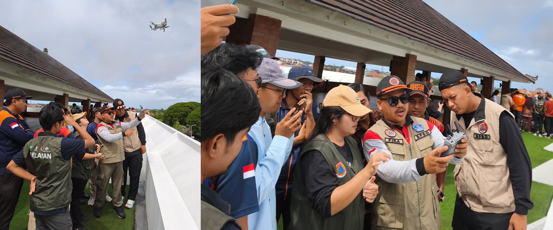
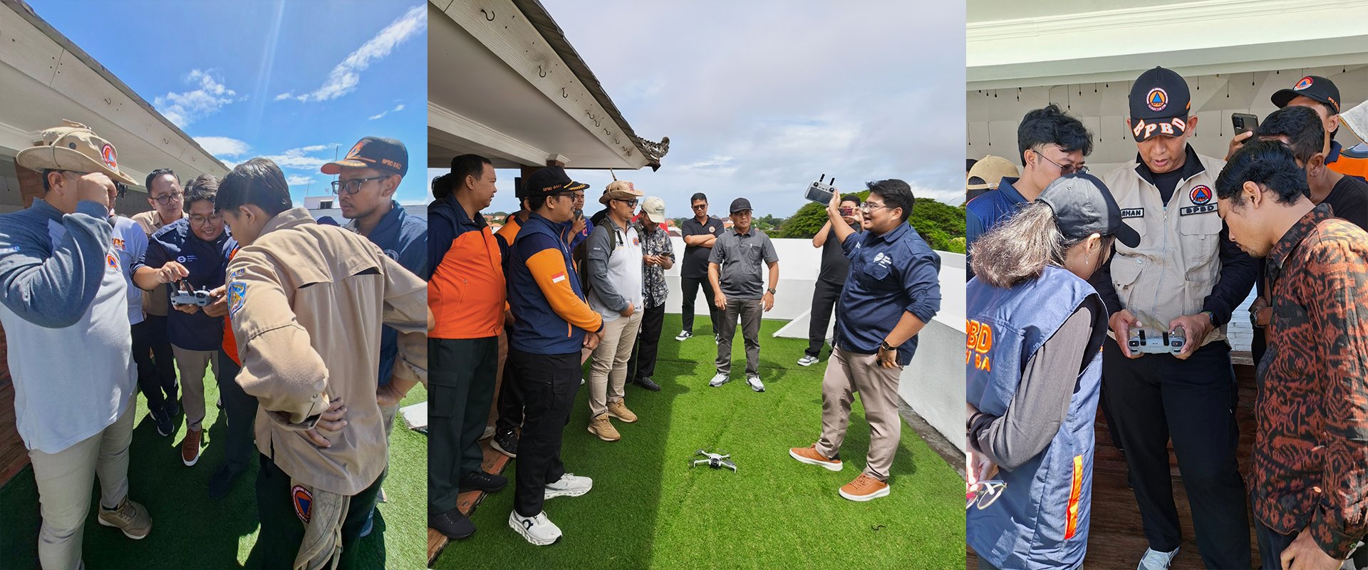
For some participants, this was their first time flying and operating a drone. While DroneTM enables automated flight and mapping, the session also included basic manual operation to support participants in gradually building confidence in handling the drone.
Participants with prior drone experience also learned many new things, including staff from Jembrana Disaster Management Agency who shared that they had previously used drones to take photos of flood impacts, but only through manual methods. With DroneTM, the process became easier and more efficient.
“Just [by setting up flight plans] on a laptop, we can fly the drone and it will automatically come back with results. I find this really impressive.”
– ChatMap and uMap: Turning Whatsapp Messages into Evacuation Maps
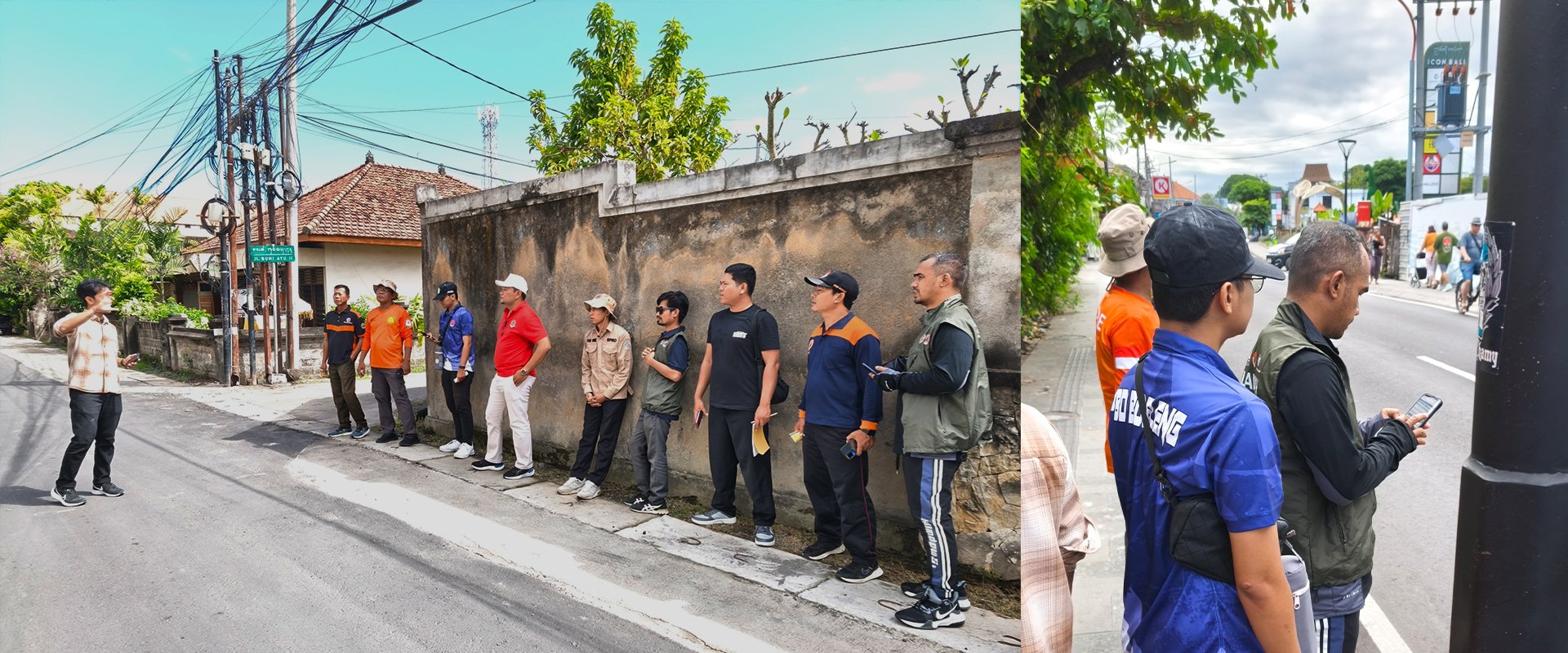
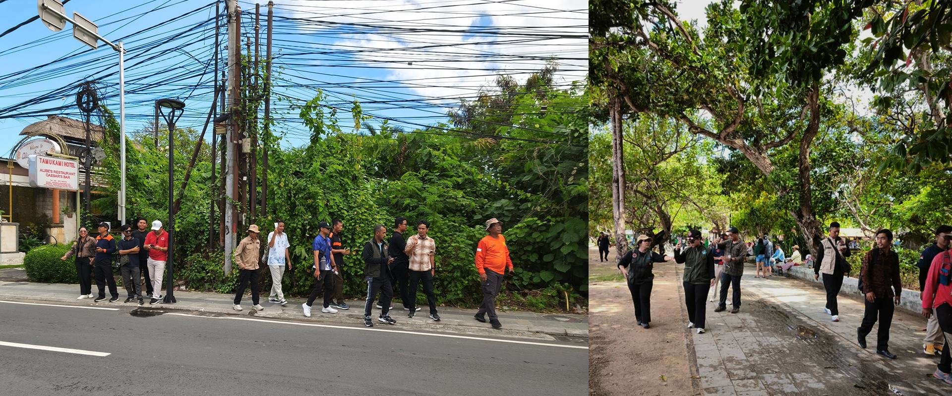
Field mapping in Sanur | Photo: BPBD Bali
While drone mapping provides a wider, elevated perspective, on-the-ground data collection remains equally important. For the field exercise, participants explored the Sanur area to identify and capture potential evacuation points and shelters.
Using a familiar, everyday platform like WhatsApp, ChatMap helped transform information collected through the messages into structured data with photos and accurate coordinates.
Using ChatMap and uMap, participants converted field data collected through WhatsApp group chats into an intuitive digital map. | Photo: BPBD Bali
The data were then visualized using uMap, which seamlessly integrates with ChatMap. With just a few clicks, participants were excited to discover that their simple WhatsApp messages and field inputs could easily be transformed into a practical evacuation map.
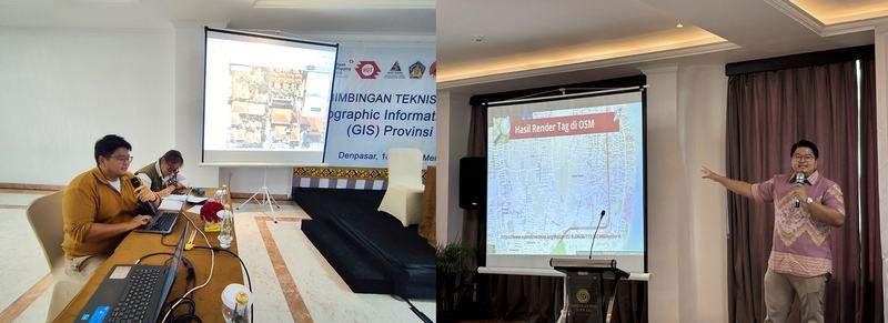
– QGIS: Visualizing Data into Map Products
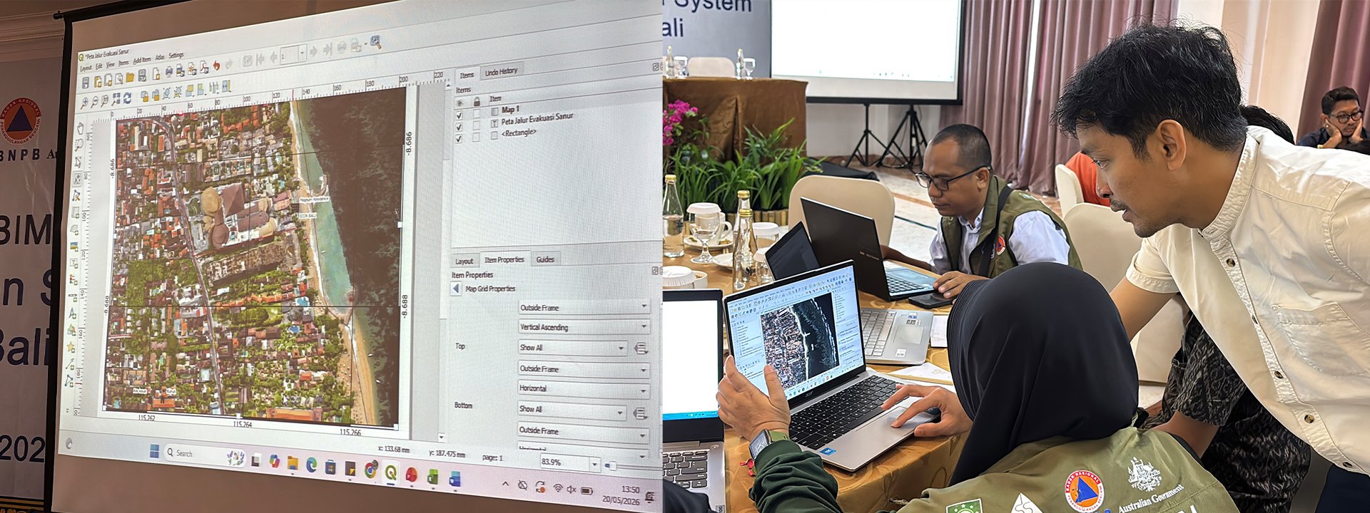
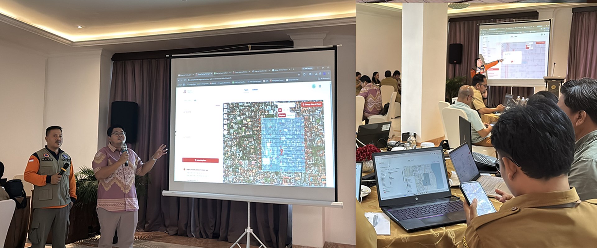
Using drone images from the DroneTM exercise, participants developed clear, actionable maps in QGIS. | Photo: Diah Pramesti / SIAP SIAGA
For the final session of the training, participants focused on creating digital map visualizations using QGIS, led by SIAP SIAGA and BPBD Bali. By the end, each participant had successfully developed a sample participatory map for risk analysis or evacuation planning.
“All the tools introduced were new to me [and] were very helpful, especially when we conducted drone activities and brought the drone images into QGIS. It allowed us to clearly see the evacuation points. I feel very grateful to be able to learn these tools and will continue learning.” – I Gede Agus Wira Adi Kusuma, Disaster Risk Reduction Forum (FPRB) of Laba Sari Village
Community at the Center of Participatory Mapping
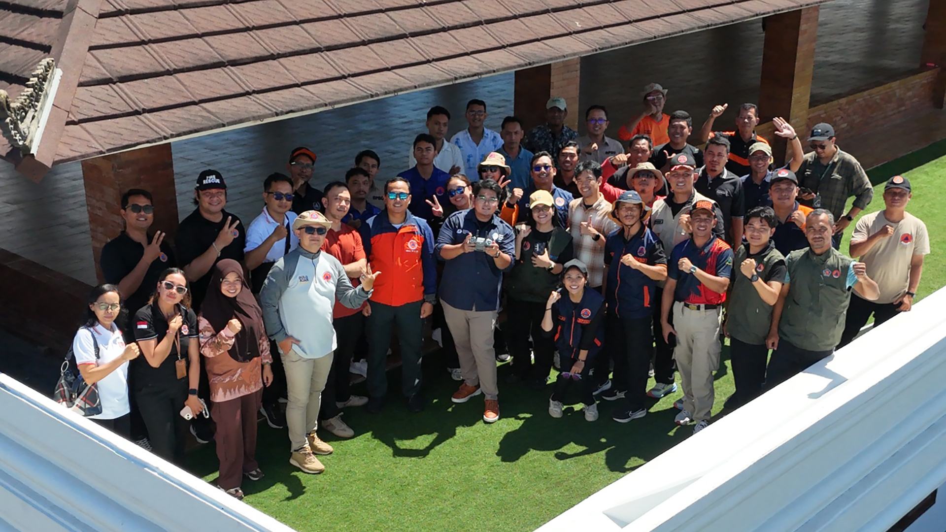
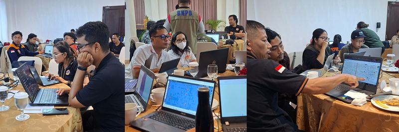
Driven by a shared commitment to strengthening their work with communities, BPBD staff and other local disaster actors actively engaged throughout the training. | Photo: Diah Pramesti / SIAP SIAGA
Beyond the tools and technical guidance, a key recurring theme throughout the training was the important role of community. At the end of the day, while technology can significantly advance data-driven disaster preparedness and response, it has to be grounded in local knowledge and lived experience.
In this context, community involvement is essential not only in building stronger local ownership, but also because, in practice, communities hold critical contextual and location-based knowledge.
Pika, who works closely with communities, including through his role at BPBD Karangasem, emphasized:
“Local communities understand best the actual conditions and risks in their area. Their involvement is key to successful participatory mapping.”
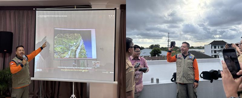
In addition to technical explanations, Pika shared several use cases of drone imagery for disaster analysis and highlighted the role of communities in co-creating disaster risk reduction strategies that are grounded in local contexts. | Photo: Diah Pramesti / SIAP SIAGA
Beyond the Training
With participants coming from diverse agencies and communities across Bali, the training is expected to serve as a starting point for them to bring the knowledge and skills back to their respective communities, where they can be applied, adapted, and further shared in their daily work in disaster risk reduction.
“This training is a small step, but it has a big impact for us. In this training, we included representatives from some of our partner villages. Previously, they only looked at drones, but now they can operate them. Previously, they only looked at maps, but now they can create map products that can be used as sources of information in their documents.
What I [also] find most interesting is how tailored the training was to your needs. [Our organization] has limitations when it comes to drones, but the HOT team helped us find a solution so our drone can perform more comprehensive aerial mapping.” – Almer Fitrianto Faizal, Program Officer at Yayasan IDEP Selaras Alam (IDEP Foundation)
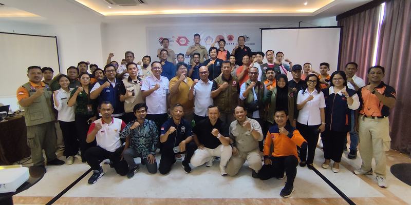
As the training concluded, participants left with greater expertise and confidence in applying GIS and open mapping in disaster management. | Photo: BPBD Bali
Following up, HOT’s Open Mapping Hub - Asia-Pacific will continue working with SIAP SIAGA and BPBD Bali to advance preparedness through upcoming joint activities, including field mapping for tsunami preparedness in Sanur. Stay tuned for more updates!
Thank you to Diah Pramesti (SIAP SIAGA) and the BPBD Bali team for capturing and providing documentation, interviews, and the official event press release that informed this article.
Share
