



The Missing Ingredient in Early Warning is People and Maps
Posted by Pauline Omagwa • Oct. 14, 2026
Early Warnings and Saving Lives
An early warning alert can only save a life if the receiver understands it and trusts it and then acts on it. A storm alert cannot just say, "A storm is coming." It must have a complete, actionable message that answers three common questions of when to move, where to go, and how to get help.
Across Africa, 75% of nations report having early warning capabilities. As UN Assistant Secretary-General Selwyn Hart stated at the Africa Early Warnings Forum, "Africa has made significant progress, but we are still a long way from universal protection.
While this government can successfully set up early warning systems across its local governments, 60% of people in these areas are less likely to receive alerts due to a disconnect between regional networks and local terrain. To close this gap, the UNDRR calls for a shift toward impact-based forecasting warnings that focus not just on what the weather will be, but on what the weather will do to local infrastructure and lives.
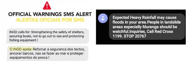
Screenshots of messages communities received in Mozambique during the 2026 floods and in Kenya in 2023. | Photo: HOT
But an impact-based forecast is only as effective as the local reality behind it. To say what the weather will do, you first need to know what is there: which homes, schools, and clinics are in its path, who is most at risk, and which routes are passable when it floods.
That ground-level detail is precisely what a layered people-generated map provides.
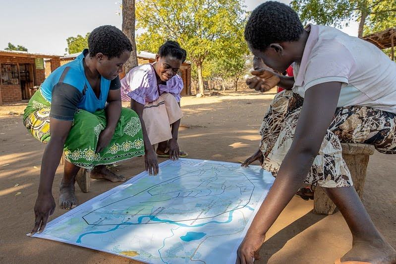
Eneless Peterson (in purple) is a community leader in her village in Chikwawa District, Malawi. She helps other women understand disaster risk and read maps that HOT and the Malawi Red Cross Society built fo
The Four Layers of a Lifesaving Map
An early warning system fails if an evacuation route passes through a bridge that gets covered during a flood or if a family reaches a clinic only to find it submerged because maps were not updated. To prevent such scenarios, systems rely on a baseline hazard layer created by scientific institutions using historical records, satellite imagery, and predictive computer models.
This layer is accurate at showing what threat is coming and where it will hit. However, a hazard map only shows the physical weather. It cannot show the human impact, meaning an early warning system simply cannot work on a hazard map alone.
To turn early alerts into successful warnings, hazard maps have to be layered with an exposure layer that shows the exact locations of homes, schools, hospitals, and critical supply routes. Next, the vulnerability layer pinpoints high-risk realities, such These include rain-fed farming zones, informal riverbank settlements, and homes on unstable hillsides.
The final layer, the communication & response layer, shows the actual infrastructure needed to deploy alerts and coordinate escapes from active mobile network coverage zones to verified, passable evacuation paths.
Isolation risk and resilience map of Mapai, Mozambique. It combines flood extent, flooded and passable roads, building density and key services such as schools, health centres and water points to show which communities could be cut off during a flood. Use the layer list to turn layers on and off. | Map: HOT, view full map
Have layered maps worked before? Yes.
At the Africa Early Warning Forum, Dr. Asha Mohammed from the IFRC emphasized that the strongest warning systems must combine technical data with local volunteer networks, leaders, and community radio.
For over 15 years, the Humanitarian OpenStreetMap Team (HOT) has been championing the use of open-source mapping and geospatial data for building all-weather systems. Generate critical geospatial data quickly at scale.
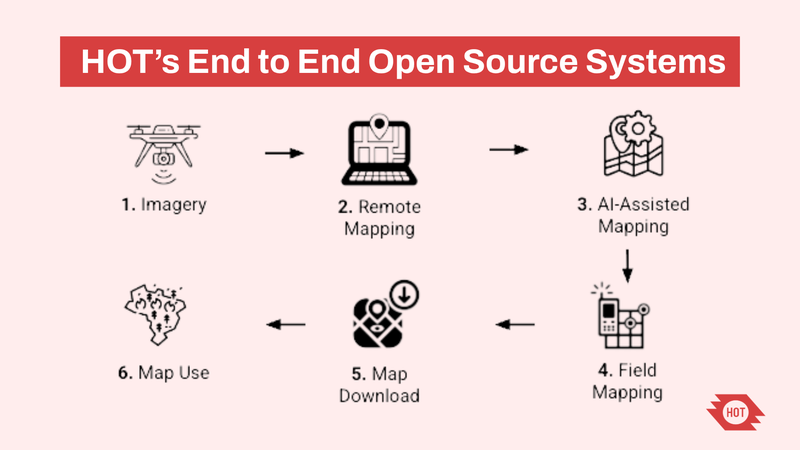
HOT uses a four-step pipeline to turn imagery data (satellite, drone, and mobile phone 3D/2D cameras) into live, layered maps at scale
- In Mozambique: Supported by the Gates Foundation, HOT partnered with the National Institute for Disaster Risk Management and Reduction (INGD/CENOE) and FDC to map critical infrastructure, evacuation routes, and community demographics before disaster struck. Pre-mapped layers alongside live drone imagery were used to respond to January–February 2026.
- In Somalia: In partnership with FAO’s Somalia Water and Land Information Management (SWALIM), the project mapped surface water catchments and natural ponds. The maps created were integrated into FAO's early warning systems to trigger anticipatory actions, track water scarcity, and send localized drought alerts to protect vulnerable communities before severe La Niña dry spells hit.
- In Sierra Leone: HOT partnered with local communities alongside the National Disaster Management Agency (NDMA) and the Japan International Cooperation Agency (JICA) to map flood- and landslide-prone areas using high-resolution imagery. Pre-mapped layers and open spatial data were developed to help local populations build resilience, prepare for hazards, and strengthen efforts to reduce disaster risk.
Why this scales and the open-source advantage
Institutional investment in climate science, high-performance computing, and satellite infrastructure is essential, but it is only half the system. The other half must be built at the speed of locally generated data, updated continuously, owned by communities, and understood by those who need it most.
HOT’s open mapping flow can provide the other half of the solution. Through the Tasking Manager, our AI-assisted mapping tool fAIr, and a global network of trained local mappers, HOT is able to turns satellite imagery and drone imagery into layered, community-owned maps quickly, at scale, and accessible for everyone.
Since the data is open, governments, agencies, and responders can access it. Helping them make community-centered decisions when it comes to supporting response and preparing for disasters
And as world leaders declared in the Addis Ababa Call to Action at the UNDRR Africa Early Warnings Forum, the ultimate goal is to "bridge the remaining gaps and reach the last mile because a warning only saves lives when it reaches people in a form they understand, trust, and act on."
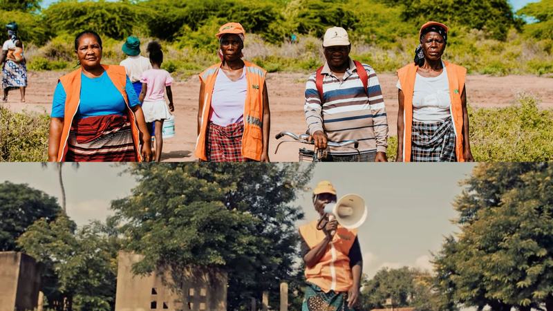
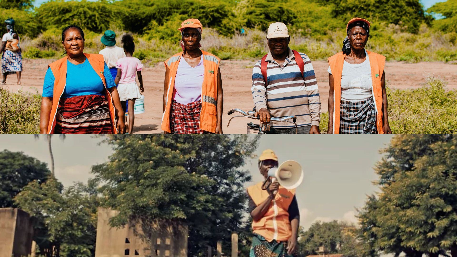
In Mozambique, the Instituto Nacional de Gestão e Redução do Risco de Desastres (INGD), the government agency that coordinates disaster risk management, relief operations and climate resilience, works with community leaders who use megaphones to broadcast early warning alerts so everyone is reached. | Photo: HOT
Share




