KYC Africa: Drone Mapping in Freetown City
Learn and Connect • Freetown City, Sierra Leone • Community-Led
Freetown City’s residents are taking climate action into their own hands. With rapid growth within informal settlements and climate challenges, planning, especially without up-to-date high-quality imagery, has become increasingly difficult. Freetown City Council, HOT, and local partners launched a community-led drone mapping project to capture the city in high-resolution detail. With new skills, low-cost drones, and HOT’s Drone TM, residents can now produce their own aerial imagery and use it to inform smarter urban planning, disaster response, climate resilience, slum upgrading, and more accessible services for people with disabilities.
Understanding Freetown City
Freetown, Sierra Leone’s capital, is a city of rapid growth and potential, but it faces pressing challenges in urban management. The city’s steep hillsides, dense informal settlements, and vulnerability to flooding make planning and service delivery complex, problems identified by Freetown City Council and grassroots organisations like CODOHSAPA and FEDURP alike. These limitations affect the daily life of many residents, including persons with disabilities, who regularly have to take longer detour routes to reach their destination.
To address this, Freetown City Council, OSM Sierra Leone, and CODOHSAPA AND FEDURP, with technical support from the Humanitarian OpenStreetMap Team (HOT) and funding from the German Federal Ministry for Economic Cooperation and Development (BMZ), set out to fill a critical information gap: the lack of recent, high-resolution imagery to guide planning and decision-making at a city-scale.
And to keep this data relevant, capacity building, the central component to this project, would begin with the city’s residents themselves, an approach that produced not only 80km2 of high-quality, low-cost data but also builds skills for communities to fill future data gaps autonomously.
This new data would help city planners and communities conduct accessibility assessments, improve disaster preparedness, strengthen service delivery, and even regenerate the central business district, making it safer, greener, and more accessible. Overall, the heart of this project would be training Freetown’s residents to collect, analyze, and maintain their own data. By building these local skills, this collaborative effort would ensure the city not only gains accurate information but also the lasting ability to use it for a more inclusive and resilient future.
Mapping Freetown: From Training to Takeoff
This project's approach involved:
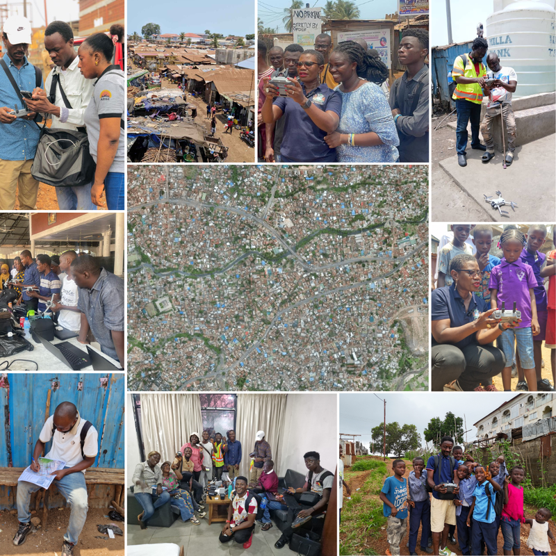
- Capacity building: Thirty residents, comprising women, persons with disabilities who were members of CODOHSAPA/FEDURP, Freetown City Council, OSM Sierra Leone, and the National Commission for Persons with Disabilities, participated in training sessions, first learning how to operate a drone, followed by an introduction to creating a flight plan using the Drone TM, and lastly, how to process the imagery retrieved.
- Data Collection: Fourteen of the residents and community members trained became the official Freetown Open Drone Crew, who were commissioned to map Freetown. Using low-cost drones, they collected 5cm resolution imagery and 3D point cloud data across 80km2 of the city. The imagery was then used for remote and field mapping.
- Data Processing & Analysis: The ultimate value of data lies beyond not just collection, but processing and analyzing it to extract actionable information and insights. Imagery collected by the crew was published on OpenAerialMap, making it available to create 3D models, interactive maps, walkability assessments, and even disability analysis, all of which support planning and management for the city.
“This afternoon, I joined the teams in Crab Town, Aberdeen, and was taught how to fly a drone! I was then able to share my newfound knowledge with children from a nearby school as we participated directly in the creation of the maps. This mapping exercise also provides training and skills development with about 20 young people (from informal settlements, FCC, and Ministry of Lands) participating.” Yvonne Aki-Sawyerr - Mayor, Freetown City, Sierra Leone
Explore Freetown's Imagery by interacting with the map below
Transforming Imagery into Action
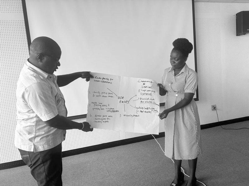
Freetown City Council is currently utilizing the collected imagery to regenerate data for targeted products and analytical visualizations to inform their priority use cases in:
- Municipal taxation: Through accurate field mapping of properties and commercial entities to improve revenue collection and urban planning.
- Infrastructure management: Extracting data from remote mapping
waste management, drainage maintenance, road network improvements, and water sources across the Central Business District and formal settlements in the Western Urban Area of Freetown. - Resilience and service delivery: Mapping features to support flood mitigation strategies and the equitable delivery of essential services.
- Disability analysis: Conducting walkability assessments supported by the National Commission for Persons with Disabilities, six settlements, which provided feedback on interactive and static transect maps, and shared their lived experiences.
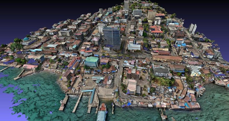
3D imagery of Freetown City, Central Business District (Source: HOT )
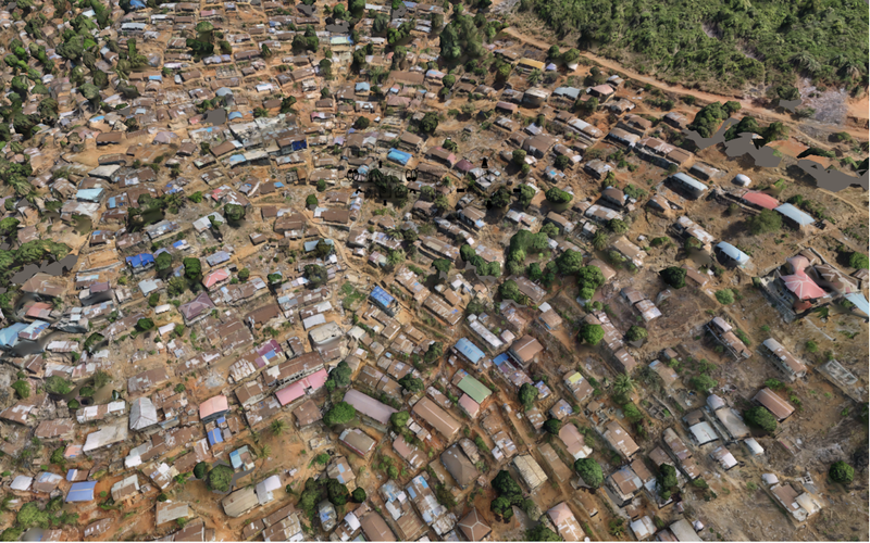
3D render of Coconut Farm, Freetown(Source: HOT Tech)
“As an agency, we really do rely on using drone images, especially for our hazard profiling/mapping and vulnerability risk assessments…. We use drone imagery in our response activities as well. … We hope to use the imagery [that has been collected] to map out the city. We are going to roll out to other cities because, as an agency, we are not only responsible for Freetown but the entire Sierra Leone.” Deputy Director for Risk Reduction and Disaster Preparedness, Gerald King.
Beyond data outcomes, the project has created a lasting impact within the community. Over 120 people have been trained through several workshops/training sessions that have been held over the course of the project, including Freetown Council representatives for property valuation, engineering, waste management, health and sanitation, the Freetown Open Drone Mapping Crew, OSM Sierra Leone, and CODOHSAPA/FedURP. These sessions covered understanding different departments' data needs to craft a data model and learning how to use digital data collection tools such as the FMTM web form, ODK, QField, and Mapillary.
Informal settlement residents have already used the imagery for remote mapping and surveying to establish “Special Planning Area” status, a gateway to formal recognition and, with that, inclusion in city planning, a testimony to how inclusive mapping approaches help build stronger trust between residents, community organisations, and the local council.
The imagery from this project is also openly available on OpenAerialMap.
The Next Phase in Freetown’s Mapping Journey
Looking ahead, the achievements of this project are motivating partners and donors to take on larger strides, scaling to more open drone crews in six cities in Sierra Leone, and one in Senegal. The Freetown Open Drone Crew team is looking forward to conducting training for the new drone crews in secondary cities, using a community-to-community approach, which eliminates language and cultural barriers, essential to steering a sustainable model of peer learning.
During a recent learning exchange, one of our partners from FedURP shared:
“[We] continue to engage with young people from the communities, as they are very tech savvy. The current drone crew team had no prior experience in flying drones and managed to absorb the skills and knowledge very quickly.
In addition to shifting focus from the capital of the country towards cities, our projects there will be giving slum dwellers hope and showing them interest in their life and its improvement; another opportunity is that it gives people from the settlements possible job opportunities and improves livelihoods which is much needed to keep people in their areas and not have to move to the big city to gain such access”
