End-to-End Mapping Solution for Volcano Evacuation Routes - Bali, Indonesia
Indonesia
End-to-End Mapping Solution Bali focuses on strengthening local capacity to use open and accessible tools for disaster risk reduction around Mount Agung. Through hands-on training and field mapping activities, local disaster management agencies and communities actively planned, collected data, and transformed it into practical maps and disaster management planning tools.
Improving Preparedness at Mount Agung
Mount Agung is one of Indonesia’s most active volcanoes, posing ongoing risks to communities in Karangasem and surrounding areas in Bali. While local disaster management agencies (BPBD Bali and BPBD Karangasem) have been leading evacuation planning and the installation of early warning systems, there are still gaps in up-to-date spatial data, technical capacity, and tools needed to produce usable maps for official contingency planning.
These challenges were identified by BPBD during the preparation of the Agung Volcano Contingency Plan. Existing maps were often static, difficult to update, and lacked detailed village-level information, such as evacuation routes, safe points, and critical infrastructure. This limited their usability during emergencies, especially for communities living closest to the volcano.
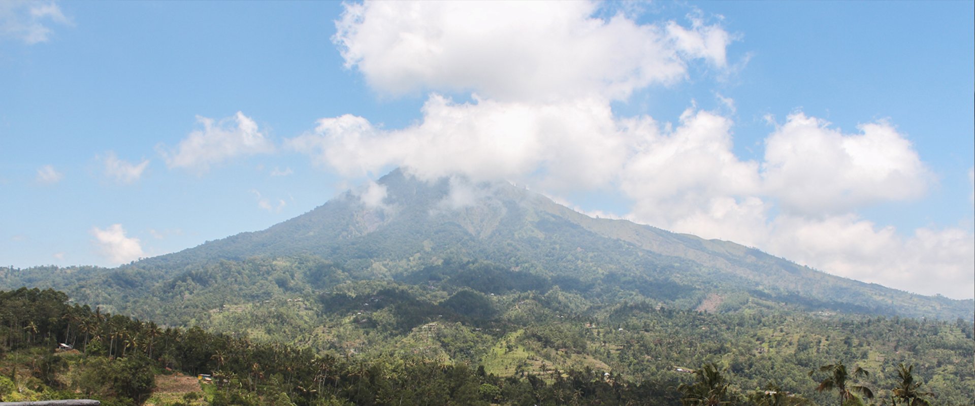
View from one of the hamlets in Ban Village, located within Mount Agung's volcanic red zone | Photo: Tony Liong / Open Mapping Hub - Asia-Pacific
End-to-End Mapping Solution Bali
As part of the End-to-End Mapping Solution (E2E), the project in Bali focused on strengthening local capacity to independently collect, analyze, and use geospatial data for volcano-related disaster preparedness around Mount Agung. This was achieved through training and the co-development of tools with BPBD and local communities, who together established the Center of Excellence following HOT’s prior engagement in Karangasem.
The initiative was implemented through close collaboration between HOT, HOT's Open Mapping Hub - Asia-Pacific (AP Hub), BPBD Bali, BPBD Karangasem, and local communities.
Strengthening Local Capacity for Sustainable, Contextual Disaster Preparedness
E2E Bali combined capacity building with participatory, locally-led field data collection and collaborative map production across two priority zones around Mount Agung.
– Zone 2: Evacuation Preparedness
Covering five villages, BPBD and community members were trained to collect data on evacuation routes, critical infrastructure, and safe points using ChatMap, a WhatsApp- and web-based data collection tool developed by HOT. Collected data was then visualized directly on maps and integrated into uMap for interactive, dynamic exploration.
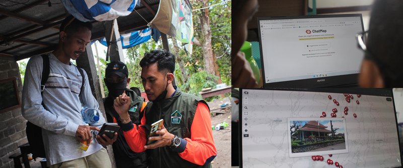
Through ChatMap, BPBD and community members were able to easily contribute to map data collection by sharing images and relevant information via WhatsApp group. | Photo: Tony Liong / Open Mapping Hub - Asia-Pacific
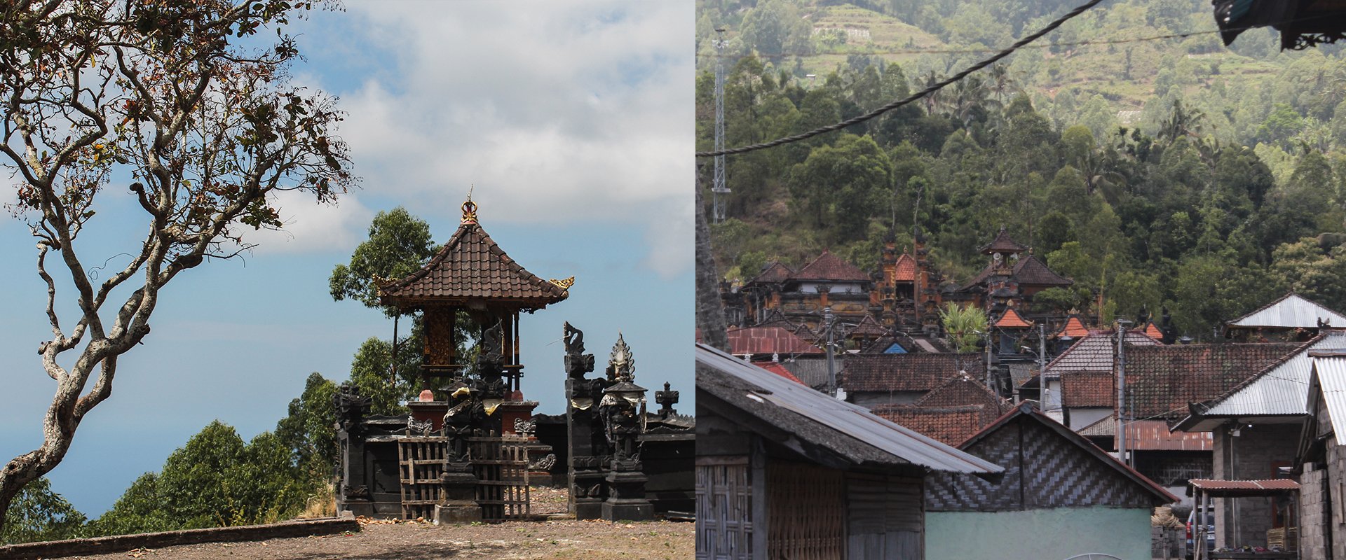
– Zone 3: Early Warning Systems
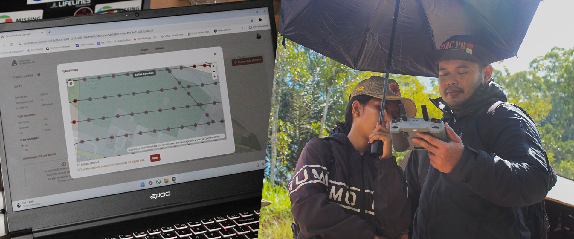
Also known as the “red zone”, these are areas with the highest risk during a volcanic eruption and include villages closest to the volcano. Focusing on Ban Village, the BPBD team was trained to use the Drone Tasking Manager (DroneTM), which allowed them to capture high-resolution aerial imagery using low-cost drones.
The imagery was then used to map the locations of existing early warning systems and analyze suitable locations for future systems installations. Additionally, the imagery was uploaded to OpenAerialMap (OAM) as a ready-to-use dataset, making it openly accessible for mapping and analysis.


Ultimately, capacity building was the foundational component of the project. Prior to the field activities, the BPBD team strengthened their skills and confidence with the tools through a two-day, hands-on training. This preparation helped them take a leading role in the field, conducting effective and successful data collection and drone operations.


The AP Hub team and Open Mapping Gurus, with support from HOT’s Tech & Data team, delivered training on open mapping tools to BPBD (September 2025). By localizing the training in Indonesian, the BPBD team was able to engage more effectively and deepen their understanding of the tools and topics. | Photo: Tony Liong / Open Mapping Hub - Asia-Pacific
From Capacity Building to Local Leadership
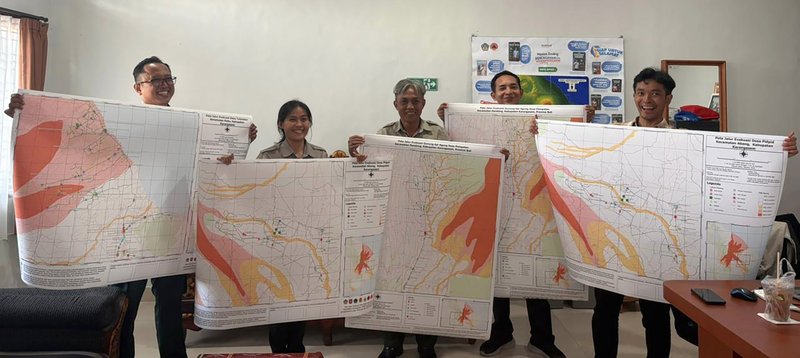
After the initial training and field activities concluded, the BPBD team continued mapping activities independently from October to November 2025. The project concluded with a Focus Group Discussion (FGD), maps finalization, and the official drafting of the Contingency Plan document in December 2025.
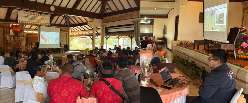
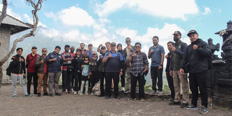
During the FGD with local community representatives (November 2025), Harry Mahardhika, E2E’s project lead, shared about the project's participatory mapping method and the latest map outputs co-developed with BPBD. The discussion resulted in a shared agreement to continue finalizing the maps for stronger, more comprehensive disaster management and preparedness. | Photo: BPBD Bali
Outcomes and Impact
The project resulted in over 1,000 village-level datasets on evacuation routes, safe points, critical infrastructure, and early warning system locations across high-risk areas around Mount Agung. BPBD Bali and Karangasem used these datasets to produce official maps for the Agung Volcano Contingency Plan, including dynamic uMap links for some villages for ongoing use.
Accessible, Actionable Evacuation Route Maps
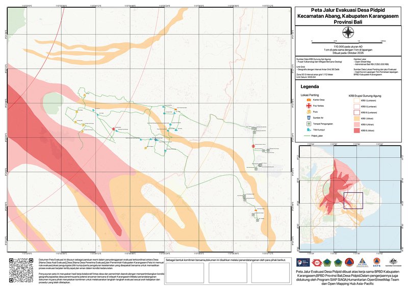
Map of evacuation routes in Pidpid Village, Karangasem, visualized using data contributions from ChatMap | Map visualization: BPBD Karangasem, BPBD Bali, and Pidpid Village community members
The simple use of ChatMap allowed faster, community-driven contributions with rich local context. This data is then visualized into maps that will be featured in the Contingency Plan document, with each map including a QR code that links directly to the related uMap.
With this QR code, community members can access the map anytime on their mobile phones and explore routes and points in more detail, including key information and photos of each location.
Drone Imagery for Data-Informed Early Warning System Installation
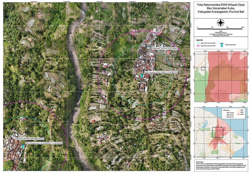
Map showing recommended potential locations for future early warning system installations in Ban Village, Karangasem | Map visualization: BPBD Karangasem and BPBD Bali
The high-resolution imagery, taken using DroneTM, provided detailed views of terrain and residential areas, which helped BPBD to create maps to support informed analysis and planning for early warning system installations.
Local Agencies and Communities Leading Disaster Preparedness
While mapping and open tools played a significant role, the project’s success was mainly driven by and only possible thanks to BPBD’s leadership and dedication. | Photo: Tony Liong / Open Mapping Hub - Asia-Pacific
Through the project, local disaster management agencies and communities gained hands-on experience using open-source tools, enabling them to independently carry out the full end-to-end mapping process: from planning and field data collection to analysis and the creation of maps with direct relevance and use for future disaster preparedness and response.
These maps not only support faster, clearer decision-making during volcanic emergencies, but also help communities prepare better for them.
In January 2026, BPBD completed the official evacuation route maps for their Contingency Plan, covering all five villages involved in the project. The maps were then handed over to local village offices, giving communities access to the data they helped collect to improve evacuation planning and emergency response. | Photo: BPBD Bali
Beyond the product outcomes, the project contributed to fostering strong local ownership. Every point mapped and every image shared was collected by local agencies and communities, all actively working together to build their own resilience toward disasters.
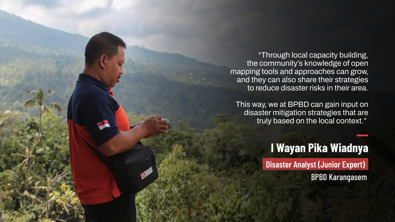
I Wayan Pika Wiadnya, Disaster Analyst at BPBD Karangasem, emphasizes the importance of local community involvement in disaster risk reduction efforts. Having accessible tools, as introduced through the project, will significantly help improve this by lowering barriers to broader community participation. | Photo: Tony Liong / Open Mapping Hub - Asia-Pacific
Next Takeoff Points
Looking forward, BPBD will continue collaborating with HOT and upskill its team through independent, ongoing skills development and consistent practical application.
As the tools evolve over time, BPBD hopes they can be adapted for more types of disasters – with the end goal of sharing the knowledge, insights, and expertise gained to all disaster-prone areas across the world.
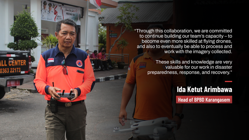
For Ida Ketut Arimbawa, Head of BPBD Karangasem, the collaboration has brought many new insights and possibilities. For example, seeing a demo where HOT transformed imagery from DroneTM into 3D maps made him excited for the potential that the BPBD team can develop the same skill in the future. | Photo: Tony Liong / Open Mapping Hub - Asia-Pacific
More from E2E Bali: Video and Maps
1) Explore interactive evacuation route maps co-created with BPBD and the local communities: Pidpid Village - Tulamben Village - Amertha Bhuana Village - Datah Village - Pempatan Village
2) Access and download all drone imagery on OpenAerialMap: Area 1 - Area 2
