Why Open Imagery Licensing Is the Foundation of Humanitarian Mapping
Publié par Melissa Rosa • 24 août 2026
Every day, satellites, aircraft, and drones capture detailed pictures of a changing planet. These images help monitor traffic congestion in growing cities, estimate crop yields months ahead of harvest, and flag illegal deforestation in places that may be difficult or dangerous to reach.
That same imagery should be available the moment a hurricane makes landfall, an earthquake levels a neighborhood, or a community needs to map an evacuation route out of a flood zone. Despite the abundance of high-resolution imagery, reliable access for humanitarian mapping remains limited.
That is why open licensing matters. It is part of the operational infrastructure that determines whether imagery can move from a provider’s archive into the hands of humanitarian organizations, volunteer mappers, and affected communities.
For the Humanitarian OpenStreetMap Team (HOT), imagery sits upstream of nearly every mapping workflow. Tasking Manager splits the area into task grids, so volunteers can map roads and buildings in a coordinated way, fAIr helps identify features at scale, and tools such as MapSwipe and ChatMap connect remote mapping with information collected closer to the ground.
The tools are different, but they all depend on the same upstream condition: accessible high-resolution imagery must exist with clear, practical licensing terms.

HOT Tasking Manager used open licensed imagery for the Mexico National Mapathon in 2025. Read more
The access problem
This is where the friction point appears again and again. A provider may already have captured the right location at the right resolution, but community responders still have to determine who can view the imagery, whether it can be shared with partners, whether volunteers can trace from it, whether derived data can be published publicly, and whether an AI-assisted workflow can process it. Those questions consume time that communities do not have during an active response.
Open licensing removes the need to renegotiate those permissions for every organization, tool, and use case. It creates:
- Speed: imagery can enter a response workflow without waiting for a new negotiation or legal review.
- Reach: governments, local organizations and volunteer communities can use the same source, not only institutions with procurement budgets and legal teams.
- Interoperability: imagery can move between mapping, analysis, and field tools without a separate agreement at every handoff.
Open licensing turns a one-time image into shared infrastructure
That distinction matters because humanitarian response is rarely carried out by one organization using one platform. It is a networked effort, and the data must be able to move through that network. Communities can start to build reliable “before” maps and test workflows before a crisis, while one image release can support many responders, datasets, and future uses.
For commercial satellite providers, the request to “open more data” is not simple. Satellites are expensive to build, launch, and operate, and providers must account for customer agreements, regulatory and security restrictions, misuse, and the cost of preparing a public release. The concern that free access could undercut a paying market is real. Some providers already release a defined portion of an archive or acquisition stream for disaster events, but access is inconsistent, provider by provider, and these releases can still be limited by geography, timing, resolution, or permitted uses, and are often concentrated on high-profile events.
This challenge is receiving international attention as well. In June 2026, the Satellites for Peace conference in Vatican City brought together governments, UN organizations, researchers, humanitarian experts, and commercial satellite providers to examine how satellite information can better support peacebuilding, crisis response, and conflict prevention. The conference focused on strengthening commitments to provide and fund very-high-resolution imagery (VHR) for humanitarian purposes. Participants also explored forming an alliance to coordinate knowledge, funding, and action. Together, these discussions reflect a growing recognition that imagery access is not only an operational challenge for individual organizations, but a shared global concern. These are the same commitments HOT’s OpenAerialMap (OAM) is built to operationalize.
What HOT and OpenAerialMap Make Possible
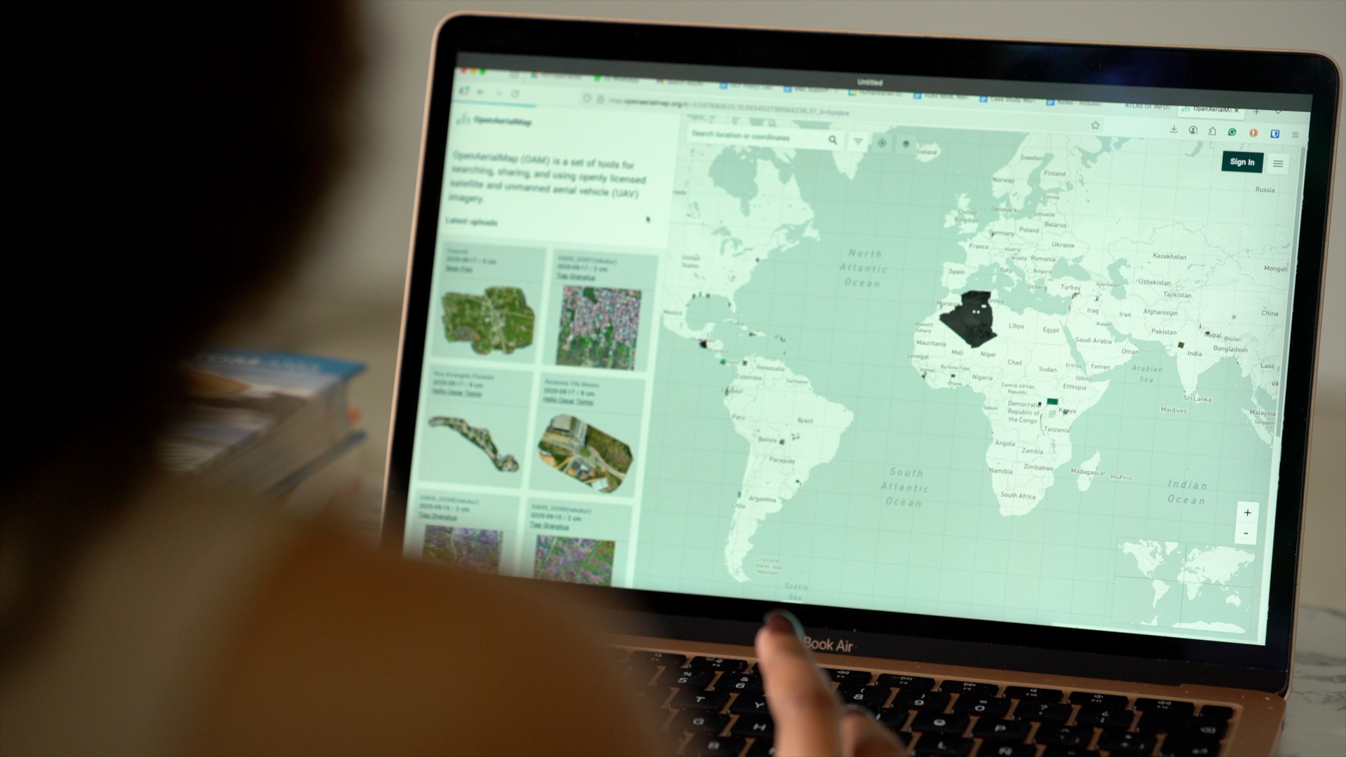
Volunteer and community-driven mapping only works if users can access the imagery needed to produce timely, decision-ready information. This is at the core of HOT's model. OAM provides a commons of openly licensed aerial and satellite imagery where users can search, preview, download, and connect imagery to other applications. Licensing is clear at the point of discovery, so responders do not have to reconstruct the terms after they find the data.
HOT adds the human and operational layer around that infrastructure. Through its regional Open Mapping Hubs, technical tools, volunteer community, and relationships with local humanitarian and government partners, HOT connects imagery providers to real humanitarian demand and helps build a practical pathway from provider constraints to community use.
That includes supporting licensing, onboarding, and metadata workflows; documenting use cases; and carrying feedback from imagery users back to the organizations collecting it.
This approach does more than ask providers to release imagery for free. It reduces repetitive one-off requests, makes provider contributions visible and attributable, demonstrates how their imagery performs in real operating conditions, and turns a public good commitment into credible impact stories across the humanitarian ecosystem.

OpenAerialMap in use, showcasing openly licensed satellite and drone imagery.
From open imagery to operational impact
Two recent HOT activations show what this can look like. As part of HOT’s broader Hurricane Melissa response across the Caribbean, HOT and Jamaica Flying Labs coordinated 300 drone flights in Jamaica, covering roughly 900 square kilometers. The resulting imagery was uploaded to OAM for open access and further analysis, supporting a broader response that combined remote mapping, citizen-reported information, government systems, and local partners. The value was not only that the imagery was collected; it was that the output could move beyond the original flight team and become part of a shared response resource.
The Gaza building-footprint update illustrates a different part of the same argument. Using pre-October 2023 imagery, HOT’s Tasking Manager volunteers added a net 59,223 buildings and completed 469,152 edits to create a more accurate, comprehensive pre-conflict baseline in OpenStreetMap. That baseline is what damage analysts now compare against to determine which structures have been destroyed. It's a reminder that open licensing isn't only about the first hours after a disaster, it's also what makes it possible to have reliable “before” imagery ready before the next crisis hits.


Slide to showcase imagery from the Hurricane Melissa Response in the Caribbean.
What Comes Next
The building blocks for more open imagery already exist: imagery providers with public good commitments, open mapping tools for imagery access, field data collection, and data analysis, international mechanisms for cooperation, and community-level responders that make imagery easier to discover, and use. The next step is to build clear, repeatable pathways for providers to release imagery under appropriate terms for humanitarian users, and for providers to see the value their contributions create.
In a future post, we'll go deeper into how OAM's catalog actually works, from metadata standards to what it takes to move imagery from a provider's archive into a searchable, open resource.
Stay tuned for the full release of OAM v2 and the new uploader that will be launched in the coming weeks as well!
Get involved!
Have imagery to share?
info@openaerialmap.org →Looking for openly licensed imagery?
Explore the OAM catalog →Interested in learning more about OAM?
Read OAM stories →Share