HOT COVID-19 RESPONSE

As the world grapples with the global pandemic of COVID-19, at HOT we are concerned for vulnerable groups worldwide.
Multiple, ongoing crises will be exacerbated by COVID-19. These crises include those trapped or displaced by conflict and living in close quarters like refugee camps and informal settlements for whom social distancing may not be possible, as well as populations with additional vulnerability, e.g. people living with TB or HIV/AIDs.
As the crisis grows globally, it is more important than ever to understand that the 1 billion people living in partially or completely unmapped communities face increased risks. They may be left out of life-saving programs and lack access to healthcare and other forms of support. Furthermore, the ability of local and national governments to anticipate and plan for response needs, including testing, treatment, contact tracing is seriously hindered by the lack of reliable maps.
Due to the scale and unprecedented nature of the COVID-19 crisis, we at HOT find ourselves in new territory, and we are adapting our response to the rapidly changing needs on the ground. However, in addition to creating data, consideration for the way that data will be used is paramount if it is to be effective.
HOT’s response will focus on three areas:
Helping government agencies and responders: Given the rapid spread of the crisis, it is crucial to get OpenStreetMap data into the hands of government agencies/health authorities and other actors requesting it for the response. We are working with the UN OCHA Centre for Humanitarian data to provide daily map exports in the hardest hit locations on HDX, and to provide remote training, support and analysis to governments, CSOs and NGOs.
In many countries, the outbreak has led to restrictions on movement that are affecting people’s livelihoods and created a need to plan for cash-based interventions (e.g. cash assistance) in rural and under-mapped areas. Maps are required for government teams to identify where vulnerable populations are and to provide them with a way to track and visualize their progress. This work is starting in Peru immediately, with projects available for mapping and validation. You can contribute to these efforts now.
Identifying populations most at risk: We are working to identify gaps, such as disaggregated data on where the most vulnerable live (including the 60+ population and the prevalence of pre-existing conditions such as HIV/AIDS) as well as missing data on health infrastructure such as facilities, testing sites, pharmacies and laboratories. We will also need to consider missing data on resource distribution centers, such as markets and food centers, to understand how resources are allocated and where those in need are gathering. We will also focus on mapping place names and administrative boundaries. Finally, it will also be necessary to re-prioritize existing mapping projects in high risk areas and tag them with COVID-19 in the Tasking Manager to direct mappers to these critical projects.
Mapping in places most at risk: Local data communities are already using OpenStreetMap to solve the real needs of local responders. We plan to fund local mapping groups via HOT Emergency Microgrants to support and scale up mapping efforts that have been identified as urgent.
HOT works to ensure map data should be accessible and used in decisions that save and improve lives, and that everyone can engage and contribute to the map. The scale of the need we are facing with COVID-19 is truly unprecedented. A flexible, considered approach that enables vulnerable communities and essential services to be mapped, and that gets maps into the hands of those who need them, is our highest priority.
Global solidarity is essential to tackling a global pandemic. To get involved:
-
Connect with the Disaster Activation Working Group by joining the HOT Slack channel #disaster-mapping
-
Stay tuned on Twitter, Facebook, and the OSM Wiki for updates as our response evolves
Other notable coordinators not listed (no website profile): Logan McGovern, Katarina Spasenovic, and Jarmo Kivekas
Recent news from HOT COVID-19 RESPONSE (View all news)
A Joint Approach to Facilitate Covid-19 Vaccine Delivery
"Rolling out a vaccine against Covid-19 is the most pressing challenge of our time - and nobody wins the race until everyone wins." - Global Alliance for Vaccines and Immunization - GAVI
Building a Global Network to Map for COVID-19 Response
With support from the Humanitarian-to-Humanitarian Network, HOT has engaged the global humanitarian mapping community to support local Covid-19 responses in the biggest disaster activation in HOT's history.
Covid-19 Pandemic in Peru: Mapping Health Implications
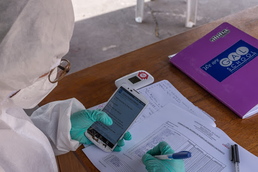
As Peru struggles with the impacts of Covid-19, HOT and GAL Group are helping public health officials at all levels of government plan how to support communities by mapping rural and vulnerable populations in the Cusco region.
Second Round of Rapid Response Micrograntees Announced!
Congratulations to the latest COVID-19 Rapid Response Micrograntees! Their work will make their communities more resilient and help people stay safe.
HOT Rapid Response Microgrants: COVID-19 – First round of Micrograntees announced
We’re excited to announce the first round of awardees for HOT Rapid Response Microgrants: COVID-19. Microgrants, which are provided to OpenStreetMap communities to support their local response to the pandemic, have been awarded to projects in Liberia, Uganda, Kenya and Mongolia. Over the next 6 months, these Microgrants will support the following work:


