Mapping for Climate Ready Cities - Nepal Road Network Validation
Climate Ready Cities • Nepal
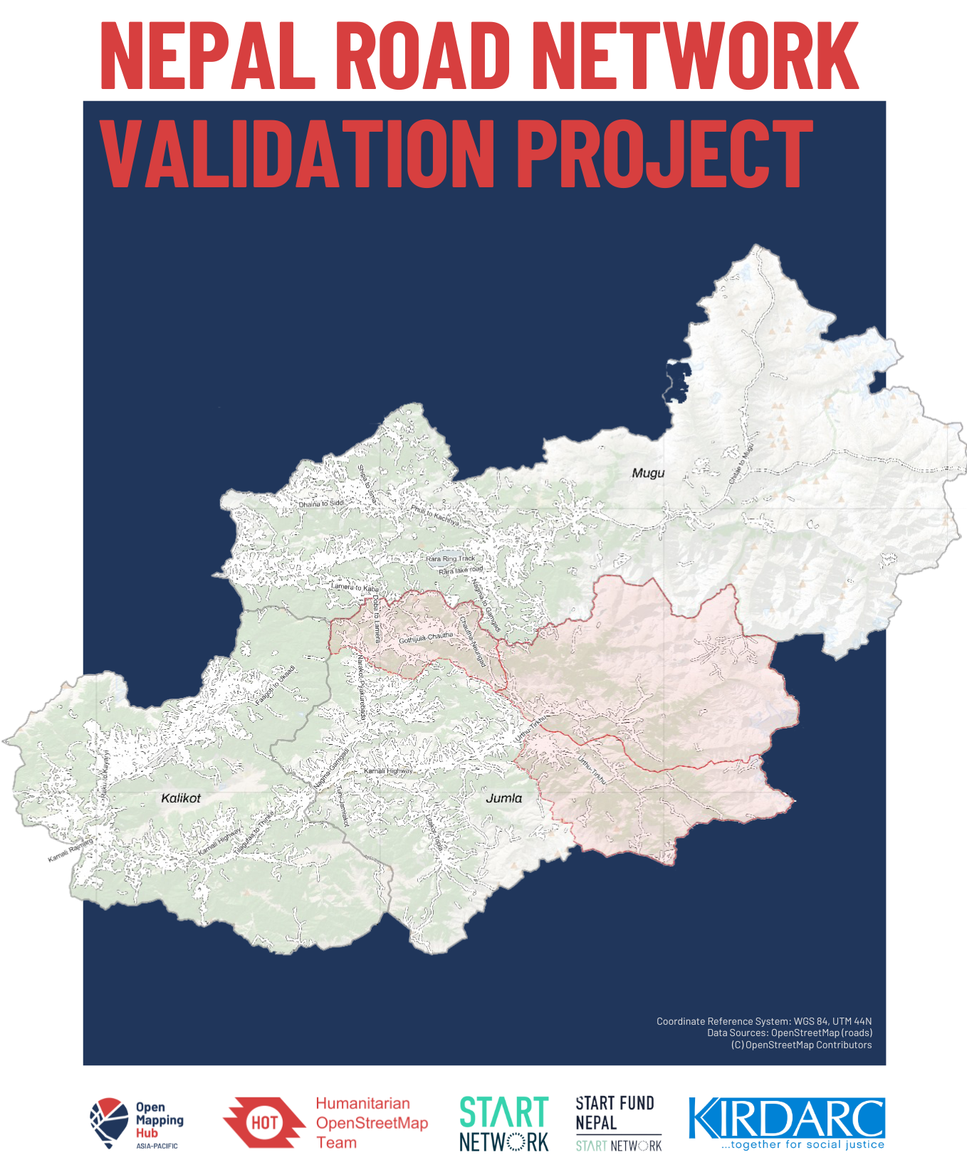
Through our Mapping for Climate Ready Cities program, HOT is supporting the development of a thriving ecosystem focused on the creation, interpretation, and use of maps to respond to and reduce climate risks in urban areas across four priority regions. This project page highlights our work in Karnali Province, Nepal through HOT's Open Mapping Hub - Asia-Pacific.
Road Networks in Rural Nepal
Road networks play a crucial role in supporting economic and humanitarian activities within societies. In rural areas, roads are paramount for enhancing accessibility, fostering economic development, and promoting social integration. Improved road infrastructure also facilitates easier access to essential services like healthcare, education, and markets.
Currently, the rural regions of Nepal face a lack of reliable road network data. Moreover, existing poor-quality OpenStreetMap (OSM) road network data can result in inaccurate routing. Additionally, inaccurate and inaccessible data can also slow down or impede effective humanitarian aid during emergencies.
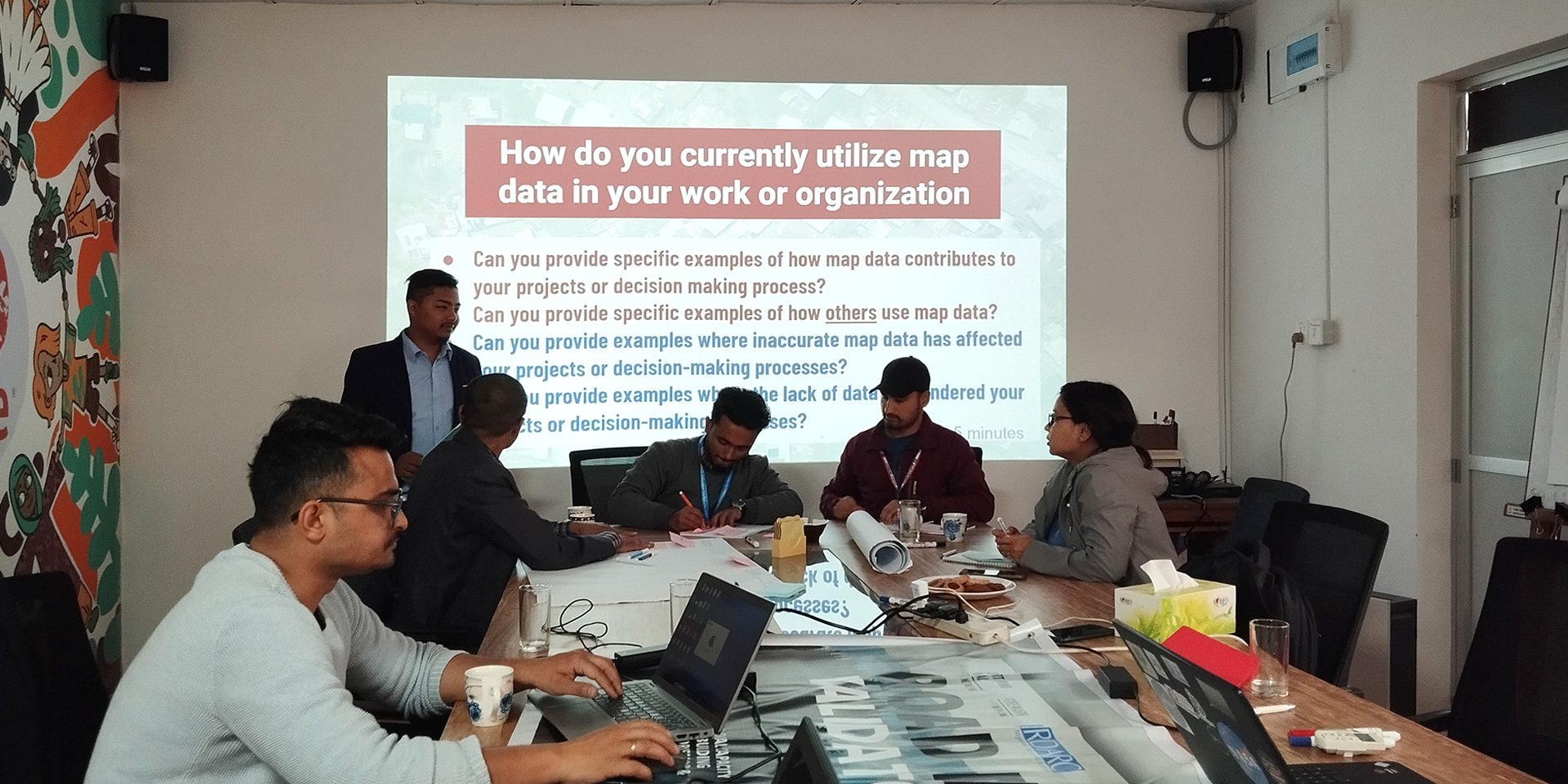
While OSM allows actors, such as local governments, to add missing features or rectify and update data in OSM, knowledge of OSM in the region is still limited. Thus, it is critical that local stakeholders are trained on OSM so that they can (1) leverage it to inform their decision-making and (2) maintain and update OSM data to support local development and humanitarian efforts.
To address these challenges, since 2023, Start Fund Nepal (SFN) and HOT's Open Mapping Hub - Asia-Pacific (AP Hub) collaborated with local communities and the Karnali Integrated Rural Development and Research Centre (KIRDARC) to enhance the capacity of at-risk communities in Karnali Province, Nepal.
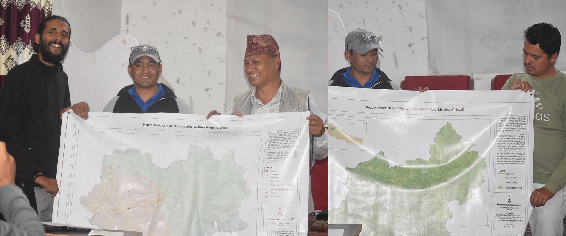
This pilot project focused on improving existing data on road networks and key disaster response infrastructures in the region, along with a series of technical workshops to engage and build capacities among local stakeholders.
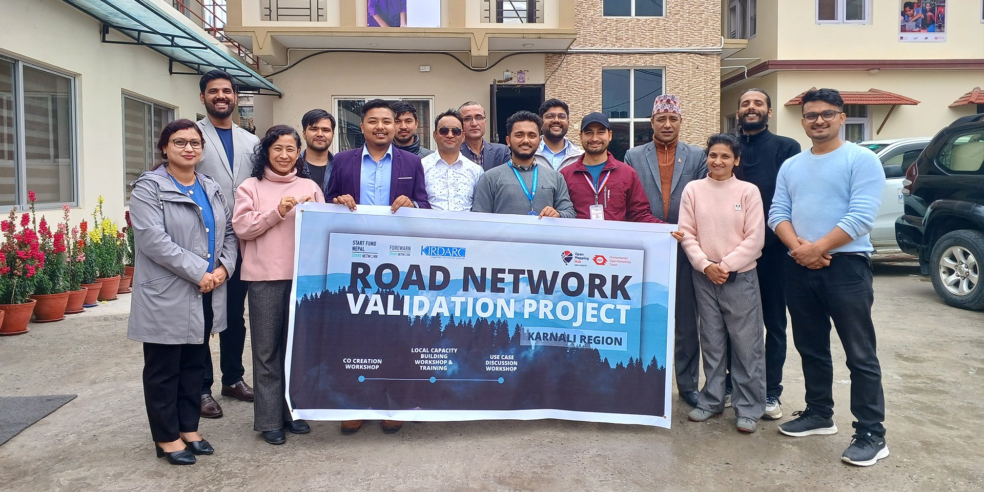
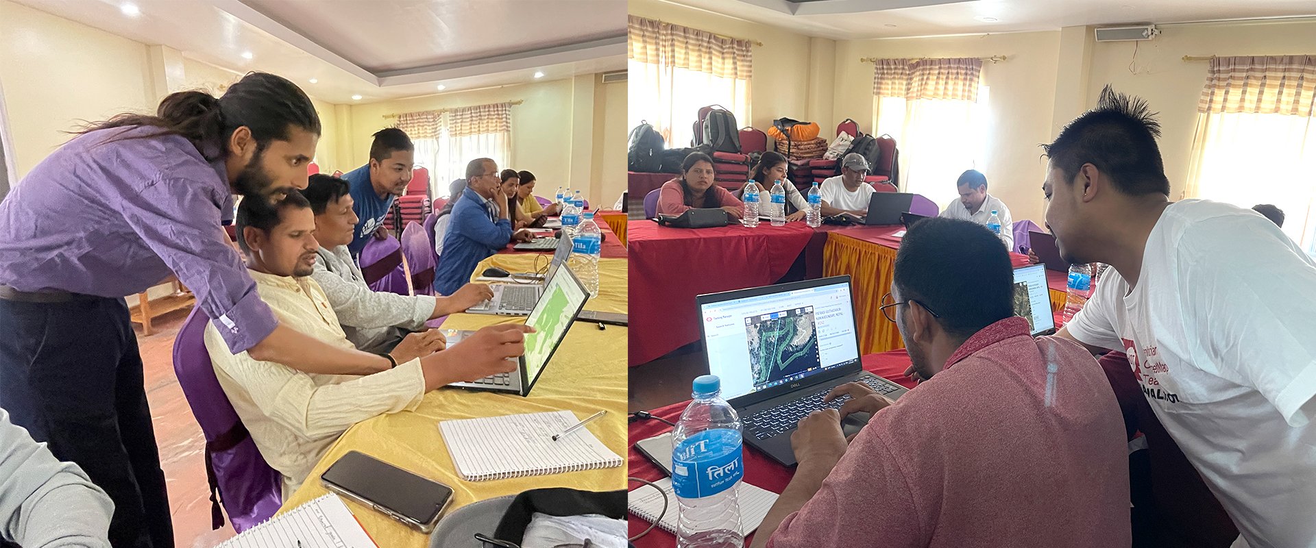
Local stakeholders participated in the Foundational Phase of the project (March 2024). | Photo: Ashim Poudel and Rabi Shrestha / Open Mapping Guru
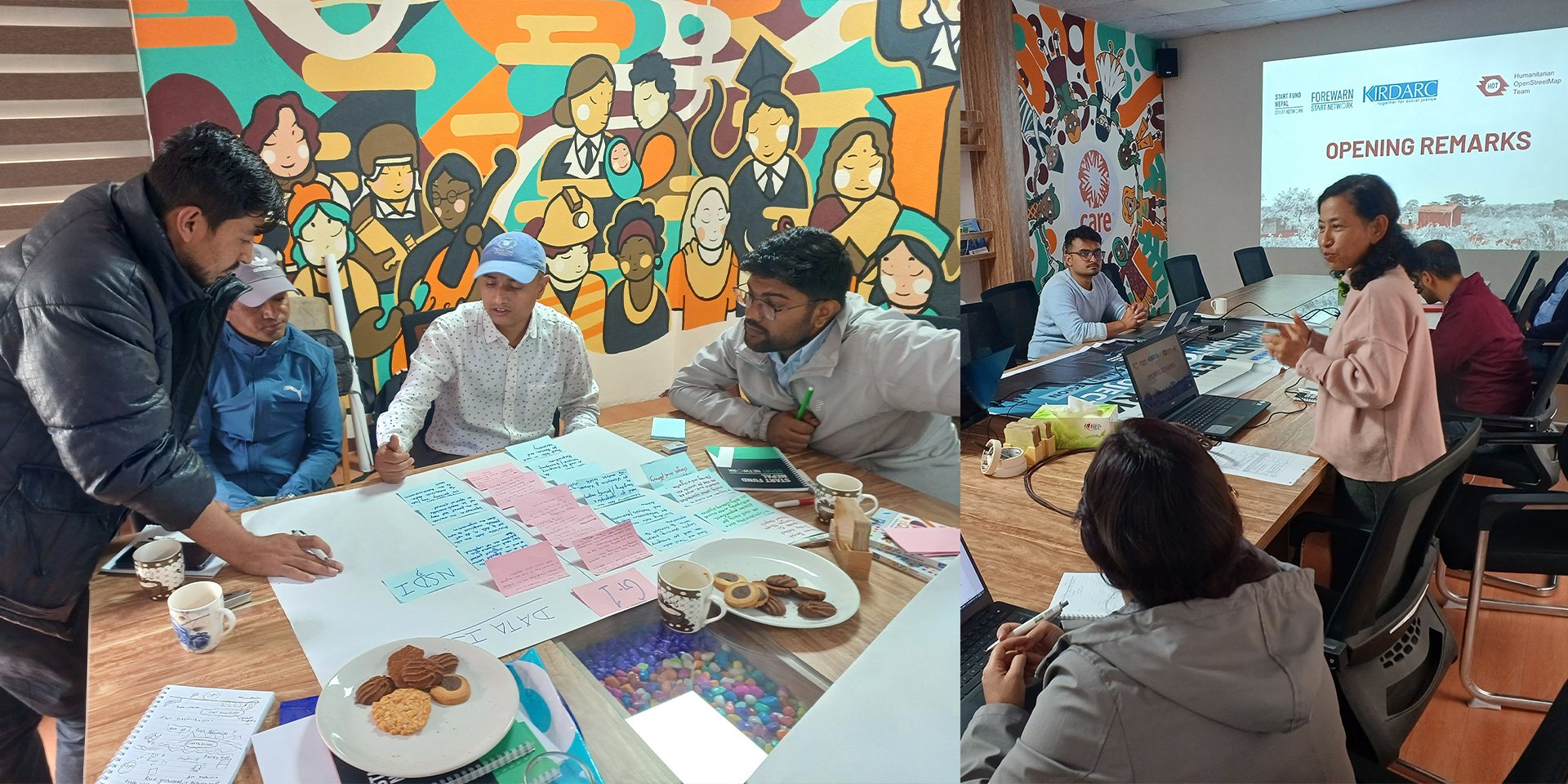
Co-Designing, Capacity Building, and Networking
The project co-designed and implemented the following workflow with local stakeholders, including Start Network and KIRDARC:
- The Foundational Phase improved and reviewed the OSM road data with local stakeholders to understand their needs, gaps, and challenges.
- The Project Planning Phase was co-created with local stakeholders, and priority open-mapping capacities were identified to be developed.
- The Building Local Capacities Phase worked with key local stakeholders, such as KIRDARC and local government representatives, through training and hands-on practice on the grounded foundational dataset.
- The Building Networks Phase provided local stakeholders opportunities to network with the wider OSM Nepal Community for future collaborations.
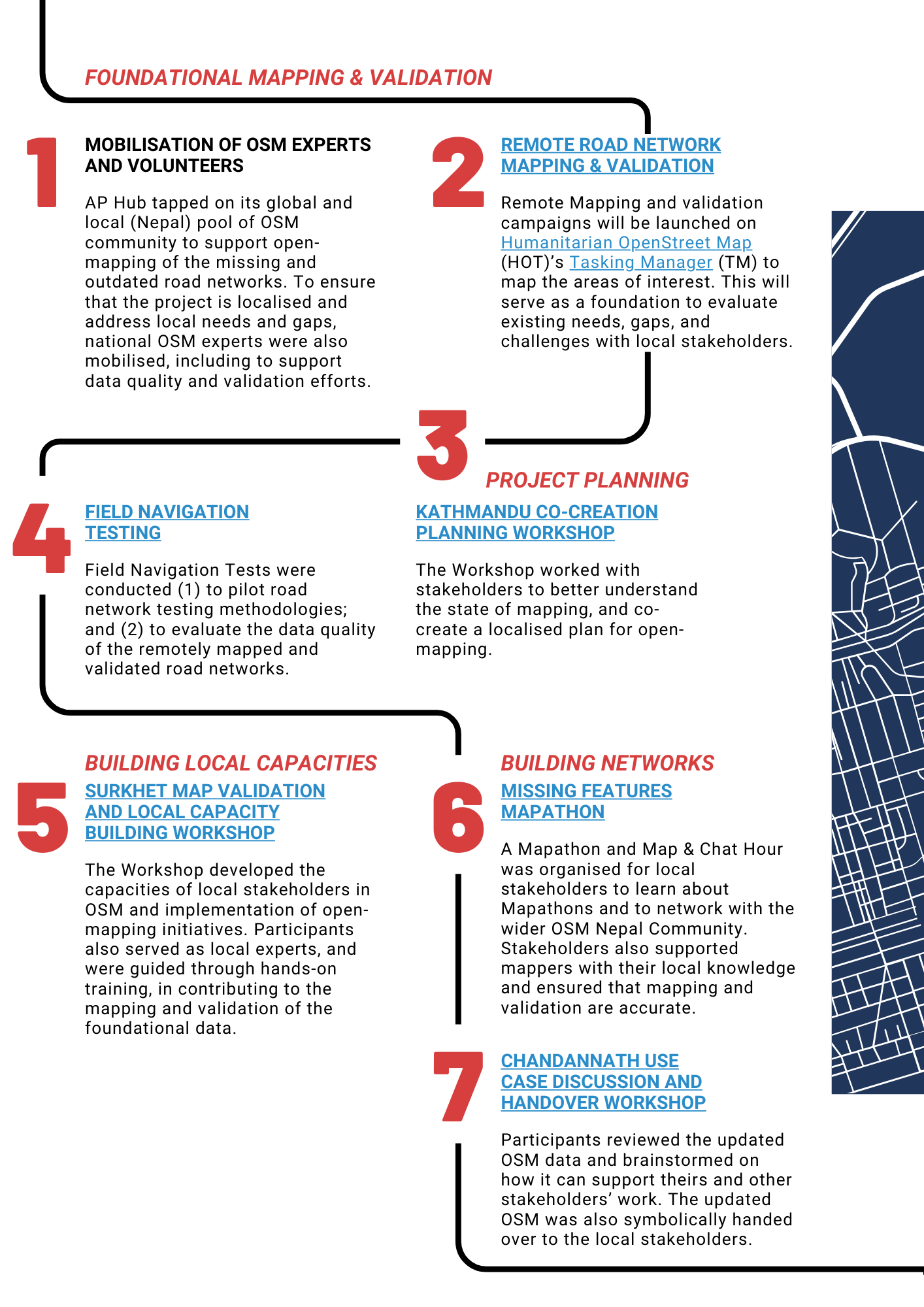
The project's workflow was co-designed with local stakeholders, tailored to the local Karnali Province context.
Throughout the project, a series of technical workshops and training was conducted for the participating Start Network member organizations and volunteers on OpenStreetMap, covering a range of topics from field mapping to data analysis and creation using open-source tools. OSM experts were also mobilized nationally to support data quality and validation efforts.
Tools used included:
- Tasking Manager and MapRoulette: to update and prepare validated OSM maps for review.
- OSMAnd, Organic Maps, and BRouter: to conduct local validation of updated road network OSM data.
- Ushahidi: to report local road closures (e.g., from landslides) that can be captured and updated on OSM.
Outcome and Impact: Empowering Communities Through Open Data
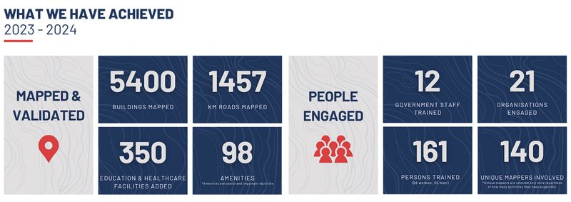
Through the project, the region has seen an average of 44.17% increase in road network OSM data, through the mapping and validation efforts led by AP Hub (see image below).
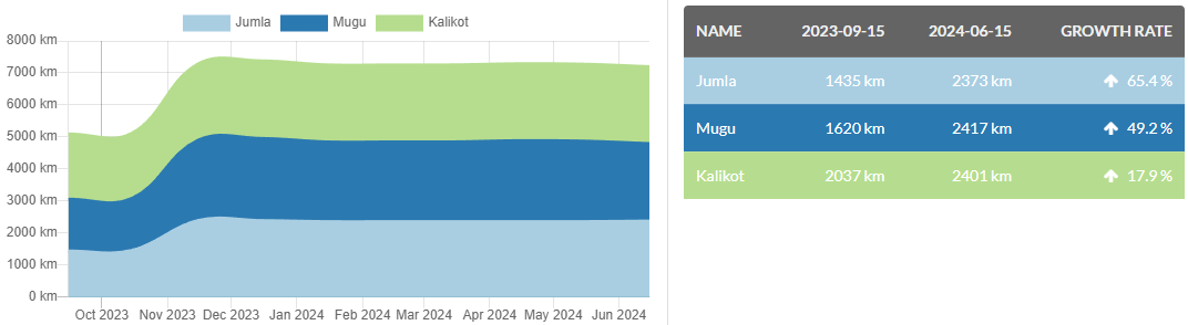
OSM Road Network Data growth and changes between October 2023 and June 2024 (ohsome, 2024)


In the long term, it is expected that this validated road network data will enable humanitarian and development actors to effectively reach communities that were previously uncharted on the map in this region.
In the short term, local stakeholders, including community members, have acquired the necessary open-mapping skills to actively participate in mapping and validation activities, especially to reflect changes in road network accessibility. Local stakeholders also have access to the project's OSM Wiki page and the training materials covered, allowing them to review as they practice the skills. In addition, the open data will be fully available for local stakeholders, such as other NGOs, to use for their own initiatives.
Looking for more information?
The AP Hub has released a comprehensive resource booklet covering the outcomes of this project. Read here (or by clicking on the image below).
Cover photo credit: Nirmal Kathayat
