Sustainable Cities: Mai Tou Togo
This project, which has received a national award, is providing crucial information to urban planners and policymakers in Togo. The data collected through this project has proven to be highly beneficial in refining urban plans, modifying policies, and creating new sustainable regulations through a participatory approach. Local municipalities require well-organized and structured geospatial data to comprehend better and manage vital aspects of urban infrastructure, services, and resources.
Objective
As the world becomes more urbanized, with more than half its population living in cities, making cities safe, inclusive, sustainable, and resilient is a priority for all nations, from the most developed to the least developed.
While cities contribute relatively economically to national growth, they also immensely produce pollution and other factors that expose urban populations to negative consequences for their living conditions and contribute to climate change impacts on them.
Across cities in West and Northern Africa, demand for scarce infrastructure and public services is on the rise due to increasing urban population growth, thereby contributing to the housing crisis, traffic congestion, supply chain management, solid waste, informal settlements, unemployment(quality jobs), and food security, among other issues.
Municipalities in Togo are facing significant challenges hindering their ability to plan sustainable cities. One of the main issues is the need for more local expertise in GIS. Municipal technical departments often need more skills and expertise in GIS and spatial data analysis, which makes informed decision-making and effective city planning difficult. This has led to a need for more geospatial and structured data. The lack of data makes it challenging for municipalities to effectively understand and manage critical aspects of urban infrastructure, services, and resources.
Solving the problems related to sustainable cities requires a combined effort from various stakeholders, including the national government, the private sector, development partners, academics, non-governmental organizations, and the community. The first step towards creating a more sustainable city should be a national policy that drives all actors towards the common goal. Fortunately, the Sustainable Development Goals (SDGs) provide a global framework that most countries follow to make their cities more sustainable.
The Mia Tou Togo project tackled these challenges through sustainable solutions.
- The project provided comprehensive GIS training to municipal teams, which helped bridge the gap in expertise within technical departments.
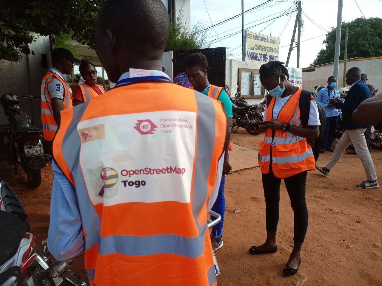
- The project gathered structured geospatial data through fieldwork and remote mapping. This was essential for mapping urban infrastructure, identifying resources, and improving municipal services.
- The project actively promoted using open-source tools and methodologies, such as OpenStreetMap, for urban development. It conducted awareness-raising campaigns, engaged municipal authorities, and demonstrated the practical applications of open geospatial data.
Approach
What methodologies did we use?
- Stakeholders mapping, engagements, and Workshops
- Remote mapping and field data collection
- Data analysis and map product development capacity building of technical stakeholders and local community youth
What tools were used:
- Tasking Manager - was used for remote mapping activity
- Central Server - ODK Central server was used to authenticate store data
- JOSM- was used for data cleaning and validation
- Quantum GIS - QGIS was used for data analysis and visualization
- Open DataKit - was used for field data collection
What datasets were collected:
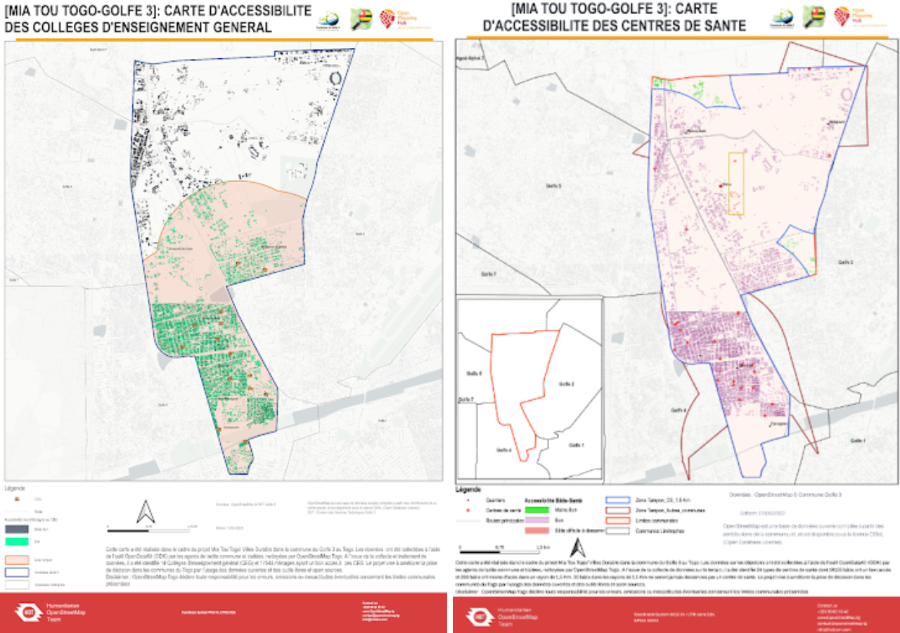
- Amenities(education, health, parks, place of worship, markets, communications, factories, electricity, sport courts, toilets, waterpoints, transport, businesses, solid waste)
- Drainage networks (coverts, bridges, drain segments)
- Buildings, roads (roads, railway), and waterways (lakes, rivers)
- Place names
Various data on city planning, service delivery, transport, solid waste, electricity, and more were collected based on specific use cases and needs. These datasets were cleaned, analyzed, and shared with commune authorities and other stakeholders. Only non-identifiable datasets were uploaded to OSM and included in the general maps developed.
Outcomes and Impact:
The project contributed:
- 109,012 Buildings
- 2,138 Km roads
- 6,415 Km waterways
- 32 printed maps
Five training sessions were conducted, two for the project’s core team and three for technical stakeholders in Atakpame, and Golfe 3.