Eight New Communities Selected for 2019 HOT Microgrants
Posted by Rebecca Firth • April 12, 2019

Female drone pilots mapping Africa’s largest slum, a youth group changing waste management behaviours in mega-cities, and mappers making Manila more accessible for persons with disabilities. These are a few examples of the eight incredible new community projects that are the recipients of the 2019 HOT Microgrants!
The HOT Microgrants program has been supporting local communities to scale their mapping activities since 2017. This year we received applications from over 30 countries and the diverse range of recipients reflect HOT’s mission for a world where everyone is counted. Learn more about the communities selected and the projects they will be executing throughout the upcoming year:
Action for Resilient Communities (Philippines)
Action for Resilient Communities (ARC) aims to move the city of Manila one step closer in becoming more accessible for persons with disabilities. ARC aims to empower persons with disabilities and youth with mapping skills through workshops, supporting them to map the accessibility of public infrastructure for those living with disabilities. ARC will collaborate with FEUTech YouthMappers and other mapping experts in the area, building professional networks between new mappers and existing communities. ARC’s goal is to create an inclusive environment for all mappers and increase opportunities for individuals of all abilities and ages to take part in their community’s development.

Code for Africa (Nigeria)
Since 2012, Code for Africa uses civic (open source) technology and open data to empower citizens with local information for better-informed decision making.
CfA will be mapping Makoko, one of Africa’s largest slums. A third of the community is built on stilts in a lagoon off the Lagos mainland, where transport is by canoe. Since land mapping proves difficult in this area, CfA will be using cheap fixed-wing drones to photograph and algorithmically map the community, training 5-7 women as drone pilots. Land-based data collectors will then help annotate the aerial maps with key buildings and infrastructure, and how they are used. The resulting open geodata will for the first time give community leaders, residents, planners, and development agencies exact intel on everything from schools and clinics, to waters sources, sewers, roads, markets and homes in Makoko.
.jpg)
Cuerpo Consultivo para el Desarrollo de Río Piedras (Puerto Rico)
Cuerpo Consultivo para el Desarrollo de Río Piedras (CCDRP) aims to develop the first community-driven disaster preparedness and recovery mapping inventory in Puerto Rico. Created in 2016, CCDRP is an effort to establish a new governance framework for the city of San Juan, Puerto Rico. They aim to design a project from the grassroots, community-level, changing the top-down approach of government-led development initiatives. Mapping activities will be completed across the eight communities that form Río Piedras to understand what unmet needs still exist from past disaster events, to identify critical infrastructure needed to support disaster relief efforts, and to identify organizations and individuals who can support future relief efforts.

Leclara (Ghana)
Leclara introduced community-run, sustainable tourism initiatives in Larabanga, Ghana, in order to generate revenue at the local level. A prerequisite for successful tourism is having a map of the community. Leclara plans to train groups of youth in the region on open mapping, conducting regular exchanges with experienced mappers from OSM Ghana. Using OpenStreetMap, Leclara aims to build a meaningful source of sustainable income and new pathways for youth to gain skills that unlock future job opportunities.

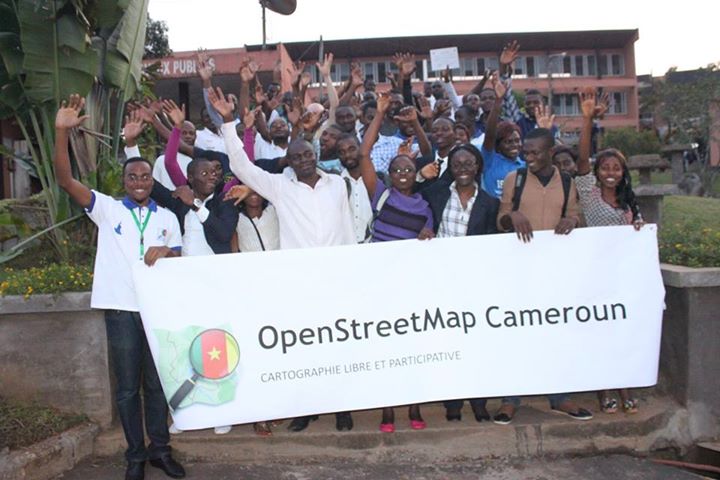
OpenStreetMap Cameroon (Cameroon)
OSM Cameroon’s aim is to not only produce data in OpenStreetMap, but also to ensure that the data creates value-added services that have an impact on people's lives. OSM Cameroon aims to create a free provision of GitHub – the code of the infrastructure they have built – so that the OSM Communities of surrounding African countries have an OSM data recovery infrastructure. Boot camps and work sessions will focus on introducing and training participants from different backgrounds to contribute towards and reuse OpenStreetMap data. They will also be equipped with tools to create their own open source geospatial products and platforms based on OpenStreetMap.
OpenStreetMap Gambia (The Gambia)
OSM Gambia has been building its mapping community for over a year. Placing a high priority on creating a diverse and inclusive mapping community, 70% of the mapping community are young girls from surrounding secondary schools and universities.
OSM Gambia will work with the Gambia Tourism Board and the National Environmental Agency to identify ecotourism areas and capture the current state of vegetation and wildlife to stimulate The Gambia’s tourism industry and assist in planning efforts focused on environmental conservation and preservation.
OpenStreetMap Nicaragua-MapaNica.net (Nicaragua)
OSM Nicaragua-MapaNica.net has a vision to create the most detailed and complete map of Nicaragua that empowers individuals to use open data and participatory technologies to solve common challenges. OSM Nicaragua-MapaNica.net’s aim is to continue mapping the public transit routes in Managua and surrounding cities, expecting to reach at least five new cities. They believe mapping is the first step towards improving the transportation system, while engaging new individuals in mapping. By engaging local stakeholders to use OSM for urban planning, the goal is to improve mobility and transport policies in the country.

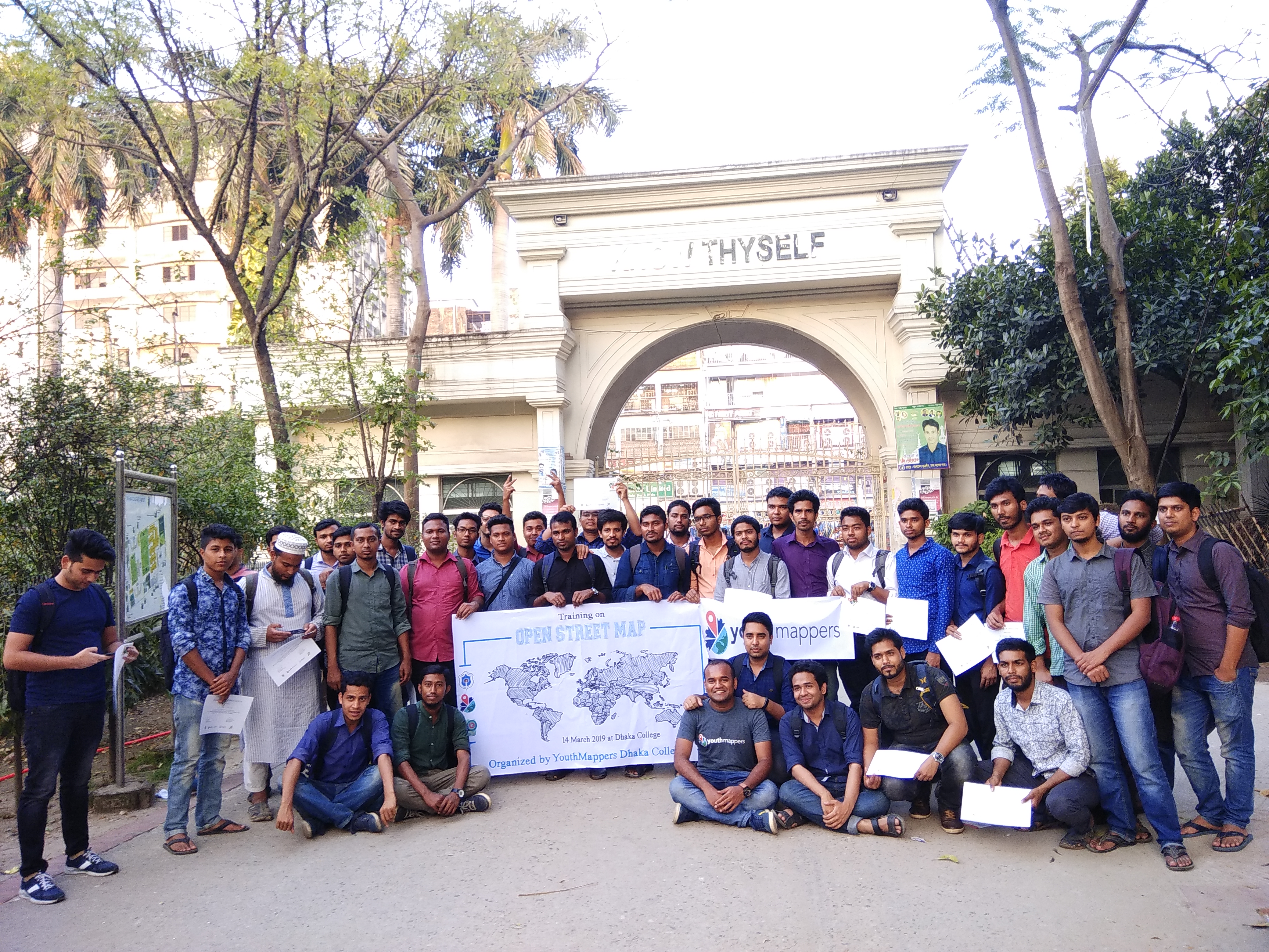
YouthMappers Dhaka College (Bangladesh)
YouthMappers Dhaka College aims to address a growing challenge for many mega-cities across the world: waste removal. Dhaka’s population has boomed, causing local leaders to focus on several issues affecting individuals related to health and environment. But a cross-cutting issue is the 4,500 tons of waste produced on a daily basis in the city and few effective measures have been taken to mitigate the issue. YouthMappers Dhaka College plan to map all waste collection points in the city to make them easier to find and bring about behavior changes for better waste management practices. Better data will also help city planners determine the ratio of waste collection points to the population.
We are also excited to share that the HOT Voting Members have selected a 2018 Microgrant community to receive a follow-on grant for the 2019 year, via a community vote:
Fundación OpenStreetMap Colombia (Colombia)
In the Caribbean Darien Zone on the border between Panama and Colombia, there is a sustained migratory crisis, with Venezuelans continuing to seek refuge. The humanitarian emergency is exacerbated by the arrival of refugees and displaced persons from other parts of the world hoping to continue their journey through Latin America. Fundación OpenStreetMap Colombia (pictured at top) will work to map the borders, building relationships with local responders and authorities to use the data for planning response activities.
Many thanks to the individuals and organisations who donated to the 2018 Fundraising campaign to make Microgrants possible, and to Board & Voting Members who reviewed the applications.
Share
