Equipping University Students with Digital Geospatial Skills: More than 10,000 Flood Data Points Mapped in Eight Weeks
Posted by Hawa Adinani • Nov. 5, 2020
Ramani Huria has been training students in Dar es Salaam and equipping them with industrial and technical skills for the 21st Century while generating vital high-precision, low-cost data for flood prediction and preparedness.
Training and working with university students has been a core part of the Ramani Huria project since it started in 2015. Since then, we have trained over 1,000 university students in industrial placements, equipping them with the valuable open geospatial skills they can use in their careers. While training students, we have also been able to collect a variety of datasets to support urban resilience programs, particularly flood preparedness in Dar es Salaam.
Over these past five years, we have improved our skills-sharing with students. This not only enables reliable and cost-effective data acquisition thanks to their work, but it also exposes them to new ways of doing things without investing a lot of money on expensive equipment. For example, we familiarize students with accessible open tools and software that they can use beyond their industrial placement.
Deploying Students in the Field
Working with the Tanzania Resilience Academy to train 200 university students from three universities between September and November 2020, we were able to give them field mapping experience while collecting flood-extent data in flood-prone areas in Dar es Salaam.
In the past two months, students were able to work with community members from 20 wards in Dar es Salaam to collect data on the extent and depth of water when it floods. The data collected will build upon the already existing data from our river cross-section survey to further develop the city flood model to help predict and prepare for future flooding.
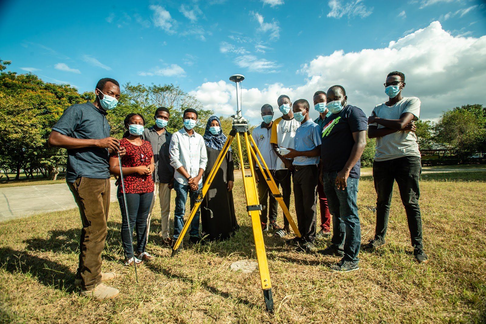
One of our goals is exposing students to the latest open-source geospatial technologies and innovations. We gave a small team a low-cost dual-frequency (u-blox) receiver that they used to collect ground control points using the precise point positioning (PPP) technique, providing data with a high level of position accuracy that could be used for rectifying drone imagery. This work created the data we required for these catchment areas while also equipping students with skills in using low-cost equipment that is readily available.
As it is a fundamental skill for any newcomers to the geospatial world, we also trained students in digitizing building footprints using JOSM software. The students then updated the already digitized buildings in Dar es Salaam using up-to-date high-resolution, 2020 Maxar imagery with 50 cm accuracy.
"Many companies and organizations need spatial skills that meet their business or industrial needs. The skills I gained as a student may pave the way to different opportunities that will require digital geospatial skills" - Batuly Lukonge, Student, UDSM.

Call for Action
We advise organizations and startups that are eager to equip youth with relevant industrial and technical skills to work directly with students and engage them in real-world projects. This supports them academically and creates a cohort of youth that are problem solvers and ready to take part in this technologically advancing world. It also makes them marketable in the 21st Century, supporting them in competing for opportunities around the world.
Share
