OpenStreetMap Contributors Needed to Map Khartoum Ahead of New Radar Satellite Imagery
Posted by Raiza Pilatowsky Gruner, Jessica Pechmann, Claudio de los Reyes • May 27, 2025
Over the past two years, conflict in Sudan has driven the country into one of the world’s largest humanitarian crises. Satellite radar coverage gaps have hindered efforts to assess damage to urban areas. With the launch of the Sentinel-1C radar satellite by the European Space Agency, that gap is beginning to close — but a comprehensive dataset of building footprints from OpenStreetMap (OSM) is essential to make this satellite data actionable.
Two Sides of the Same Coin: Optical and Radar Imagery for Damage Analysis
Since our ability to understand and respond to crises in hard-to-reach areas like Sudan depends heavily on earth observation capabilities, primarily through remote sensing technologies due to security constraints on the ground, having updated, appropriate imagery becomes paramount to our work. On one hand, OSM building footprints are derived from optical imagery, and on the other, change detection layers are commonly derived from radar imagery.
In order to identify the impact that a region has sustained during conflict, damage researchers need a pre-conflict baseline from which to base change detection on. In this case, OSM building footprints that have been digitized using optical satellite imagery, pre-conflict, are used to determine urbanized areas and as a geographical (spatial) filter. However, optical imagery by itself is not always a good measure of damage, as details can be concealed from the original imagery due to the angle or resolution.

On the other hand, radar imagery automatically detects damage from multiple angles. By registering different types of surfaces through different amounts of scattering, it is able to register if a building has been damaged. Radar images can be compared across time periods to determine the evolution of damage in a conflict area. However, this means that up-to-date radar imagery is crucial to provide informed damage analyses that reflect the current situation on the ground.

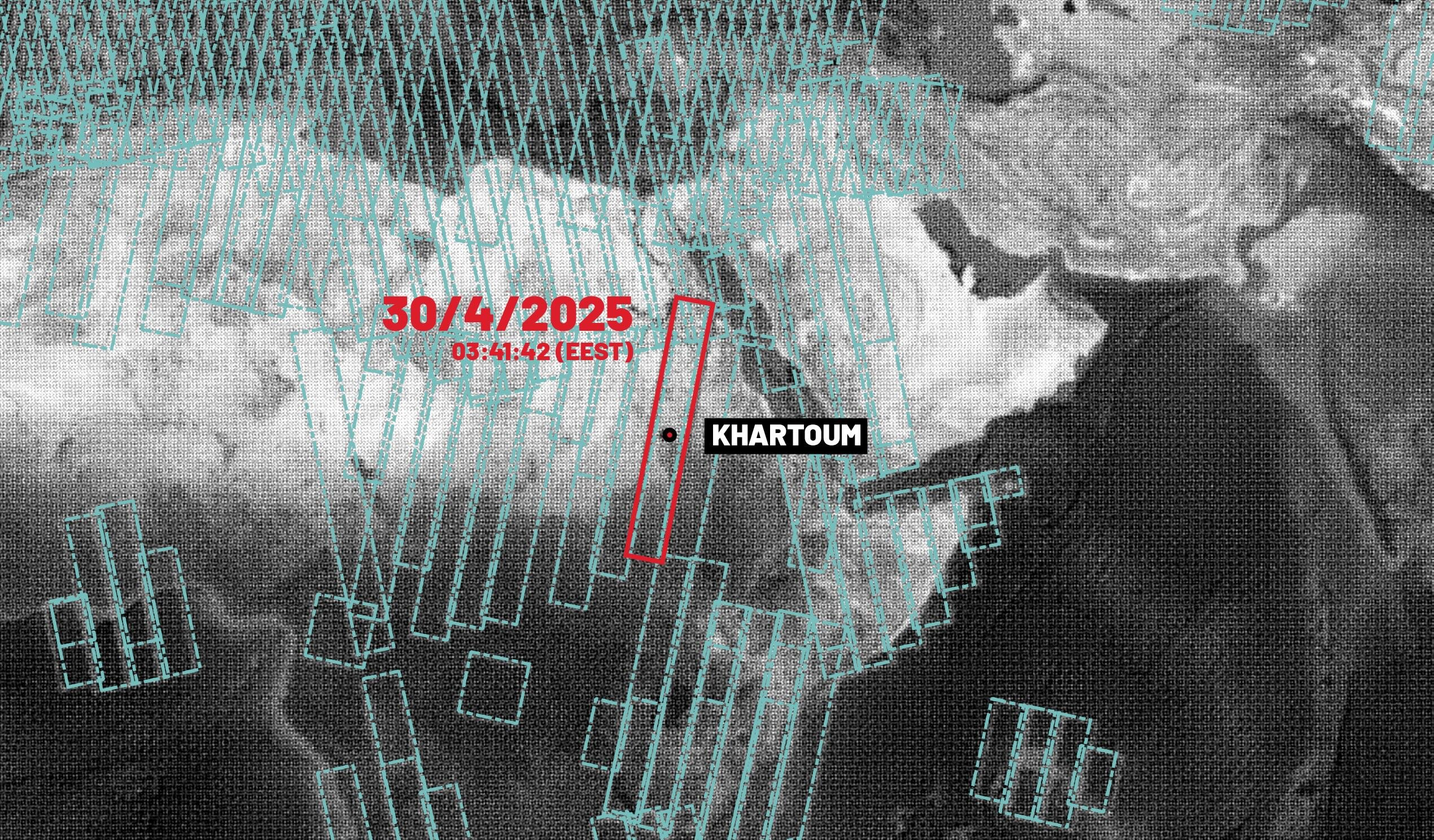
New Satellite Insights: The Sentinel-1C Opportunity
Following a four-year gap in coverage over Sudan, the European Space Agency's Sentinel-1C satellite with radar sensing was successfully launched in December 2024. Sentinel-1C will pass over key conflict-affected areas including Khartoum and Al-Fashir in April and May 2025. This timing is crucial as it allows for comparison between pre-conflict and current conditions using Synthetic Aperture Radar (SAR) data. Now, for the first time since the war started, researchers who are partners with HOT will be able to detect the impact of the conflict on communities at scale.

The Critical Importance of Building Footprints
Now that new radar imagery from Sentinel-1C will be used to update conflict damage change layers, it is important that building footprints are also up-to-date and accurate. Beyond being part of damage assessments, this data is also the foundation for humanitarian response and recovery planning. Mapping (digitizing) buildings is particularly crucial for several reasons:
- Establishes baseline data for comparison with post-conflict imagery
- Enables systematic damage assessment through change detection techniques
- Helps humanitarian organizations estimate population distribution and needs
- Supports planning for aid delivery, reconstruction, and service restoration
Why is this Data Needed So Urgently?
The Sudanese conflict that started in 2023 has evolved into one of the world's most severe humanitarian crises, with impacts that continue to devastate communities across the country. Since fighting erupted between the Sudanese Armed Forces (SAF) and the Rapid Support Forces (RSF) in April 2023, Sudan has faced unprecedented challenges, becoming the country with the largest number of displaced people globally – with over 14 million people uprooted from their homes as of late 2024.
At least 24,000 people have been reported killed in the conflict in Sudan, though the actual death toll is likely much higher when accounting for indirect deaths. According to the Armed Conflict Location and Event Data Project (ACLED), nearly 9,000 attacks were recorded between April 2023 and October 2024, with more than half occurring in Khartoum (54%), followed by Gezira State (12%) and North Darfur (9%). Specifically in Khartoum State, there have been over 2,000 explosions and over 2,500 battles, all likely causing damage.
The internal displacement patterns are similarly alarming. By November 2023, an estimated 5.8 million people had been displaced within and outside Sudan, with approximately 4.63 million internally displaced across all 18 states. In Darfur alone, about 1.77 million internally displaced persons (IDPs) were recorded.

Call to Action – OSM Mappers Needed!
HOT is coordinating a campaign to map buildings in key urban areas of Sudan in preparation for remote damage analyses once Sentinel-1C fully covers Sudan. By creating open access geospatial data, HOT ensures that humanitarian organizations, researchers, and policymakers can make evidence-based decisions in their response efforts.
Map today! Visit the HOT Tasking Manager and look for projects in Khartoum or Al-Fashir or visit this link.
This project is part of HOT’s Conflict & Displacement Program. To learn more visit our website: hotosm.org/programs/conflict-displacement or email us at data@hotosm.org
Share
