News — 23 April, 2024
Our End-to-End Mapping Solution: Training the Balinese Disaster Response Team in Karangasem
HOT envisions an ecosystem of open mapping technology that enables everyone, and in particular vulnerable communities, to make the right open map data available in order to use that to make a positive impact on people’s lives.
To work towards that vision, HOT’s Tech & Data team have for the past years been working jointly with volunteers and partners on closing key gaps in the open mapping ecosystem. Our individual tools have been gradually evolving and are today intensively used in most of HOT’s projects and far beyond.
Apart from building/improving individual tools, our aim is to develop a streamlined, full end-to-end open mapping workflow that is user-friendly and accessible by people living in vulnerable areas. The end-to-end solution allows anyone to access and apply the full mapping workflow: from collecting raw data to generating insights based on the locally collected data.
“… an end-to-end solution allowing everyone to access and apply the full mapping workflow, from collecting data to generating insights …”
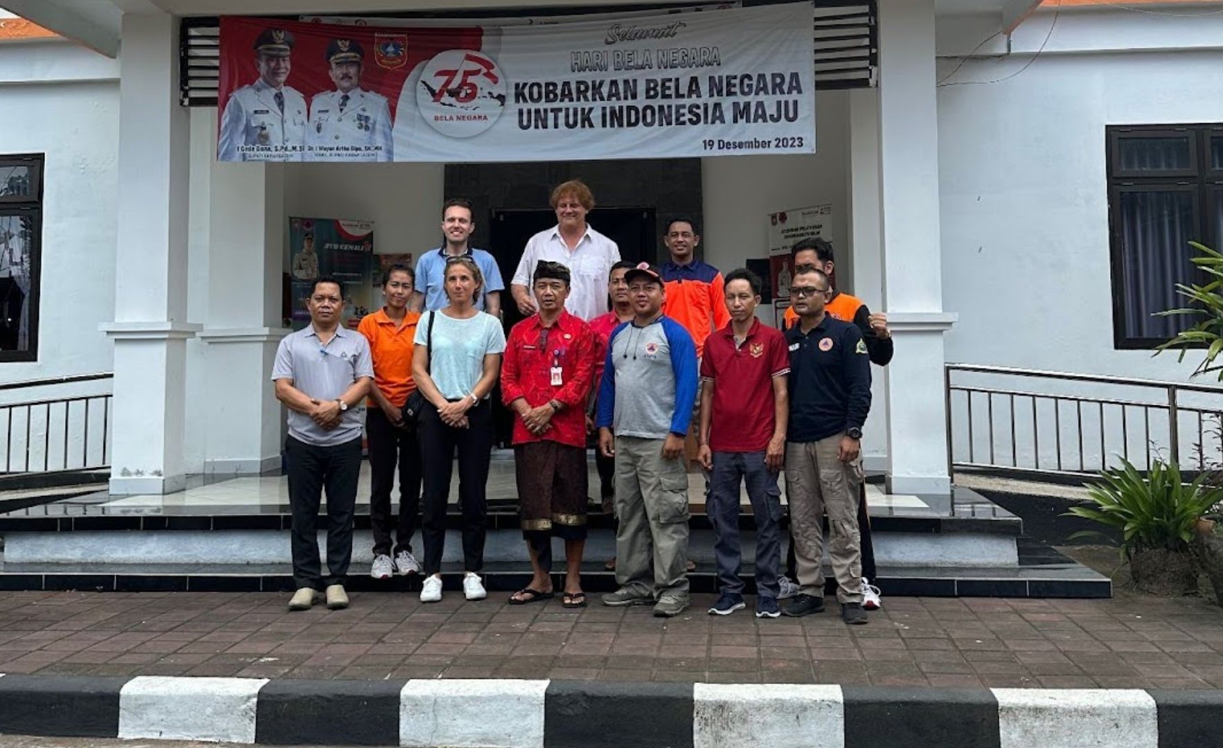
In March of 2024, HOT’s Tech&Data team ran an end-to-end community mapping exercise with the local office of the BPBD, the disaster management agency in Bali, Indonesia, in the eastern regency of Karangasem. We made use of many of the tools created and maintained by the HOT’s team and were able to test our full end-to-end solution. And, we were able to train the local disaster management agency to apply our end-to-end solution in areas that are prone to disasters, in particular landslides.
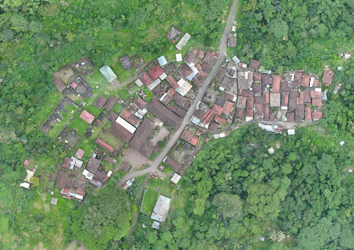
The primary field location was the village of Sega, in Karangasem Regency (Eastern Bali).

Location of the village Sega and the BPBD Karangasem office
Sega is a beautiful location, but quite vulnerable to landslides and other natural disasters, perched on a steep ancient volcanic mountainside and apparently eroding quite quickly.
View from the village Sega on a drone orthophoto
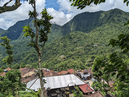
View from Sega from the hillside just above
HOT has been training the Karangasem office of the BPBD on the full end-to-end mapping workflow so as to enable them to generate and use data for landslide risk assessment.
The key steps in the workflow:
STEP 1 - Acquire base & sensor data We flew a drone to capture recent and high resolution imagery from the village. We used open software (ODM and OAM) to process the raw imagery and shared the imagery as well as the resulting DEM for wider use.
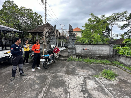
Local staff of the BPBD operated the drone to collect aerial imagery
STEP 2 - Process-based & sensor data
We used HOT Tasking Manager to collaboratively and remotely map the buildings of the village. We also trained a local AI model with that training data, for future AI-assisted mapping of buildings in a similar context.
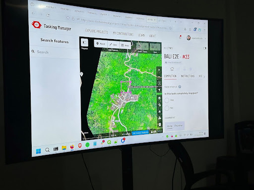
Using Tasking Manager to remotely map buildings and generate training data for a local AI model
STEP 3 - Add local knowledge to the data.
First in the office, we elaborated a survey collection form with specific questions to be used in the field. In the village, we trained the staff to use HOT’s FMTM (Field Mapping Tasking Manager) to add local context to the buildings generated. In particular the BPBD was interested in the building materials, specific vulnerability to erosion (a big problem in Sega) as well as the number of persons present in buildings at certain periods of the year to assess the human impact of disaster risk.
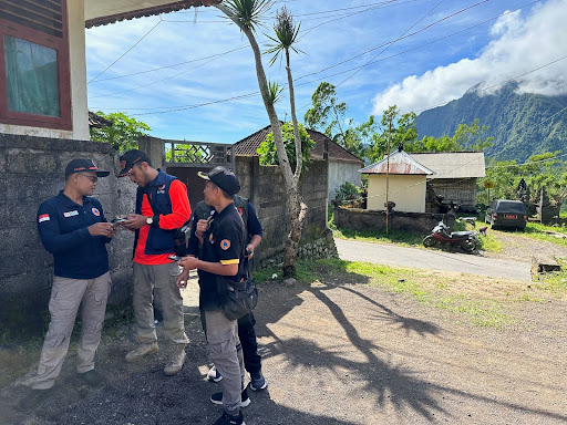
Staff of the BPBD Office and the Chief of the village, using FMTM to add context to buildings in the village.
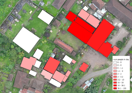
Addition of amount of people residing in a building in the village while mapping in the field with FMTM
STEP 4 - Make map data accessible
We trained the staff on HOT’s Export Tool and geospatial formats.
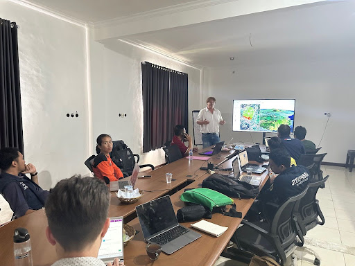
Training on HOT’s tools in office
STEP 5 - Analyze map data for impact
We trained the staff in using an open GIS (QGIS), for visualizing new data alongside various other open datasets. The BPBD staff were enthusiastic about learning how to use QGIS; in particular they felt that the 3D visualization capacity would help them identify vulnerable areas where more disaster risk assessment would be needed. They also realized that they had a great deal of geospatial data that they weren’t able to use, and were excited to learn how they could make use of the data they already had! We agreed that HOT will continue supporting the BPBD with GIS training using QGIS through our OSM Guru program.
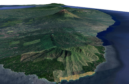
A 3D map generated in QGIS showing the mountainous, disaster-prone areas of Karangasem Regency. Mount Agung, a highly active volcano that produced a series of disastrous eruptions between 2017 and 2019, can be seen in the background.
During this process, we were able to both train the BPBD officers but also learn a lot from them. We discovered practical barriers when working with our tools in remote environments as well as challenges our team further needs to focus on, both on an individual tool level and for ensuring the complete end user experience is smooth and adapted to the local context.
We would like to thank the BPBD Office of Karangasem for this first test, which will not be our last however. We are ideating with them on how we can build a center of excellence for open mapping for disaster response in Karangasem. It’s a great pleasure to have such a proactive, engaged, and capable local disaster management partner to work with HOT and the open mapping community to improve community resilience!