News — 31 January, 2019
Piloting Tanzania's First Patient Origin Tracking System

Putting hyperlocal data to use at the Amana Regional Referral Hospital in Dar es Salaam. Pictured above is Dr. Omari Mahiza who is helping lead the charge.
Imagine you’re a doctor in one of the most densely populated cities in East Africa. Imagine seeing a sharp spike in patients suffering from a certain disease but, when examining the hospital’s record system, all you find is the most basic patient location information: name and city of residence. Let’s say it is the rainy season in Dar es Salaam and cholera cases are popping up across the city but you lack the tools to pinpoint precisely where the origin and high risk areas are. What do you do?
This is the exact position that Dr. Omari Mahiza, a pediatrician at Amana Regional Referral Hospital in Dar es Salaam, has regularly found himself in. Some would say that Tanzania’s health sector is already struggling with a lack of system and infrastructure to add even more nuanced requirements. However, Dr. Mahiza in collaboration with the HOT team in Tanzania developed a method to collect more useful patient location data using the local knowledge citizens already possess of their own communities.
Prior to HOT’s intervention, hospital staff at Amana Hospital said the vague nature of data collection meant that the hospital could not do much with the information collected. In spite of the registration process at Amana being recognized as a critical part of the hospital’s operation, the substantial amount of data being collected was neither systematic nor useful to understand where patients were coming from. “We receive over 2000 patients a day and we have 3 key staff collecting the data on different shifts. It’s a time consuming task so it’s important that we use the information collected to make a difference” says Fatma Mlawa, head of registration.
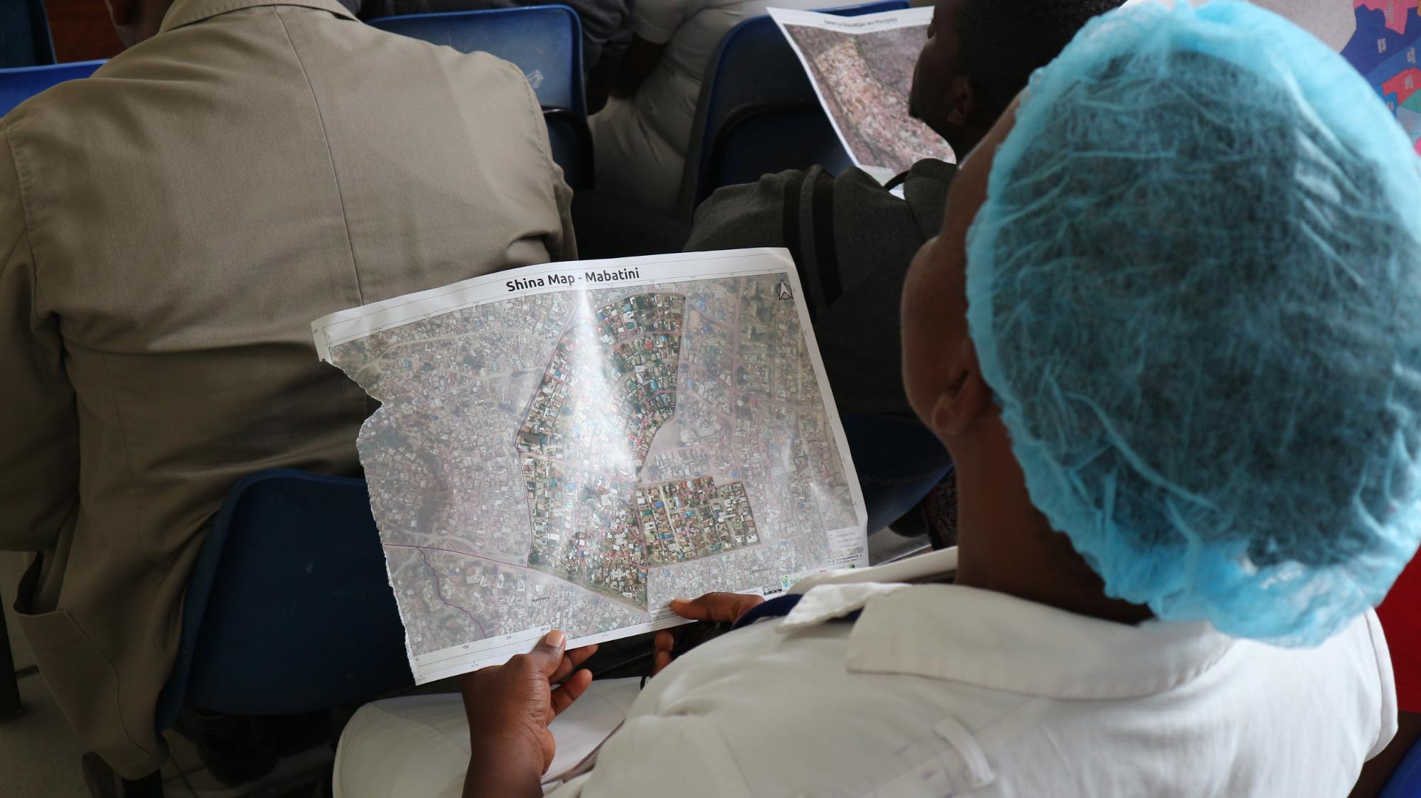
Understanding the need for more systematic data collection to enhance data quality and overall usefulness, the HOT team updated Amana Hospital’s existing electronic health information system (eHIS) with geographic relevance to make the data coming out of the registration process more useful for patient origin tracking. Working with Global Professional IT Group (GPITG) - the Tanzanian software development group who built the eHIS at Amana - to enhance the system’s efficacy, we provided the names of the ward and subward level divisions across 5 districts collected from prior mapping efforts to create drop down bars that hospital staff could select to register a patient’s location using the respective ward and subward names. The system update also included the names of local leaders each responsible for more granular admin boundaries existing below the subward level - the hyperlocal administrative boundaries. These boundaries, mapped for the first time by the HOT Tanzania team, uses the names’ of local leaders (wajumbe) responsible for the administration of 30 to 150 households to create granular divisions below the subward level.
Amana Hospital is one of a few hospitals in the country to recently digitize its registration process. “Before we wrote down everything by hand, we still have stacks of old books and files with patients’ data. You can see our staff need a change in mindset. We need to keep in mind that this information is important,’’ the head of registration points out.
 Nurses at Amana Hospital receive map literacy training and insight into how maps can be used to track patients and isolate disease outbreaks more quickly.
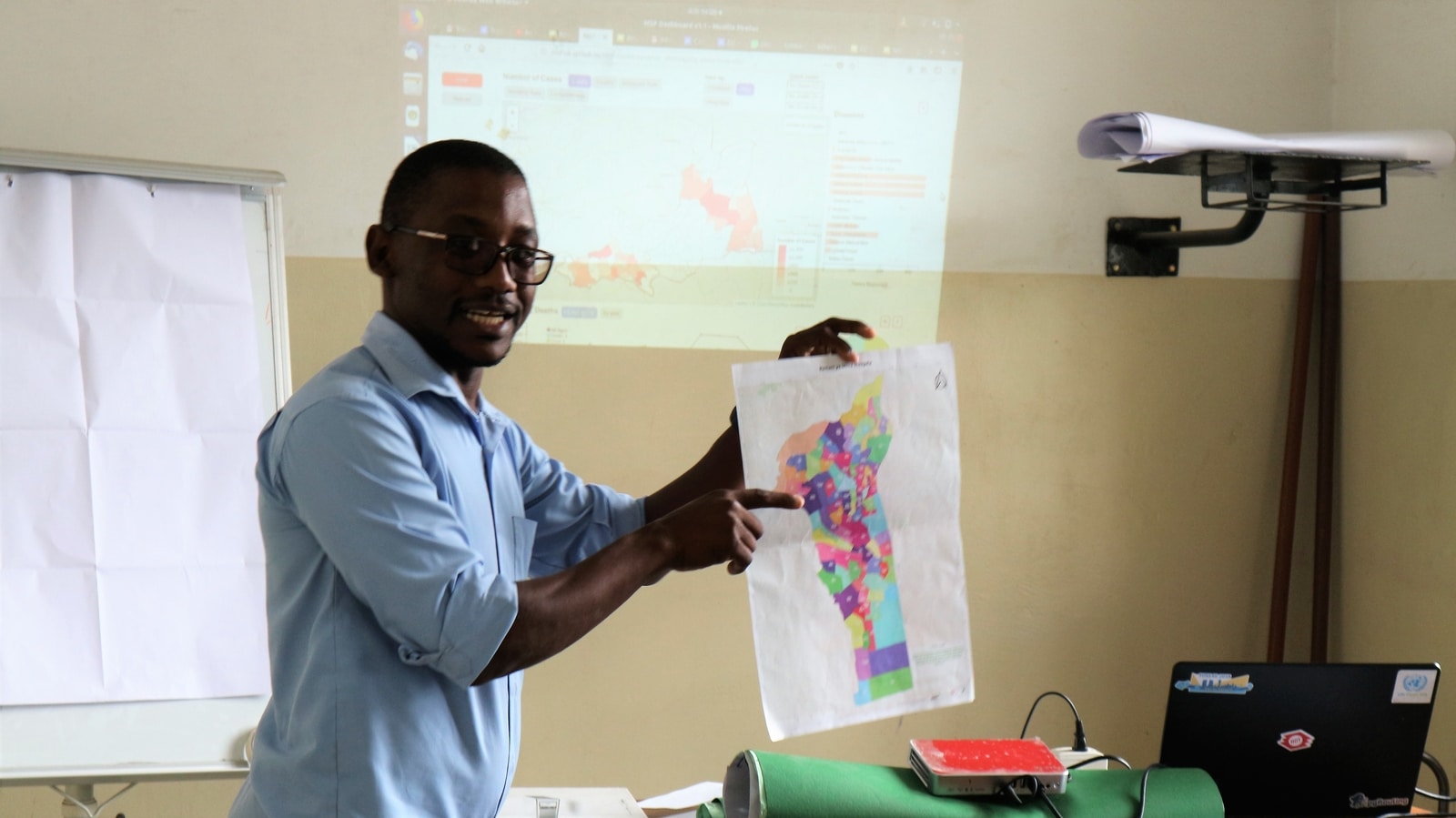
To foster this change - along with adaptations to the hospital’s eHIS - HOT organized a two-day intensive training for 20 key registry staff on using the new system to generate more location specific data at the hyperlocal community level. As of early December, Amana’s staff have started using the new system. Both HOT and Dr. Mahiza are keenly waiting to use the data in the near future. “This is the first project of its kind in the country,” Asha Mustapher, Mapping Supervisor at HOT says. Indeed, Amana Hospital stands to be a very important point of reference for other medical facilities in the country. “If this project works well here it will be a pilot to roll out to other facilities in the country,” she adds.
 Dr. Mahiza explains how assigning hyperlocal areas could help to identify patients and improve disease surveillance (feature image)
View the Amana Hospital Project infographic


Disease/infection prevention
Dr. Mahiza is even more optimistic: “The end goal for this project is disease prevention, once we have enough data we can get to work on identifying problem diseases in their problem (geographic) areas.” Dr. Mahiza’s method of disease prevention is simple, “Education and awareness raising are key. Once we have highlighted which areas are prone to malnutrition in infants, for example, we can take more aggressive steps to work with those specific communities and their leaders to educate parents about needed nutrition.”
The doctor also thinks the data can help to change Tanzania’s health system from the bottom up. Presently, Dr. Mahiza and other pediatricians in the district have to refer all cases of infant acute malnutrition to Muhimbili Hospital, the only facility equipped to handle such cases. “If we have enough data showing other areas in the district with high numbers of acute infant malnutrition, we might be able to influence government to invest more in tackling malnutrition.”
Such a bottom up approach is what HOT aims for as well and it is possible through partnerships with institutions like Amana and grassroots focused interventions that can achieve meaningful results.
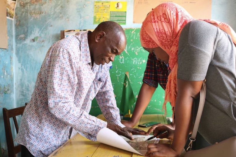 HOT team shares and verifies hyperlocal boundaries with leaders before finalizing maps to ensure boundaries have been mapped correctly.
It all comes down to mapping
Projects such as the Amana Hospital engagement would not be possible without community driven mapping projects. While this is the first time that Dar es Salaam has been mapped to such a detailed level, HOT has also mapped hyperlocal boundaries across wards in Mbeya and Kyela Districts. In a quest to ensure communities understand the generated maps, the HOT team regularly returns to the communities it has worked in to share the data with local government and citizens, discuss the findings, solicit their feedback and explore more concrete ways for data to be used by decision makers.
Wajumbe play a key role in community members’ wellbeing. In some cases, health clinics ask patients to list their wajumbe when registering. Yet despite the fact that most Tanzanian people know who their wajumbe are, there are no current open databases recording the shinas they administer. This makes it difficult for officials and community members to locate people in times of crisis, or deliver services to a specific locality, because, often, a community member can only describe their location based on their shina leader.
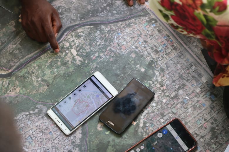 Verifying the boundary traced by phone with the actual map of the area.
Hyperlocal maps can help solve this problem. According to subward leader, Issa Suleiman, shina maps provide crucial information for leaders: “I need shina maps because they may help future subward leaders who may come after me to know how many wajumbe that the subward has, where they are located, and the number of houses each shina has. This will help ward management and record keeping.” Furthermore this will help community leaders to work with institutions such as hospitals to prevent disease outbreaks in their communities.