Reaching Inaccessible Communities Through Road Mapping for Sustainable Development
Posted by Carter Draper, Dinar Adiatma, Tonny John Kanyenye • Oct. 25, 2021
Since 2017, HOT has partnered with Facebook to build up and improve the data in OSM, particularly for countries in Southeast Asia where HOT has extensive experience in generating open geodata for humanitarian actions.
Facebook has been running a project to perfect various editing tools like AI-Assisted Road Tracing, vandalism and profanity cleanup, and MapRoulette Challenges within OpenStreetMap.
Besides the huge amount of data being surveyed, digitized, and reviewed in a growing professional workflow, together with Facebook we’re working on improving the Tasking Manager, the iD OSM editor, and equipping trained teams with cutting-edge machine learning technology to speed up the process.
This ongoing effort across Thailand, Indonesia, Malaysia, Vietnam, India, and Tanzania is studying how various machine learning algorithms can be integrated into mapping workflows while maintaining human-supported data quality.
So far, OSM roads data have been used to: * Connect people in different areas of the world through location and navigation services. * Help in the development of new software tools for open and participatory mapping. * Propel development of businesses, e.g. growth in online marketing and door-to-door delivery of goods and services since it is easier to reach customers.
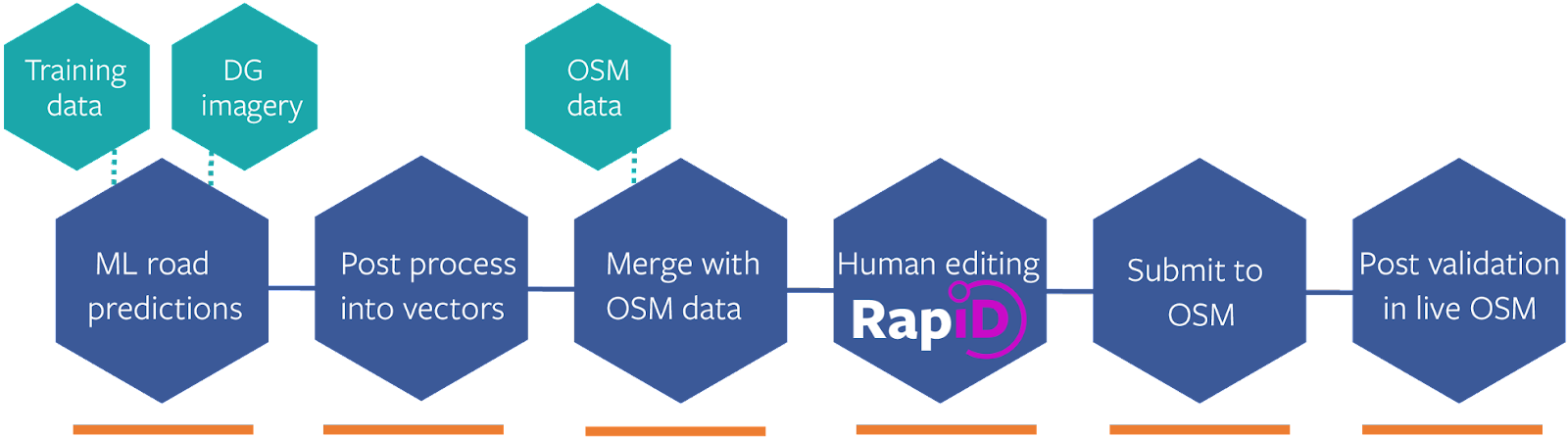 Deployed Methodology in Road Mapping
Using these tools, a total of 791,355 km of roads and 913,544 buildings have been mapped from October 2019 to September 2021, covering countries in Southern Asia - Malaysia, Vietnam, Indonesia to Tanzania in Eastern Africa.
Where are we?
Initially, the Facebook Roads Project was carried out by a consortium of partners to map Malaysia.
Now, the project is being implemented remotely by two teams. POI of Indonesia who has remotely mapped Indonesia, Vietnam and is expected to move on to Myanmar. OMDTZ, meanwhile, is mapping cities across Tanzania: Mbeya, Dodoma, Morogoro, Zanzibar, Moshi, Arusha, Shinyanga, and Mwanza. Next on this list is Dar es Salaam, and once it is done, the team will look forwards to other settlements or countries within the region.
By providing tools that can accelerate mapping and amplify the work of human mappers, this project supports the goal of mapping an area home to one billion people.

Project Learning and Benefits
- We encountered a lot of community feedback from changeset discussions. This feedback helps us improve our workflows. Feedback from countries like Vietnam and Tanzania is managed using Pascal Neis tools.
- Our project is largely focused on data quality. Therefore, we plan to have a Quality Assurance team ready to validate the full project once it is done by our mapping team.
- We are sharing knowledge with the wider community. The new tools and methods (RapiD Editor and JOSM using MapWithAI) are being shared with other communities who could potentially roll out similar projects in their regions and countries.
- We are also spending our time supporting disaster responses. First, we mapped for the Cyclone Molave flooding response in Vietnam. Second, we mapped for the Kalimantan flooding and Sulawesi earthquake response in Indonesia.
The ongoing project runs through the second quarter of 2022, and with the progress and value that the project is adding to businesses and social life, we hope to expand the work through our partnership with Facebook to other countries and regions across Africa.
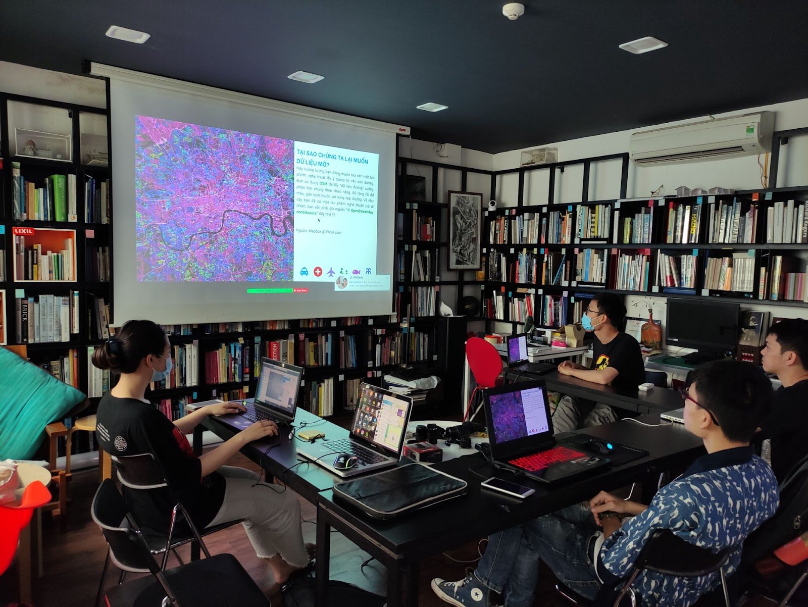
Photo 1: Mapathon, Vietnam
Photo 2: Workshop in Dodoma, Tanzania
Share
