Supporting Coronavirus Response Through Mapping in Liberia (by iLab Liberia)
Posted by Carter Draper, Sophie Mower • Sept. 24, 2020
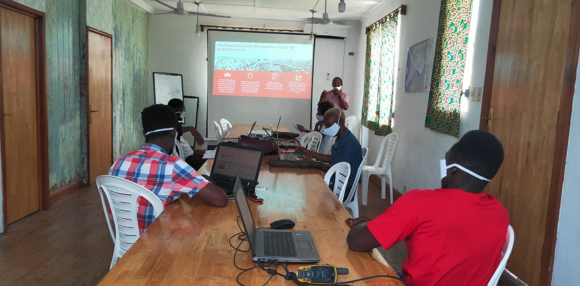
In May 2020, iLab Liberia was awarded a microgrant as part of the Humanitarian OpenStreetMap Team’s (HOT) Rapid Response Microgrant: COVID-19 Program. Here’s iLab’s community blogpost detailing their project.
The first COVID-19 case in Liberia was confirmed in early March 2020, but like most countries in the region, there was no system nor infrastructure in place to curtail the spread of the virus. By July, the country had 1,180 cases (including 623 recovered cases and 75 deaths). Despite efforts from the national government, development actors, and the private sector, new cases have continued to increase across Liberia’s 15 counties. The information available to citizens was limited, with gaps around coronavirus awareness, prevalence of cases, testing availability, and information on where to get tested, quarantined, or treated.
iLab Liberia saw this need for knowledge around healthcare access, open data policies, and infrastructure on the part of citizens, researchers, and responders in contributing to the eradication of coronavirus in Liberia. iLab is a nonprofit tech organization that has supported the central government and the people of Liberia in open data, access to information, peacebuilding, elections, data management, and visualization since 2011.
With funding from HOT’s Rapid Response Microgrant: COVID-19 Program, iLab was able to map all functional healthcare and COVID-19 facilities across Liberia to OpenStreetMap (OSM), and visualised the confirmed COVID-19 cases by creating web maps, infographics, and datasets for public use.
 Image of a printable map for county health teams
The three-month project was done exclusively through remote mapping activities, which allowed our community of mappers to work from home in the midst of a national lockdown. Working from home was a huge challenge to mappers in an environment where access to electricity and the internet is limited.
Despite the bureaucracy in data acquisition from line government agencies, the Ministry of Health, National Public Health Institute, and Liberia Institute of Statistics and Geo-Information Services recognized that our Rapid Response mapping initiative could enhance their efforts in the national response to COVID-19. The data we needed from those organizations was released to us and we were able to effectively use it in our project.
During the project, we mapped 24 hospitals, 750 clinics, and 20 healthcare centers. We also mapped other forms of infrastructure, including 10 Schools, 9 Hotels, 1 Sports Stadium, and 1 Research facility that were being used as COVID-19 facilities. COVID-19 facilities were classified as either: * a Precautionary Observation Centers - quarantine centers where suspected cases are monitored. * a Testing Centers - facilities where COVID-19 testing is being conducted. * a Treatment Unit - facilities where coronavirus patients are treated.
 iLab Liberia Country Director presents printed maps to County Health teams officers
Beyond mapping the facilities on OpenStreetMap, we developed and distributed 20 printed maps to the County Health Teams and completed a 2-week social media campaign to ensure the data and products reached as many people and institutions as possible. Our data page consists of digital maps of healthcare and COVID-19 facilities, a wide range of interactive infographics on COVID-19 cases per county, and downloadable datasets available in different formats. We shared this work with our stakeholders and the general public via email exchanges and social media.
Mr. Tijli Tarty Tyee, Jr., the County Health Services Administrator and one of the county health officers who received the printed maps on behalf of the County Health teams, stated that:
“The Ministry including the entire health teams of the 15 counties of Liberia sees your initiative of mapping healthcare facilities across our country to be a vital component to our awareness and prevention campaigns. The government alone cannot do it all, as such institutions like yours will be needed to support our data collection and GIS departments to help build their capacity in order to better serve our people” - Mr. Tijli Tarty Tyee, Jr
Evidence of the demand for our project’s products can be found on our Facebook page. There have been 101 engagements, 16 shares, and 594 people reached excluding audiences on Twitter and Whatsapp. Our website traffic has also increased by 203 unique visitors.
The products that we produced during our project will be used to inform governments, local NGOs, and local communities on where to locate healthcare services and where to get tested, quarantined, or treated for coronavirus. We believe these products can go a long way to support decision making across organizations and among individuals regarding healthcare and COVID-19 response efforts in Liberia.
Share
