News — 29 December, 2020
Using OpenStreetMap Data to Support Emergency Ambulance Response Service and Mapping of COVID-19 Amenities in Northeast Nigeria (by Humanitarian Mappers)
Humanitarian Mappers of Nigeria is using collaborative mapping to track Covid and improve ambulance services in a region already facing insecurity and conflict.
The lake Chad region (Nigeria, Chad, Cameroun, and Niger) has witnessed insurgency attacks since 2013, which have greatly impacted the people of the region, especially children and women. Currently, the BAY (Borno, Adamawa, and Yobe) states are the most affected. Because of the already degenerated socio-economic and health conditions of internally displaced persons in north-eastern Nigeria, it is crucial to deploy sustainable solutions that mitigate their insecurity, especially during the current COVID-19 pandemic.
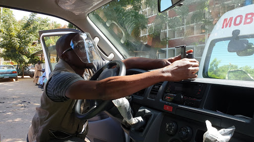
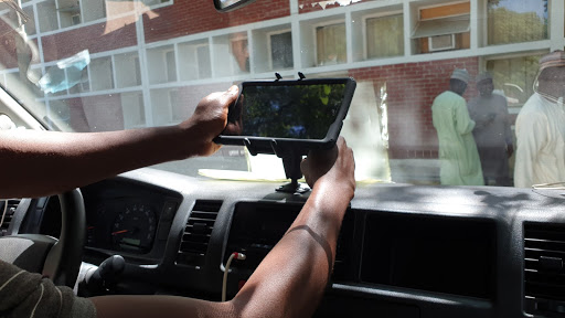
We are addressing this challenge through the use of collaborative mapping using the OpenStreetMap platform. We train community members to identify and map their communities and infrastructure, especially places related to health, emergency services, and displacement, such as roads, health facilities, isolation centers, safe spaces, etc. This data will be utilized by the community and institutions to respond to their needs. For instance, the state COVID-19 taskforce is managing cases and referrals through the efficient utilization of the OSMAnd navigation app by ambulance drivers while transporting patients.
In order to ensure sustainability and ownership of this project, we identified and met with the Albaraka health spring foundation (AHSF) and the COVID-19 task force team, the former being our local implementing partners and the latter being the Government response team for COVID-19. Over 30 community mappers have been trained in the use and benefit of OpenStreetMap, while five field officers have been trained in data collection, and seven drivers trained in the use of OSMAnd for navigation and mapping.

Over 2,000 buildings, 950 km of roads, 1,000 health facilities, 1,264 amenities (IDP camps, schools, banks, etc.), COVID-19 infrastructures (point of entries, testing centers, etc.) were digitized. A youth mapper association was created within the University of Maiduguri, and one at Ramat Polytechnic is in the pipeline.
We are looking forward to an ongoing, biweekly mapping session with the community mappers, which will also teach other skills such as GIS, project management, and communication. We are targeting students, and this skill set will help them in school and after graduation. We have learned that it is possible when the community and government are involved and partnered with to have a continuous engagement process with the stakeholders because the process is always fluid.
In the words of Dr. Ibrahim Kida, COVID19 Taskform Team, Incident Manager, Emergency Operation:
There are so many infectious diseases that require an emergency response, which includes Hepatitis, HIV, and Cholera, and Covid-19 is one of the most threatening infectious diseases in the world. Road accidents and bomb explosions are not exceptional.
To continue this work with the help of the commissioner of health, Humanitarian Mappers will be working in collaboration with the Borno state government to enhance ambulance emergency response by training the drivers in how to use OpenStreetMap, which will help them get to where they are needed on time.