HOT's Response to Hurricane Melissa: Supporting Caribbean Communities in Crisis
Posted by Fabrizio Scrollini • Nov. 7, 2025
Why This Matters to Us
The Caribbean is not just a region we serve, it's home to communities we've built lasting relationships with over years of collaboration. Just a couple of months ago, we were hosting our Caribbean Data Commons workshop in Kingston, bringing together partners from across the region to strengthen our collective capacity for open mapping and disaster preparedness. We're deeply grateful that our partners are safe, and now those same partnerships are proving invaluable as we respond to this crisis.
When disaster strikes, the need for accurate, real-time geographic data becomes critical. Rescue teams need to know where people are stranded. Aid organizations must identify the hardest-hit areas. Government agencies require up-to-date damage assessments to coordinate response efforts. This is where HOT's expertise and partnerships make the difference.

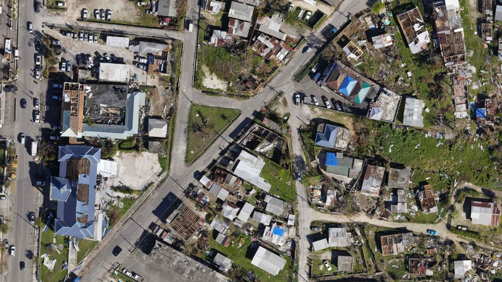
Our Immediate Response
Within hours of Melissa's landfall, HOT activated disaster response protocols in close coordination with Jamaica's Office of Disaster Preparedness and Emergency Management (ODPEM), the Caribbean Disaster Emergency Management Agency (CDEMA), MapAction, and local partners like Jamaica Flying Labs and UWI Mona’s Caribbean School of Data.
The first action was deploying ChatMap, an innovative tool that geolocates messages, photos, and videos from chats in communication apps such as WhatsApp, Telegram, and Signal. Despite the challenges of downed infrastructure, over 2,000 individuals have contributed critical ground intelligence. Residents are invited to share photos, videos, and locations of flooding, road or bridge washouts, landslides, rockfalls, fallen trees, and power lines. You can explore the map here.
This crowdsourced data is being verified and geotagged by our Humanitarian Mapping Brigade to create actionable maps for Jamaican authorities and responders. HOT is also coordinating with ESRI to ensure this data flows directly into government systems.
Simultaneously, HOT launched a remote mapping activation using high-resolution NOAA imagery, some of the best post-disaster imagery ever available, together with our Tasking Manager. Volunteer mappers across Latin America and the Caribbean and worldwide are now updating OpenStreetMap with essential infrastructure data around damaged buildings that responders need. You can start supporting here!

Moving Forward Together
HOT's response extends beyond Jamaica. Assessments are underway in Haiti, and the team is exploring support for Cuba. The data being collected now will remain available throughout the entire recovery and reconstruction phase, ensuring that communities have the geographic foundation they need to build back stronger.
This work is possible because of the trust built with local partners and the dedication of volunteers across the region. As HOT continues supporting Jamaica's recovery, this response demonstrates why open mapping matters: it puts the power of data in the hands of the communities who need it most.
Share
