Mapping for Resilience: A Collaborative Training in Khammouane, Laos
Posted by Honey Grace Fombuena • April 18, 2026
This training is part of World Vision’s strategic focus on empowering communities through data-driven decision-making and technology literacy, strengthening anticipatory action and disaster risk reduction to reduce losses and damage from natural hazards.
As a country highly vulnerable to natural disasters, with over 271,000 people affected by monsoon floods and tropical storms in 2024 (Data source: UN Lao PDR), HOT Asia-Pacific Hub and World Vision East Asia collaborated on a training to strengthen local technical and digital capacities for disaster preparedness in Laos, bringing together 46 World Vision Laos staff and government officials.

The sessions covered familiar yet crucial topics, with the HOT Asia-Pacific Hub leading the Household Risk Mapping segment. This included hands-on training with KoboCollect for household survey data collection, and an introduction to a new tool called RELIF (Real Time Early Warning Using Local Spatial Analysis on Impact Forecast), which the team was developing collaboratively with World Vision East Asia. The RELIF tool is executed semiautomatically through the use of the QGIS Model Builder so that participants could easily run it during the training.
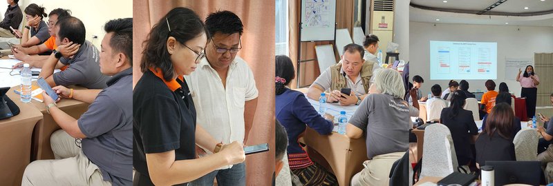
This training proved incredibly timely since the World Vision Laos team had recently responded to a flood event, making them even more eager and inspired to learn how geospatial data could improve their current workflow. They showed remarkable willingness to learn and were able to quickly grasp the technical concepts taught to them.
Passion, Food, and Community Insights
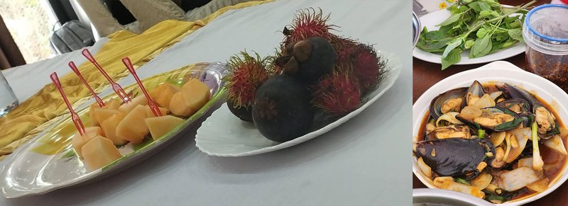
Laotian food is truly something special—hearty, healthy, and a delicious blend of Thai and Vietnamese influences, offering everything from pad thai to bánh mì. This fusion of bold flavors perfectly mirrors the people of Laos and the World Vision staff: a perfect mix of youthful enthusiasm and seasoned experience.
Despite their different backgrounds, everyone is eager to learn and willing to step beyond their comfort zones to improve. It's where passion meets skills, creating the best of both worlds. Upskilling can be challenging, but it's their passion that truly drives them forward. And with skills to match, that passion turns into meaningful impact.

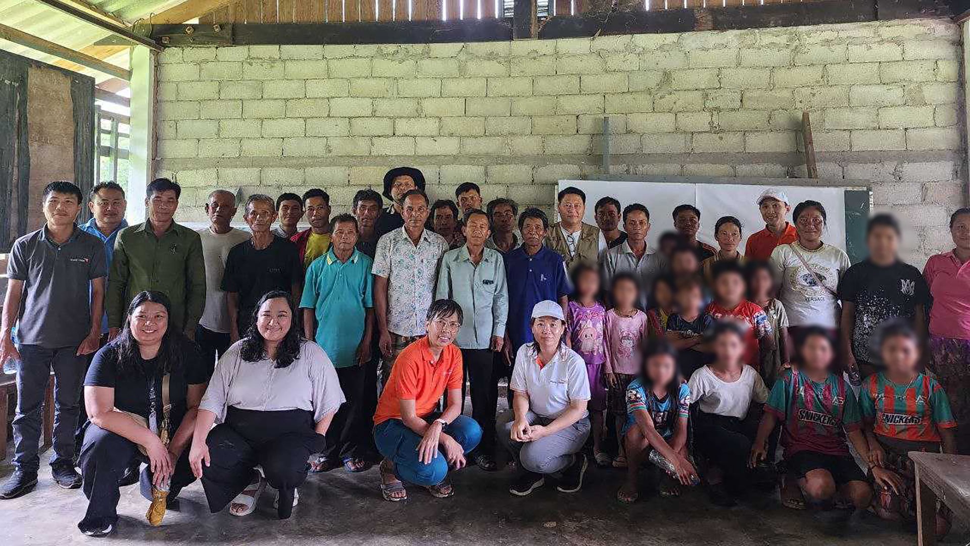
For the fieldwork, participants traveled to Ban Chakouane Village, a community divided by a river, clearly facing hazards related to its proximity to the water body. Most houses here are elevated on wooden stilts—a visible sign of how they adapt to protect their families from impending hazards.
Despite the rainy weather, the activities proceeded: data collection and side-by-side data processing with the community. The results of the risk scores and map visualization in QGIS were presented through a projector. This allowed the community to validate the findings and explain further why certain households received higher risk scores. They also discussed how the rest of the villagers can help and support the identified households.
The day ended with a heartfelt meal, lovingly prepared by the community—a feast of fresh vegetables and traditional dishes that were both delicious and filling.
Simulating Scenarios and Looking Forward
Returning to Khammouane the next day, participants engaged in a simulation of a typhoon scenario, with Ban Chakouane Village imagined as the hardest hit. This was a critical test of their new learnings, demonstrating how well they could apply the disaster frameworks in an actual response. It was fascinating and fun to watch them respond to the simulated situations, where their planning and decision-making skills are tested.
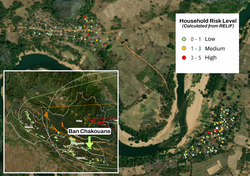
Simulated household risk map for a typhoon scenario | Map visualization: World Vision Laos
With their newfound knowledge in open mapping, it's clear that they now have a better understanding and appreciation of geospatial data. They see how integrating map data into their current operations allows for more informed decision-making, whether for pre-disaster preparedness or post-disaster response.
Having a clear, visual understanding of vulnerabilities and resources empowers them to act more strategically and effectively. With this, they are now even more confident and better equipped to launch their next response head-on.
"After receiving training in GIS-based hazard mapping, we gained confidence in identifying high-risk households. This enables village disaster management committees to better take actions and assistance before floods occur. Additionally, it is useful for the World Vision's National Disaster Management Team to utilize GIS hazard maps to assess risk areas based on tropical storm pathways." – World Vision Laos
Read our previous blog on the Household Risk Mapping training with World Vision East Asia in Cambodia.
Share
