2025 ESA Validator Fellowship: Building Regional Data Quality Leadership
The 2025 ESA Validator Fellowship brought together 42 dedicated mappers from 12 countries across Eastern and Southern Africa for an intensive 9-week program focused on advanced validation techniques, quality assurance tools, and collaborative mapping practices.
Fellowship Impact
Over nine weeks of intensive training and validation work, the cohort achieved significant results:
17 projects validated across the region 572,690 total edits to improve data quality 288,449 buildings added to OpenStreetMap 209,459 buildings modified for accuracy 312,178 buildings created to fill mapping gaps
This work directly supports humanitarian organizations, development agencies, and local governments making decisions based on reliable OpenStreetMap data across 23 countries in Eastern and Southern Africa.
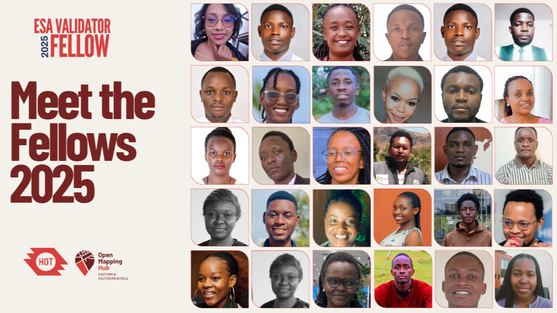
The 2025 Cohort
The fellowship selected 42 validators from hundreds of applicants, representing diverse expertise and shared commitment to using accurate geospatial data to address community challenges.
Regional Representation
Kenya (13 fellows): Environmental engineers, disaster response specialists, and community organizers Uganda (8 fellows): Experienced mappers focused on disaster preparedness and social causes Tanzania (6 fellows): GIS specialists working on waste management and humanitarian response Rwanda (4 fellows): Community trainers and geospatial professionals Zambia (3 fellows): Environmental engineers and data validators Mozambique (3 fellows): Architects and urban planners addressing flood resilience Madagascar (2 fellows): OSM community builders and coastal researchers DRC (2 fellows): Mappers working to make underserved areas visible Botswana (1 fellow): Climate adaptation specialist Zimbabwe (1 fellow): Surveyor mapping rural areas Malawi (1 fellow): Mapathon organizer and trainer
Community-Led Solutions
Fellows brought local expertise to regional challenges:
- Disaster preparedness: Mapping flood-prone areas in Uganda's Busoga region, landslide zones in Kenya, and cyclone-affected communities in Mozambique
- Resource access: Addressing water scarcity in Kenya's ASAL regions, where communities walk hours to access clean water
- Climate resilience: Developing nature-based solutions like sponge city concepts for sustainable urban growth
- Emergency response: Creating toolkits that combine mapping and storytelling to help communities visualize risks following the 2024 Nairobi floods
- Community mobilization: Revitalizing the OSM Madagascar community and training people to map their areas at local levels
- Waste management: Addressing poor waste management through mapping hotspots and engaging communities in sustainable solutions
Fellowship Structure
The program ran for nine weeks with structured learning and practical application. During weeks one through three, fellows participated in a JOSM deep dive, mastering core validation tools through comprehensive training in introduction to JOSM, advanced JOSM techniques, and conflict resolution. From weeks four through nine, fellows applied their skills through validation mapathons, advanced quality assurance training using OSMcha and Maproulette, and real-world project validation. Following the nine-week program, fellows committed to three months of active validation, achieving monthly contribution targets toward official certification.
Fellowship Benefits
The fellowship provided comprehensive professional development through an intensive curriculum in advanced data quality tools. Fellows gained mastery of complex JOSM techniques including multipolygons, relations, and feature history, along with training in QGIS and mobile mapping tools. Participants received certificates of participation and had access to recommendation letters for career advancement.
Community support formed a cornerstone of the fellowship experience. Fellows joined a supportive cohort with direct mentorship access and benefited from an exclusive validator channel for feedback and peer learning. Dedicated focal persons provided ongoing support, while fellows received recognition through digital badges and social media appreciation. High-performing fellows gained access to leadership opportunities, including paid coordination roles, chances to lead training sessions, and pathways to organize validation mapathons.
About the ESA Validator Fellowship
The ESA Validator Fellowship ensures OpenStreetMap data quality across Eastern and Southern Africa for humanitarian and development organizations. The program builds regional capacity for data validation while supporting validators with structured training, peer networks, and professional development opportunities.
For more information about the fellowship, visit the (https://www.linkedin.com/pulse/introducing-2025-esa-validator-fellowship-z0nif) or contact us at esahub-info@hotosm.org.
