Field surveying in Botswana to support the National Malaria Programme
Posted by Paul Uithol • May 16, 2018
Although a lot of progress has been made to combat malaria, and yearly deaths worldwide have declined from over 1 million in 2000 to an estimated 429 000 in 2015 (according to the WHO; estimates vary, see below), it is still one of the most devastating and deadliest infectious diseases on earth. It disproportionately affects children under five.
 Estimates of deaths caused by malaria. Source.
To combat the spread and occurrence of malaria, you need to disrupt the transmission cycle of malaria parasites. This can be done by preventing mosquito bites, reducing the number of mosquitos, and/or by decreasing the prevalence rate of malaria parasites (in both mosquitos and people). Aside from trying not to get bitten, this can be accomplished by interventions such as Indoor Residual Spraying (IRS), bednet distribution, and enabling better (faster) diagnosis and treatment.
To facilitate this, you need to know where people live, work, and sleep. The data available for these interventions can be improved further; currently, for example, spraying teams don’t have a full overview of the buildings they need to cover, and can miss buildings that are away from known population centers and built-up areas, or run out of supplies due to a higher number of residential buildings than expected. Additionally, monitoring and tracking of patients may not feed back into other interventions.
Our team is now in Botswana to start work with the Ministry of Health and Wellness and the National Malaria Program (NMP) to enhance and expand the available data in Botswana for use in malaria interventions, such as the type/use of buildings, building and roofing materials, and road conditions. This will be done by field surveying in six malaria endemic areas in Botswana: Chobe, Bobirwa, Boteti, Tutume, Okavango, and Ngami. This fits into three related projects that HOT has been working on around malaria elimination:
-
Between November 2016 and February 2017, NMP and HOT conducted activities to remotely map and enumerate buildings in malaria endemic districts using the Tasking Manager. Volunteers have helped us run a validation pass over the digitized building data in the areas we will be surveying; see the (now mostly completed) projects at https://tasks.hotosm.org/contribute?difficulty=ALL&text=Botswana-NMP. This is a great help us in the coming months!
-
Adding a ‘Health’ module to OSM Analytics, in order to provide organizations and communities the best tools to conduct analysis of OSM data in order to build a complete picture of baseline health infrastructure. This includes health facilities, distance to population and population densities, and will allow analysis key indicators/metrics based on this. This includes metrics relating OSM data to population estimates, and to evaluate completeness of data.
-
The current project in Botswana, in which the NMP and HOT will be field mapping/surveying these 6 malaria endemic areas to add additional information on all buildings on building use, structure (which determines if it’s suitable for spraying or not) and composition.
As a result of the first project, current data on OSM in Botswana include polygons (outlines) of all buildings identified via satellite imagery, but no additional information about the type of buildings mapped. This project will add information on building use (if it’s residential or not particularly since IRS campaigns focus on residential buildings)), what materials it’s made of, and general layout of buildings, and improve on the general accuracy, validity, and completeness of remotely mapped data.
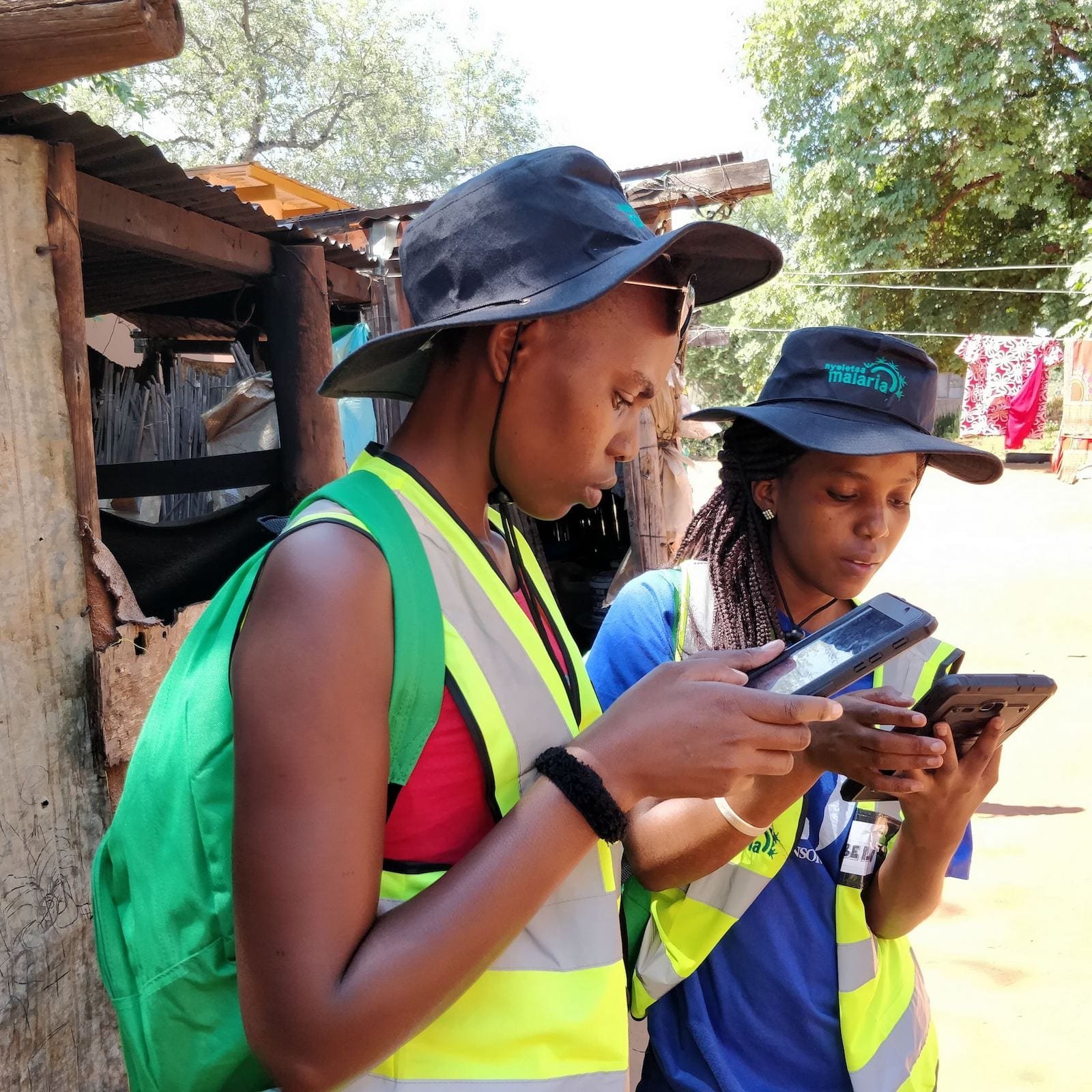
 Surveyors from the NMP and HOT collecting building data in Kasane.
The current project in Botswana will help to improve the usefulness of the OSM data in malaria elimination interventions, including support for the logistics and IRS campaigns, better data for further types of interventions, and improved monitoring and evaluation to measure intervention impacts. For the upcoming surveying, the following objectives have been defined:
-
Validate the accuracy and completeness of building locations and the estimated number of remotely mapped buildings in locations in malaria endemic districts in Botswana;
-
To accurately estimate the number of buildings in remotely mapped localities in Botswana;
-
To collect additional information on building type (residential vs. non-residential), number of bedrooms (valuable for both spraying, and interventions like bednet distribution), and building materials (to determine if a structure is suitable for spaying by IRS);
-
To extrapolate estimates based on the sample of communities selected for validation of remote household enumeration to additional localities in each district.
Working directly with the Ministry of Health and Wellness staff, including NMP and DHMT (District Health Management Team) Officers, will enable this data to be used directly to inform a more effective response and interventions. We’re really excited to start working here in Botswana, starting with training in Kasane and surveying in Chobe district, then on to surveying these districts!

Spraying a building. Credit: Nicole de Gier/PMI AIRS
Share
