HOT and CDEMA sign agreement to enhance disaster management in the Caribbean with collaborative mapping
Posted by Juan Arellano Valdivia • July 7, 2023
HOT and CDEMA -the Caribbean Disaster Emergency Management Agency- have signed a collaboration agreement to strengthen CDEMA's geospatial technological capabilities. Learn the details.
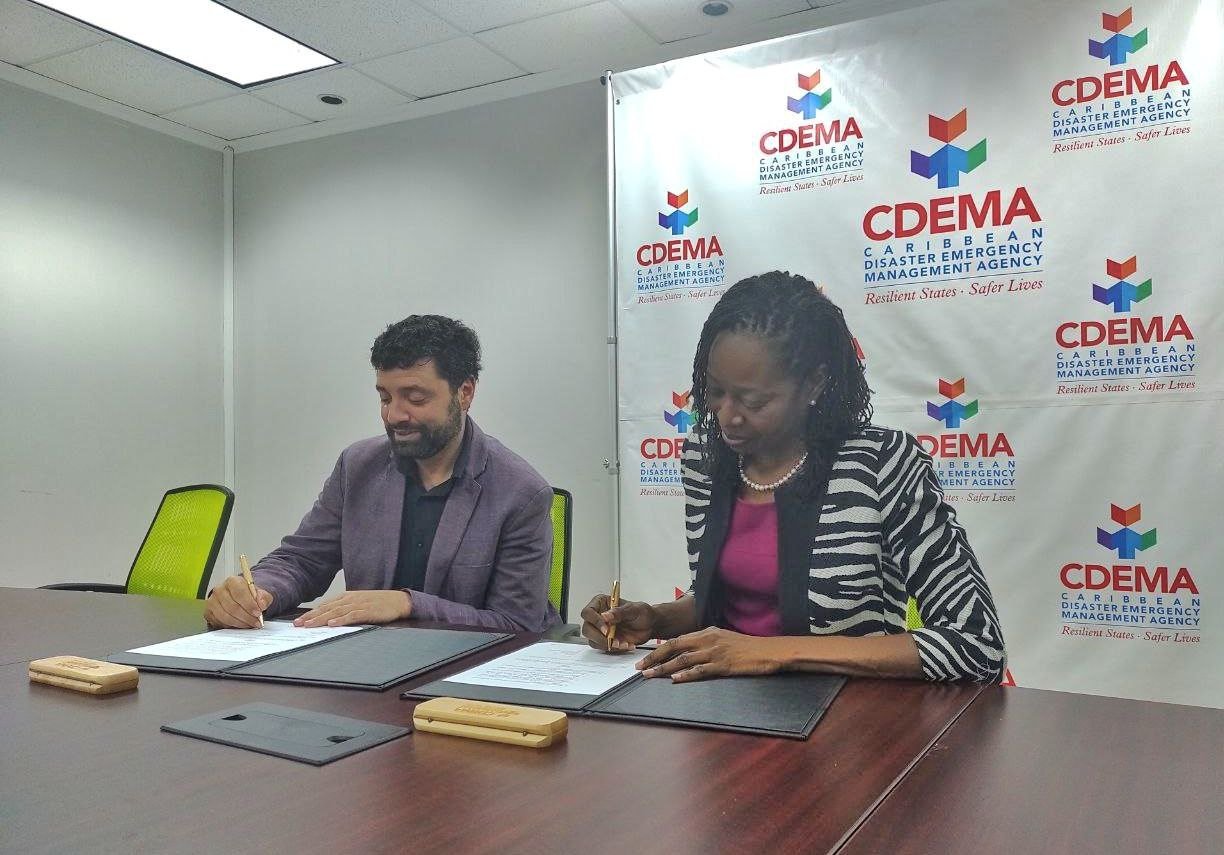
HOT and the Open Mapping Hub of Latin America and the Caribbean are pleased to announce that yesterday, Thursday, July 6, a collaboration agreement was signed with CDEMA, the Caribbean Agency for Disaster Emergency Management made up of 19 countries in the region, which aims to strengthen CDEMA's geospatial technological capabilities, thus benefiting the population served by the Agency.
In a context of climate change, exacerbated by the recent confirmation of the presence of the El Niño phenomenon at a global level in the coming months, this type of alliance is necessary more than ever to support humanitarian work on the ground.
The areas of application of this agreement, signed by Fabrizio Scrollini, Director of the LAC Open Mapping Hub and Elizabeth Riley, Executive Director of CDEMA, are mainly:
-
Geospatial support in emergency response: HOT will provide geospatial support to CDEMA through remote deployment of mapping and technical support in emergency situations. This will enable faster and more efficient disaster response in CDEMA participating states, leveraging HOT's global network of mapping volunteers.
-
Strengthening of preparedness and capacity: With the support of HOT, CDEMA seeks to incorporate geospatial concepts and GIS (Geographic Information Systems) in the disaster management of the participating states. This includes the development and acquisition of geospatial data for risk management activities and the construction of geospatial components in the Caribbean Risk Information System (CRIS).
-
Training and advisory support: Both organizations will collaborate in the development and organization of training programs for the personnel of the National Mapping Agencies and the National Disaster Management Offices of the CDEMA participating states. HOT will also provide advice on the planning and execution of emergency drills and will promote the use of mapping tools during these events.
-
Establishment of a Community of Practice: CDEMA and HOT will work together to create a community of interest/practice involving trained volunteers and disaster response personnel. This community will be useful for emergency deployment and remote mapping, and will focus on continuous skill development, establishment of standard operating procedures, and collaboration on data sharing.
We are sure of the importance and benefits of the collaboration between CDEMA and HOT in emergency response, preparedness, training and the establishment of a geospatial support network in the Caribbean region. This is part of our strategic priorities for the region, as demonstrated by our recent support for the Ecuadorian government and community in the Esmeraldas area, affected by a series of floods.
Visit our respective websites and social networks to learn more about this agreement between CDEMA and HOT.
Share
