Indigenous worldview in community forestry management through open data
Posted by Ana Prada • Feb. 1, 2024
Explore the Open Cities Guatemala Project, enhancing Indigenous autonomy in San José Poaquil. Discover the innovative use of geographic data, participatory mapping, and tech-enabled applications in sustainable community forestry management.
The Latin American and Caribbean (LAC) region faces immense vulnerability due to natural disasters and climate change. With five of the top 10 most affected countries between 1998 and 2017, recurring hurricanes, landslides, and other calamities plague this region. In response, HOT has extended its Open Cities program to LAC, specifically in Guatemala, collaborating with Global Facility for Disaster Reduction and Recovery (GFDRR) and with the generous support of Swiss Re Foundation.
Two pivotal programs unfold in Guatemala: The Open Cities Guatemala Project, spearheaded by HOT, and the To'onïk Qawinaq initiative led by the World Bank. The former aims to bolster local community resilience and territorial management capacities, especially among indigenous groups, by leveraging spatial data technology for forest management and territorial monitoring. Collaborating with the National Executing Agency, Geotecnologica and Asociación Sotz'il ONG, this effort operates in San José Poaquil, a municipality inhabited by the Kaqchikel indigenous people.

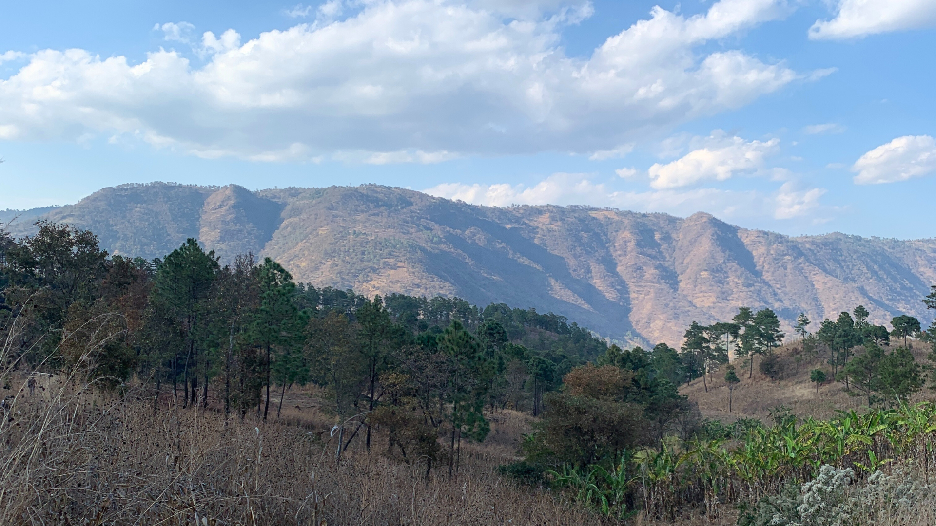
San José Poaquil is a town and municipality in the Chimaltenango department of Guatemala, and its communal lands, traditionally owned by the Cofradíahave have faced a dispute regarding their ownership for several years which resulted in regained legal control in 2021. For this reason, a dedicated group of young indigenous locals now endeavors to safeguard these communal forests and sacred sites. They strive to utilize technological tools to enhance forest management, agricultural practices, and forest protection against threats like pests and fires.
The aim of the project which includes the creation of technological tools and their appropriation by local project participants is to contribute to formulate and plan actions related to forest conservation and restoration and sustainable forest management at the municipality level that would allow to mitigate the threats of deforestation and forest degradation, maximize the benefits of conservation and sustainable forest management, including economic benefits , optimize the use of forestry incentive programs by the communities, as well as other initiatives to promote community forest management that will be implemented in the short term, within the framework of the MDE Project and test a model to support community forest management that can potentially be replicated/adapted in other regions of Guatemala.
At its essence, this project is about more than just technological innovation. It's about empowering communities, leveraging local wisdom, and nurturing a sustainable future. By combining the strengths of technology and community engagement, it's paving the way for a holistic approach to forest conservation—one that ensures a thriving ecosystem while benefiting the very people who call these forests home.
Fostering Indigenous autonomy and technical capacities through Participatory mapping in San Jose Poaquil
 It is in this context that in the heart of San José Poaquil, Chimaltenango, Guatemala a remarkable transformation is underway. The OpenCities Guatemala Project has emerged as a beacon of change, driven by a powerful vision rooted in community empowerment and sustainable forest management. At its core lies the "Model of Community Forest Management supported by geographic data," igniting a flame of hope for a better future through conservation and restoration efforts.
From the project's outset, a clear mission took shape: to foster a brighter tomorrow by promoting conservation, restoration, and community forest management. Central to this mission was the co-creation of knowledge, aimed at empowering the local community. What followed was a journey marked by collaboration, engagement, and the development of innovative solutions. Embracing a participatory approach from the start, the project actively involved the community and local partners at every stage. This inclusive strategy led to significant milestones, culminating in the creation of four mobile applications integral to a comprehensive platform.
In the course of the OpenCities Guatemala project efforts, the application of a participatory approach was extended beyond the initial phases of user identification and requirements determination. The project has united diverse stakeholders who were not accustomed to working together, forging vital connections between government, academia, and civil society. It also managed to involve 302 new participants, engaged with 2 public institutions (Instituto Nacional de Bosques (INAB), Consejo Nacional de Áreas Protegidas (CONAP)) and created more than 5 different tools, products or interactive maps. In addition, 3,400 features were mapped including 105 km of roads and 1,159 buildings, impacting approximately 26,845 people.

This project's success hinged on the active participation of community members. Thirty-eight individuals, including 40% women, underwent training in geographic data fundamentals, remote mapping, and field mapping. Armed with essential knowledge in cartography and spatial data representation, these participants were equipped to contribute meaningfully to the project's goals.
The collaborative spirit extended beyond training sessions. Participatory mapping workshops and activities and remote mapping projects were organized, engaging the community in mapping roads, buildings, and the built environment of San José Poaquil. This concerted effort empowered locals to contribute actively to the creation of a detailed municipal cartography.
Tech-Enabled Indigenous Wisdom: Nurturing Forests with Open Data Apps

The meticulous design implementation of this project has not only empowered the San José Poaquil community but has ignited a transformative wave, providing them with unparalleled access to crucial financial and technological resources. This meticulous approach has fortified their capabilities in geographic information management, breathing new life into their conservation endeavors. As a result, a path has been meticulously paved, opening doors for the community to partake in forestry incentive programs and further amplifying the impact of their collective efforts.
This result was possible by the birth of three vital mobile applications: POAQUIL field mapping, POAQUIL forest monitoring, and POAQUIL roads and trails. These apps facilitated data collection, forest monitoring, and mapping of access networks, forming the cornerstone of the project's tool development phase. The project aims to empower the community in updating their future map, enabling them to manage their territory.
More than mere data collection tools, these applications symbolize empowerment. They equip not only project participants but also anyone invested in sustainable forest management with the means to effect positive change. The platform's functionalities range from a comprehensive base map to forest fire and cover tracking, catering to diverse needs.
For this purpose the project imagined a web-based tool that transcends mere data collection. It is an empowerment tool, not only for project participants, but for all those who share a personal interest in sustainable forest management at the community level. Its main objective is to improve the community's capacity to manage and plan forestry initiatives, while increasing their capacity to monitor, control, report and evaluate our efforts.

This versatile tool is subdivided into three essential functionalities: the Base Map, the Fire Tracker and the Forest Cover Tracker. Each facet is purposely designed to meet specific needs. From visualization of the comprehensive map database to remote monitoring of forest fires through mobile applications and scrutiny of forest cover through freely available Geotechnology satellite imagery, this tool equips us with the means to effect positive change. It gives evidence of five thematic ethnic layers, Sites of interest for ecotourism, Water source, Sacred place, Sites for the collection of medicinal plants and other sites of importance in the forest.

In the course of the project, in a poignant demonstration of their impact, these tools proved invaluable during a forest fire that swept through Tiqachajij Ri Qate' Ruwah'Ulew. Leveraging the platform, the community swiftly assessed fire damage, documenting burned areas, asset damage, severity levels, and more. This unfortunate event underscored the efficiency and significance of the project's tools in real-time crisis management.

Advancing Beyond: Scaling and Replicating Success

Building resilience is a collaborative community-led effort and San Jose's story is a testament to the power of innovation and collaboration in safeguarding forests. With additional support from the World bank through the MDE Project, dedicated to indigenous community forestry management, the San Jose community will leverage this platform as a model for the indigenous networks working together with this community. Thus extending the geographic information-based community forestry management blueprint, adapting it to other regions with the support of other indigenous communities.
As ancestral leaders guide the community forward, this newfound capability opens doors to funding avenues for conservation and income generation, benefiting all residents. The impact resonates far beyond mere data collection; it's a testament to the transformative power of community-driven initiatives. The OpenCities Guatemala Project stands as a testament to what happens when a vision meets dedication, collaboration, and community empowerment. In San José Poaquil, it's not just about mapping terrain—it's about charting a course towards a more sustainable, empowered future.
Today, municipal authorities and other organizations involved in various sectors will take advantage of a publicly accessible platform, a unique source of geographic information specific to the municipality and potentially many others. This treasure trove of data amplifies the impact of their initiatives. The MDE Project (Mecanismo Dedicado Específico para Pueblos Indígenas y Comunidades Locales), dedicated to indigenous community forest management, will leverage this platform as a demonstration model. It will extend the geographic information-based community forest management model initiated by the OpenCities Guatemala project in San José Poaquil to other regions and communities.
LAC Horizons: Empowering Communities through Geographic Data for Sustainable Futures
Let´s envision the potential for replicating these community-led forestry management models in diverse geographic and community contexts, transcending borders and catalyzing positive change on a global scale. Join the open mapping community towards a future where communities, armed with technological tools and participatory strategies, become the architects of their own sustainable future. As we navigate the intricate intersections of open and culturally-pertinent technology, community empowerment, and environmental stewardship, let us collectively strive to create a world where the principles of open collaborative data resonate for sustainable and fair development.
Share
