News — 27 April, 2022
New open mapping actors in Ecuador
The collaboration of experienced free culture activists with new mappers is renewing the landscape of collaborative cartography in Ecuador.
Lea esta publicacion en castellano.
On April 16, 2016, a magnitude 7.8 earthquake shook Ecuador, leaving a large number of dead and homeless, and generating a humanitarian emergency. Among the aid actions deployed, the joint action between Mapping Ecuador and HOT allowed for a better detailed mapping of the affected areas, especially “roads, towns, villages, to coordinate the aid efforts of government institutions and the rescue initiatives of civil society.”
This was made possible mainly by the collaboration of hundreds of volunteers, local and from various parts of the world, who did their bit by donating their time and knowledge to help this humanitarian mapping project. In this regard, you can see Rafael Castro’s interesting data analysis on the contribution rate and contributions over time.
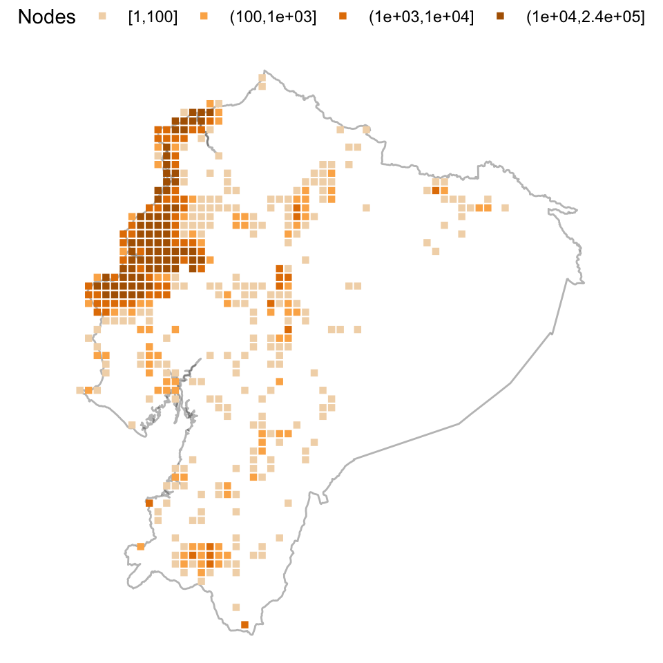
Heatmap of nodes contributed during Mapping Ecuador. Taken from Rafael Castro's blog. License (CC BY–SA 4.0).
Six years later, another earthquake is not necessary for the Ecuadorian OpenStreetMap community to continue doing things. For example, Daniel Romero-Álvarez published the article “Cantons and their population in Ecuador”, where he socializes his initiative to map the population of Ecuador for each of the cantons into which the country is subdivided. He says that he made the dynamic map using Leaflet, and here you can find the map.
But the landscape of open mapping in Ecuador has changed a bit and now the community of volunteer mappers has grown with a lively chapter of Youthmappers sprung up at the University of the Armed Forces ESPE: GeoMap ESPE - YouthMappers.
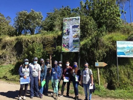
Mariela Centeno is a member of GeoMap ESPE, but she is also a Regional Ambassador of the Youthmappers. As such she is always looking for mapping opportunities and projects to support. Last year she published an article titled Mapping a Hidden Paradise during a Pandemic, detailing her experience mapping tourist sites in Lloa, part of the Quito Metropolitan District.

Daniel Moreno and Karla Meza taking information with the help of surveys. Members of GeoMap-ESPE socializing the project with residents of the area. Images from Youthmappers.
She recounts that they first coordinated with community leaders to be able to reach the area and map, then they reinforced their training in information gathering tools. After that they planned their field work and carried it out in a couple of days. Then, they carried out office work with the data, processing it and publishing it on the OpenStreetMap map. The last step was to present the work done to the community of Lloa.
Mariela summarizes the work:
More than 50 points of a tourist nature were obtained in the Lloa parish, more than 180 surveys carried out on the inhabitants of the Parish were tabulated, relevant information was collected such as fields, churches, health centers and some productivity places which did not appear in the platform.

GeoMap ESPE-YouthMappers group in Cruz Loma of the Lloa parish and its location in the OSM platform. Images by Youthmappers.
But there are more mapping actors. The UNDP Ecuador Accelerator Lab has ventured into mapping, and Paulina Jimenez, Head of Mapping Solutions, recounts one of her experiences in the article: Flowers in the Air: Routes of Memory, (in)justice and community response to femicides in Cuenca and Portoviejo. Their other experiences related to mapping can be found on the website Otros mapas, and in this video you can see how they do their work.
The OpenLabEc is “a citizen laboratory of technologies and free culture, dedicated to promoting experimentation, citizen participation, education and creativity, in support of the Free Software, Open Knowledge and Digital Rights communities in Ecuador and Latin America, through activities for the common good, and for an economy of knowledge and creativity.”
As part of the aforementioned lines of work, OpenlabEc is interested in dynamizing the Ecuadorian OSM community in order to have a strong civil society in case of need, caused or not by natural disasters. This translates into a willingness to organize events and training with universities, associations, and people active in OSM, so they organized a virtual event to spread three initiatives that go hand in hand: OpenStreetMap, HOT and Youthmappers.
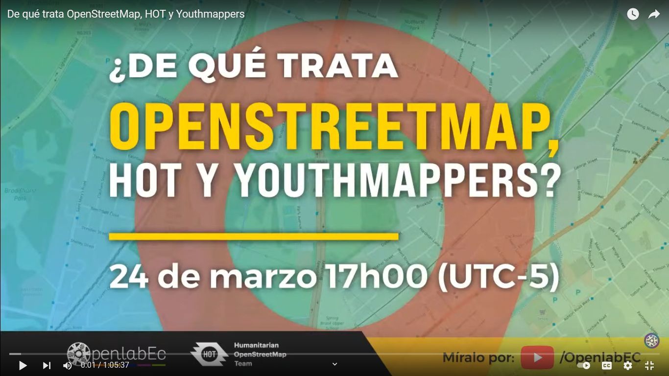
Here is the video of that event. The experience was satisfactory for OpenLabEc and a new session or webinar is already being planned for the month of June. On the other hand, both the Youthmappers and the mapping community of Ecuador are planning new activities that they will tell us about. We will be informing you in future publications and on our social networks!