News
Anunciamos nuestra Campaña de Mapas Abiertos para Necesidades Humanitarias
Ante la posible disminución de información sobre contextos humanitarios en los próximos meses, y mientras la comunidad humanitaria encuentra el camino a seguir, estamos lanzando una campaña de 90 días de Mapas Abiertos para Necesidades Humanitarias.
Announcing our Open Maps for Humanitarian Needs Campaign
Anticipating a potential drop in information on humanitarian contexts in the coming months, and while humanitarians find a way forward, we are launching a 90 day campaign of Open Maps for Humanitarian Needs.
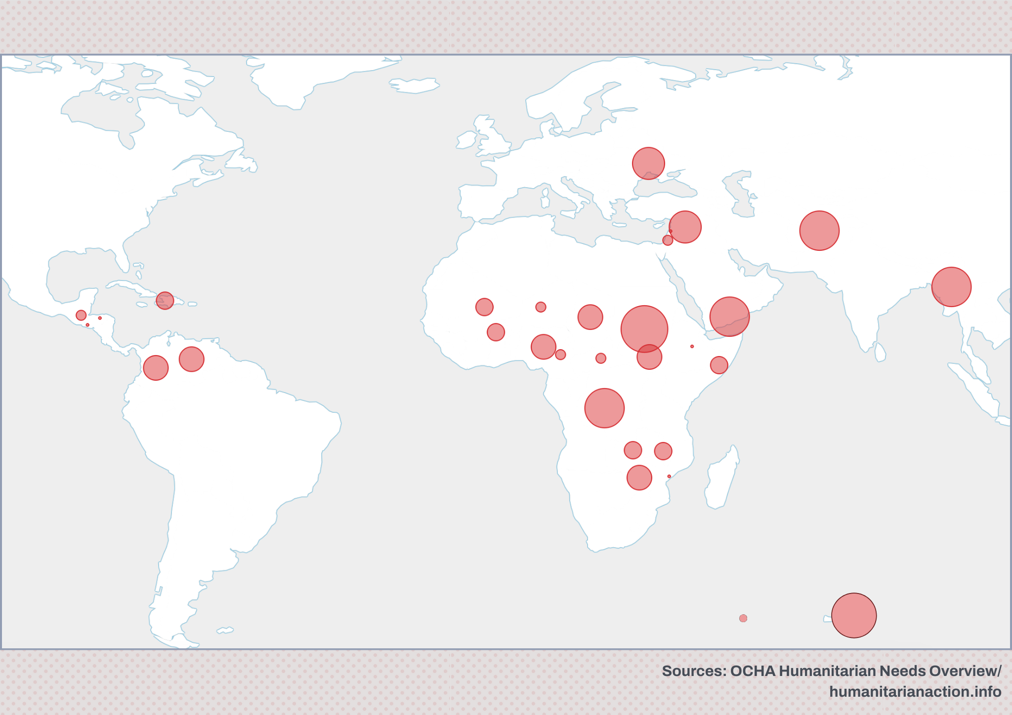
HOT Statement on the US Federal Government Disruption of Foreign Assistance
It’s been over a week since the US federal government ordered the disruption of foreign assistance through the US Agency for International Development (USAID)...
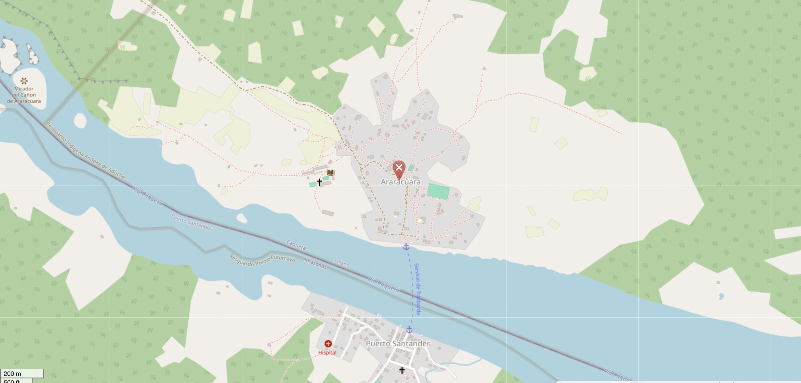
Mapeo Comunitario en el Resguardo Indígena Andoke de Aduche en la Amazonía Colombiana
Mapeo comunitario en Araracuara fortalece la gestión territorial del pueblo Andoque mediante el uso de drones, OpenStreetMap y SIG. La iniciativa combina conocimientos ancestrales y tecnología para documentar y proteger su territorio frente a la deforestación y el cambio climático.
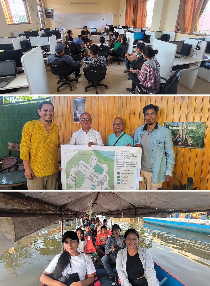
Cartografía Colaborativa en la Amazonía Peruana: Mapeo para la Defensa del Territorio y la Identidad Indígena
Junto a OpenStreetMap Perú, HOT llevó a cabo un proyecto para mapear territorios bajo amenaza con miembros de la Comunidad Nativa Shipibo – Konibo en la Amazonía peruana. Entérese del impacto que se logró en la comunidad y las posibilidades de cooperación que han quedado abiertas.
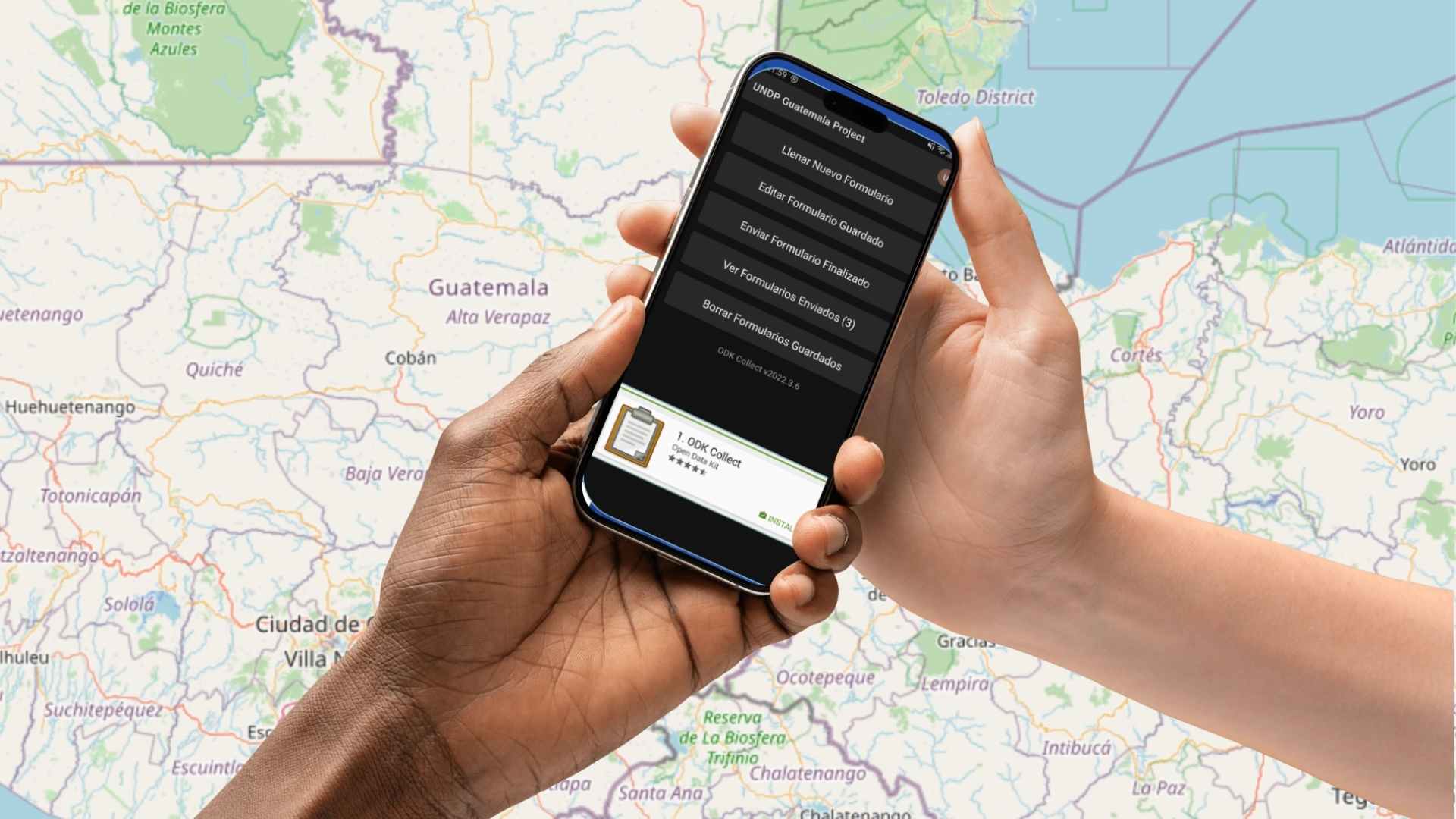
Strengthening Competencies in Natural Resource Management with ODK in Latin America
Guatemala, in collaboration with HOT, UNDP and MARN, is working on waste and natural resource management by identifying critical sites and training officials to improve infrastructure.
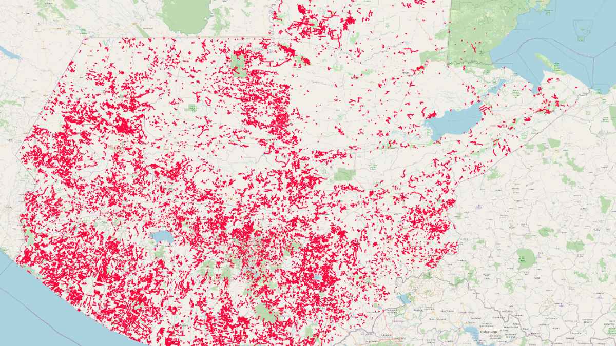
Routes for Development: Mapping Roads for Connectivity and Development in Guatemala
Discover how the mapathon led by HOT and UNDP is transforming road infrastructure in Guatemala. Routes for Development now has precise data on rural roads, enhancing connectivity and territorial development. Learn about the impact of citizen science on public planning.
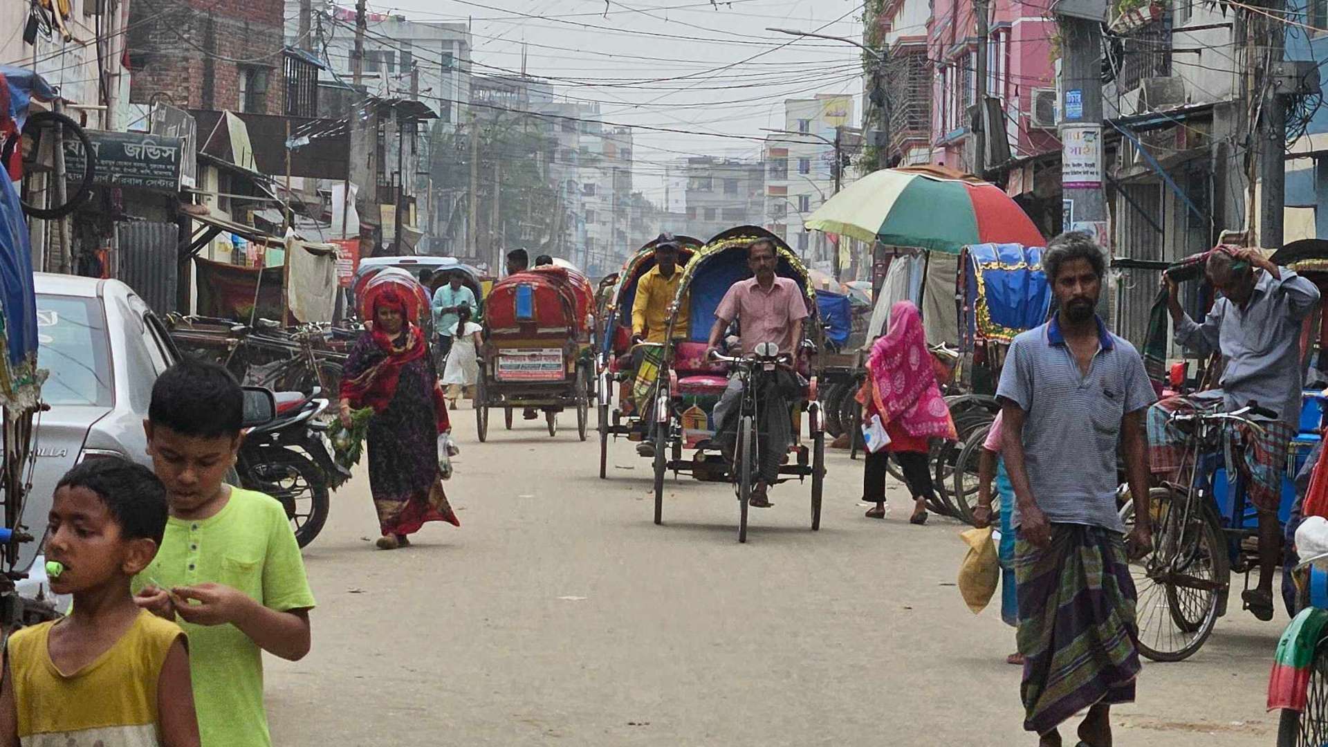
Mapping Dhaka’s Informal Settlements for Climate Resilience and Urban Development
Discover how the Dhaka Thrive Project is working with local stakeholders to collect open geospatial data to address rapid urbanization, climate change, and public health challenges in Dhaka's informal settlements.
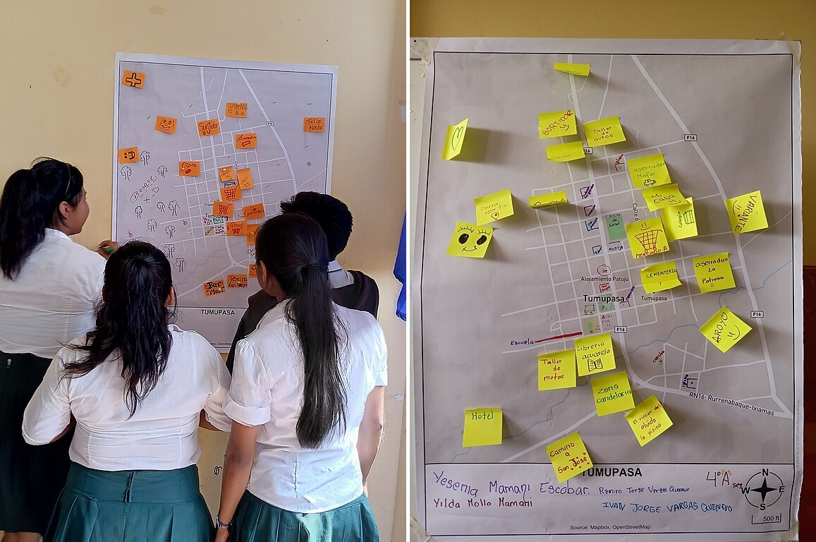
Mapeo Participativo en la Amazonía Boliviana: Fortaleciendo la Gestión Territorial de Tumupasa
Junto a la Fundación Internet Bolivia, HOT llevo a cabo un proyecto para mapear la comunidad Tacana de Tumupasa en la región amazónica de Bolivia. Explora el impacto que se logró en la comunidad y las posibilidades de cooperación.
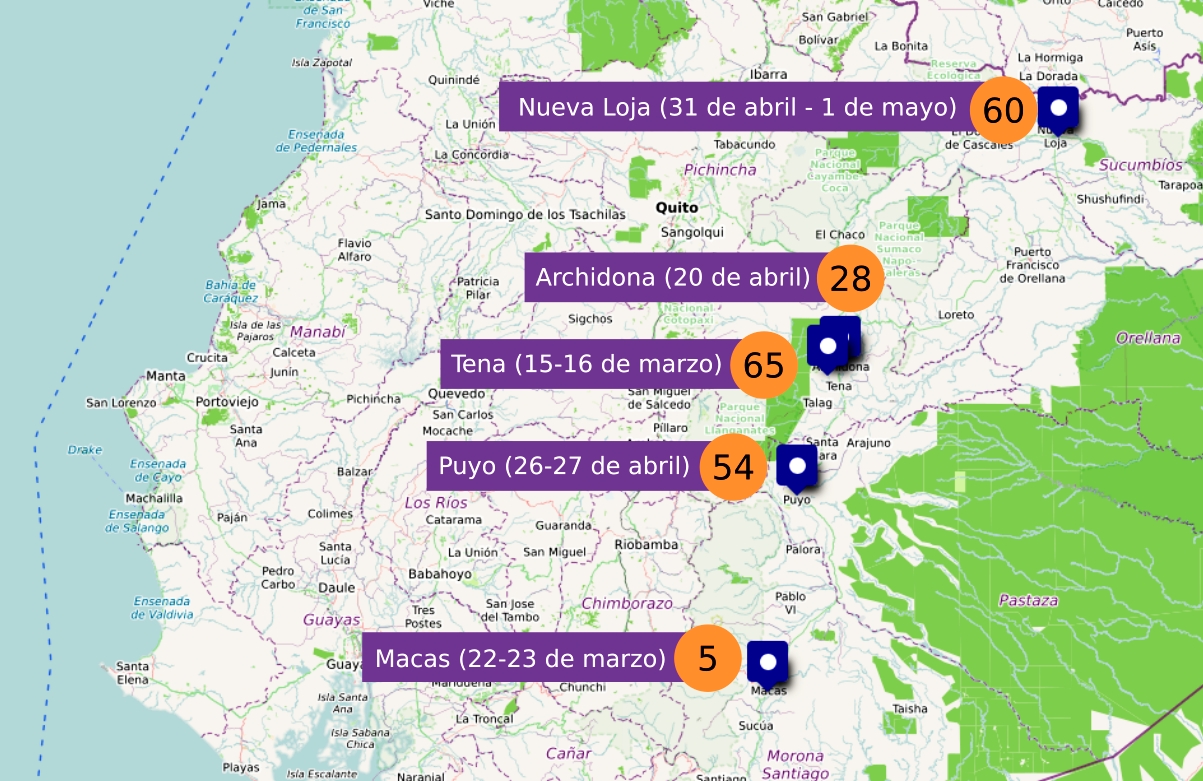
Mapeo Colaborativo en la Amazonía Ecuatoriana: Capacitación y Gestión de Riesgos para el Desarrollo Sostenible
Junto a la Fundación OpenLab, HOT llevo a cabo un proyecto de capacitación en mapeo abierto en las ciudades de Nueva Loja, Archidona, Puyo, Tena y Macas, en la región amazónica de Ecuador. Entérese del impacto que se logró y las posibilidades de cooperación que han quedado abiertas.
We Close 2024 with Unity and Community Strength: The LAC Hub Looks Towards 2025
The Open Mapping Hub for Latin America and the Caribbean concluded its 2024 activities with a community gathering where volunteers, representatives of partner organizations, and mappers came together to celebrate the end of the year and the beginning of 2025, calling for continued community-driven mapping efforts.
Cerramos el 2024 con unión y fuerza comunitaria: el Hub LAC mira hacia el 2025
El Hub de Mapeo Abierto de América Latina y el Caribe concluyó sus actividades del 2024 con una reunión comunitaria donde voluntarios, representantes de organizaciones aliadas y mapeadores en general, se reunieron para celebrar el fin de año y el inicio del 2025 haciendo un llamado a seguir mapeando en comunidad.
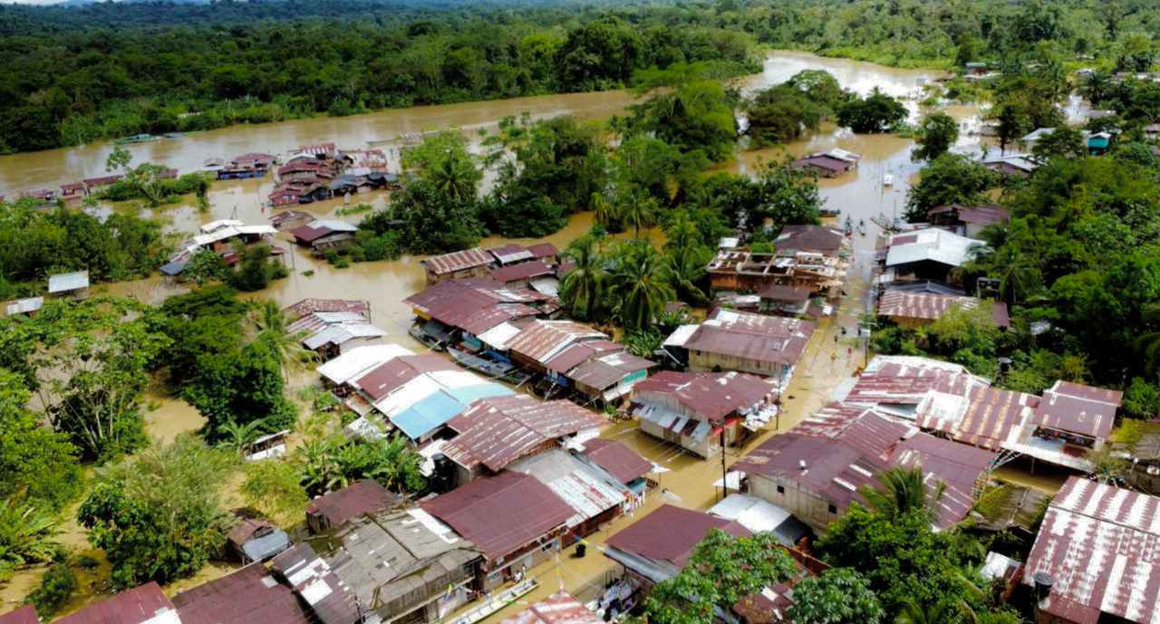
Anticipatory Annual Mapathons: Innovation and Collaboration to Close Mapping Gaps in Latin America and the Caribbean
The Annual National Anticipatory Mapathons (MANA) are an innovative strategy to close mapping gaps in Latin America and the Caribbean, strengthening risk prevention and management. In 2024, MANA made an impact in Ecuador, Peru, Colombia, and Guatemala, showcasing the power of open mapping to build more resilient communities.
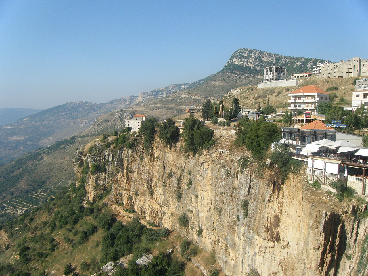
Filling OSM Buildings Data Gaps for Recovery in Lebanon
Recent conflict has impacted the humanitarian situation in Lebanon. With damaged buildings estimated at up to 25% near the southern border, accurate data is needed to plan a humanitarian response. HOT is working with volunteers to crowdsource the mapping of pre-conflict building footprints to serve as a baseline dataset and improve the accuracy of damage estimates.
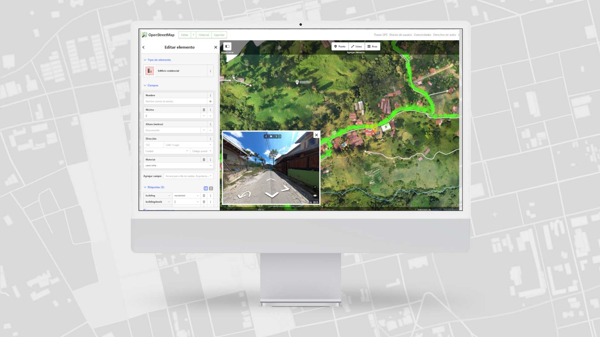
Mapillary y GoPro en Acción: Contribuciones al Mapeo Abierto en Medellín
En el marco de dos proyectos de mapeo en la ciudad de Medellín, se utilizó una cámara GoPro como parte de las actividades de mapeo en campo. Las imágenes capturadas fueron importadas a Mapillary, una plataforma que permite crear Street Views abiertos. Yessica de los Ríos, líder del proyecto, nos cuenta cómo el uso de la cámara GoPro contribuyó a alimentar la cartografía abierta de dos barrios vulnerables a distintas amenazas naturales.
Community Mapping in the Andoke Indigenous Reserve of Aduche in the Colombian Amazon
Community Mapping in Araracuara Strengthens the Andoque People’s Territorial Management Using Drones, OpenStreetMap, and GIS. The initiative combines ancestral knowledge and technology to document and protect their territory against deforestation and climate change.