News
Treinando Governos Locais no Uso da Cartografia Colaborativa: Aliança HOT - OGP Local

O projeto "Cidades Abertas Resilientes" capacitou seis governos em dados abertos e ferramentas geográficas, promovendo soluções resilientes e colaborativas diante de desafios urbanos e climáticos.
Social Infrastructure Recovery in Porto Alegre: Mapping for Resilience
After the 2024 floods in Porto Alegre, Brazil, the IDB and HOT partnered to map and assess damaged infrastructure. Using georeferenced data and community involvement, the collaboration supports sustainable recovery and resilience for the city’s most vulnerable.

Brasil, o Epicentro dos Dados Abertos e da Inovação Geoespacial neste Dezembro
Uma semana extraordinária, três eventos transformadores! América Abierta, FOSS4G Belém 2024 e State of the Map LATAM 2024 estão chegando, acontecendo de 2 a 6 de dezembro e de 6 a 8 de dezembro. Esses eventos reunirão as mentes mais brilhantes em dados abertos e inovação geoespacial, e estamos entusiasmadas em anunciar que a HOT estará no centro da ação.

Entrenando Gobiernos Locales en el Uso de la Cartografía Colaborativa: Alianza HOT - OGP Local
El proyecto "Ciudades Abiertas Resilientes" capacitó a seis gobiernos en datos abiertos y herramientas geográficas, promoviendo soluciones resilientes y colaborativas frente a desafíos urbanos y climáticos.
Brazil, the Epicenter of Open Data and Geospatial Innovation This December
One extraordinary week, three transformative events! Open Americas, FOSS4G Belem 2024, and the State of the Map LATAM 2024 are just around the corner, taking place from December 2–6 and December 6–8. These events will bring together the brightest minds in open data and geospatial innovation, and we’re thrilled to announce that HOT will be right at the center of the action.

Training Local Governments in the Use of Collaborative Mapping: HOT - OGP Local Partnership
The "Open Resilient Cities" project trained six governments in open data and geographic tools, promoting resilient and collaborative solutions to urban and climate challenges.
Map, Give, Impact: A 24 hr Telemapathon
Open map data has a powerful impact on communities in vulnerable regions, but this wouldn’t be possible without the dedication of people around the world. Whether it’s a few hours each week, a portion of their income, or teaching others how to map, their contributions make a difference.

Brasil, el Epicentro de los Datos Abiertos y la Innovación Geoespacial este Diciembre
¡Una semana extraordinaria, tres eventos transformadores! América Abierta, FOSS4G Belém 2024 y State of the Map LATAM 2024 están a la vuelta de la esquina, llevándose a cabo del 2 al 6 de diciembre y del 6 al 8 de diciembre. Estos eventos reunirán a las mentes más brillantes en datos abiertos e innovación geoespacial, y estamos emocionadas de anunciar que HOT estará en el corazón de la acción.

Mapping and Open Data Critical to Disaster Response
The Humanitarian OpenStreetMap Team (HOT) released an impact report on September 18, 2024, highlighting two years of enhancing open data for disaster response in West and Northern Africa. Key successes include vital infrastructure mapping in Morocco, Senegal, Liberia, and Nigeria, showcasing the importance of accurate data and community collaboration.

Will OpenStreetMap meet your needs? HOT’s move towards more data insights
In the spirit of FAIR data (findable, accessible, interoperable, and reusable) and with support from the H2H Network, HOT is improving the reusability of OpenStreetMap (OSM) data through improved metadata of its datasets.

From Brainstorm to (Almost) Blastoff: Building ClearPath, an Accessible Navigation App
ClearPath, a mobile navigation app, leverages OpenStreetMap to enhance accessibility in Downtown Kingston for persons with disabilities. Developed with support from HOT’s microgrant and collaboration with MSBM, ClearPath aims to map key accessibility features like curb cuts and pedestrian crossings.
Recuperación de la Infraestructura Social en Porto Alegre: Mapeo para la Resiliencia
Después de las inundaciones de 2024 en Porto Alegre, Brasil, el BID y HOT se asociaron para mapear y evaluar la infraestructura dañada. Utilizando datos georreferenciados y la participación comunitaria, esta colaboración impulsa una recuperación sostenible y resiliente para las poblaciones más vulnerables de la ciudad.
Recuperação da Infraestrutura Social em Porto Alegre: Mapeamento para a Resiliência
Após as enchentes de 2024 em Porto Alegre, Brasil, o BID e a HOT se uniram para mapear e avaliar a infraestrutura danificada. Utilizando dados georreferenciados e o envolvimento da comunidade, essa colaboração promove uma recuperação sustentável e resiliente para as populações mais vulneráveis da cidade.
Building Resilience through Open Mapping: HOT Caribbean Microgrant Recipients Tackle Flood Risks
HOT Caribbean Microgrant Programme is enhancing local communities in Trinidad and Tobago and Saint Lucia to build resilience against flood risks through open mapping. Learn about community-led disaster risk reduction, youth engagement, and geospatial data's role in enhancing disaster preparedness in the Caribbean.

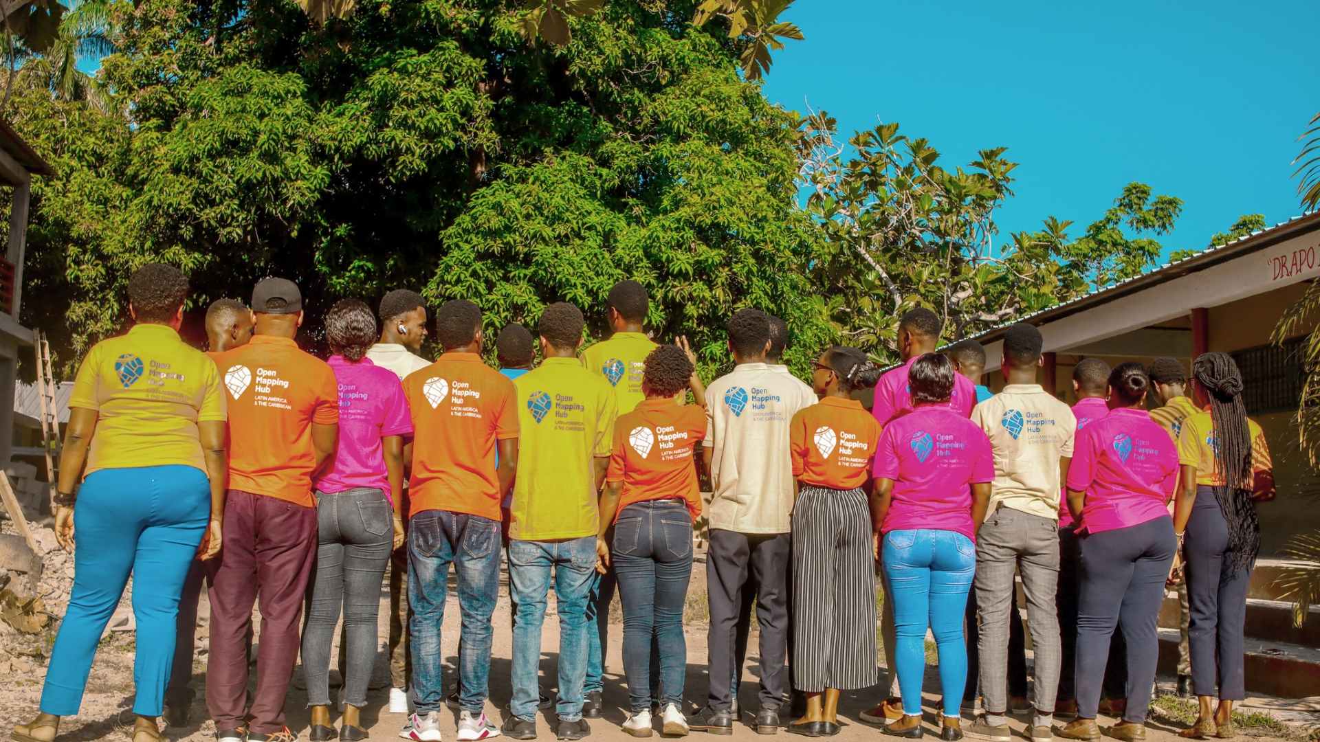
HOT and Sonje Ayiti Join Forces to Enhance Haitian Communities Through Open Mapping
HOT and Sonje Ayiti Organisation are enhancing Haitian communities by leveraging open geospatial data. This collaboration equips local students with essential mapping skills, enabling them to contribute to disaster management and development efforts. Through this initiative, a new generation of mappers is being cultivated, enhancing community resilience amid Haiti’s socio-political challenges.
Export Tool Update: New vector tiles format and improved metadata
For over 15 years, the Humanitarian OpenStreetMap Team (HOT) has been helping users access OpenStreetMap (OSM) data through the Export Tool, an easy interface that allows downloads in popular spatial data formats. This week we introduce two new tile formats and the ability to get User Info + Timestamps.
