News — 14 April, 2023
Peer Mentorship - Sharing Techniques and Inspirations
The Open Mapping Community Working Group is currently organizing the second round of its peer-to-peer mentorship program. To appreciate the value of this opportunity for members of the open mapping community, take a moment to read about the shared learnings of members of the first round.
This blog is a result of the meetings held as a part of the Peer Mentor initiative by the Humanitarian OpenStreetMap. We started off our journey as a Peer Mentor group in September-October 2022 igniting our passion to learn about Open Street Mapping from each other. We were grouped according to our region, ASIA. We met a few times, virtually discussed, shared many ideas and views. Few of them will be documented in the following article for reference to others as well.
There are many stages in Open Street Mapping which need to be addressed before the final results are available for public use.
Some of the points which need to be focussed are 1) Successful Mapping 2) Validation, which is a necessary component to achieve accuracy and 3) Final output to be put into use.
List of Participants:
- Antonin Haas – Volunteer, Mapper and Validator
- Anuradha Rajanayake - Geoinformatics Specialist, GIS/RS Application Architect, Volunteer Mapper and Validator
- Chisom Okwuchi – Geospatial Analyst, Volunteer Mapper and Validator (Group Facilitator).
- Dr. Laxmi N Goparaju - Environmentalist and Conservationist
- Charles Chilufya - Geospatial analyst, Volunteer, Mapper and Validator. Each one of us selected a particular topic based on our expertise, and prepared a small presentation. Following we discussed and tried to fill in our knowledge gaps.
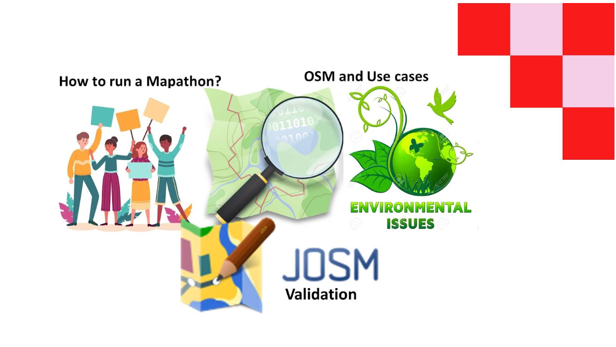
Mr. Antonin Haas - How to organize a Mapathon?
The aim of this session was to introduce the idea of what are the prerequisites required to run a successful Mapathon.
Steps in the presentation summed up different aspects of the mapping event. It is very important that good preparation is done before the event. It is manageable with a single person but it is better as a collaborative task. People responsible and who commit for the mapathon event represent the core team.
Firstly, to begin a character of the event needs to be set. Will it be a physical mapathon? A hybrid form or even a fully online session? In the case of the online or hybrid form, an online platform needs to be choosed (Zoom, MS Team, Jitsi, etc.) The physical mapathon needs a physical room. This can be hosted by a university or corporate.
Next step is to distribute the invitations via social media, posters or different channels that the community uses (eventbrite, trello, mailing list, missing maps websites, etc.). The date, time and place of the mapathon needs to be informed to the enthusiasts who wish to participate in it.
Standard mapathon has several parts. An introduction: why are we here and what will happen in the next hours. Context introduction: a presentation of the person that represents humanitarian organizations which mapathon helps to create data. For example a mapathon is targeting the MSF and the mapping is in Nigeria. Next and the largest part of the mapathon is training of the mappers or validators led by an experienced mapper. In the beginning of this part a trainer presents tools that are used to create data. Next phase is the work of the mappers itself and space for questions. Last part is giving credits to mappers, to host, to the core team and other involved people and an open discussion.
Open discussion can be casually held for example in the restaurant. Networking and hiring new people to the core team is an important part of the events to allow the community to grow.
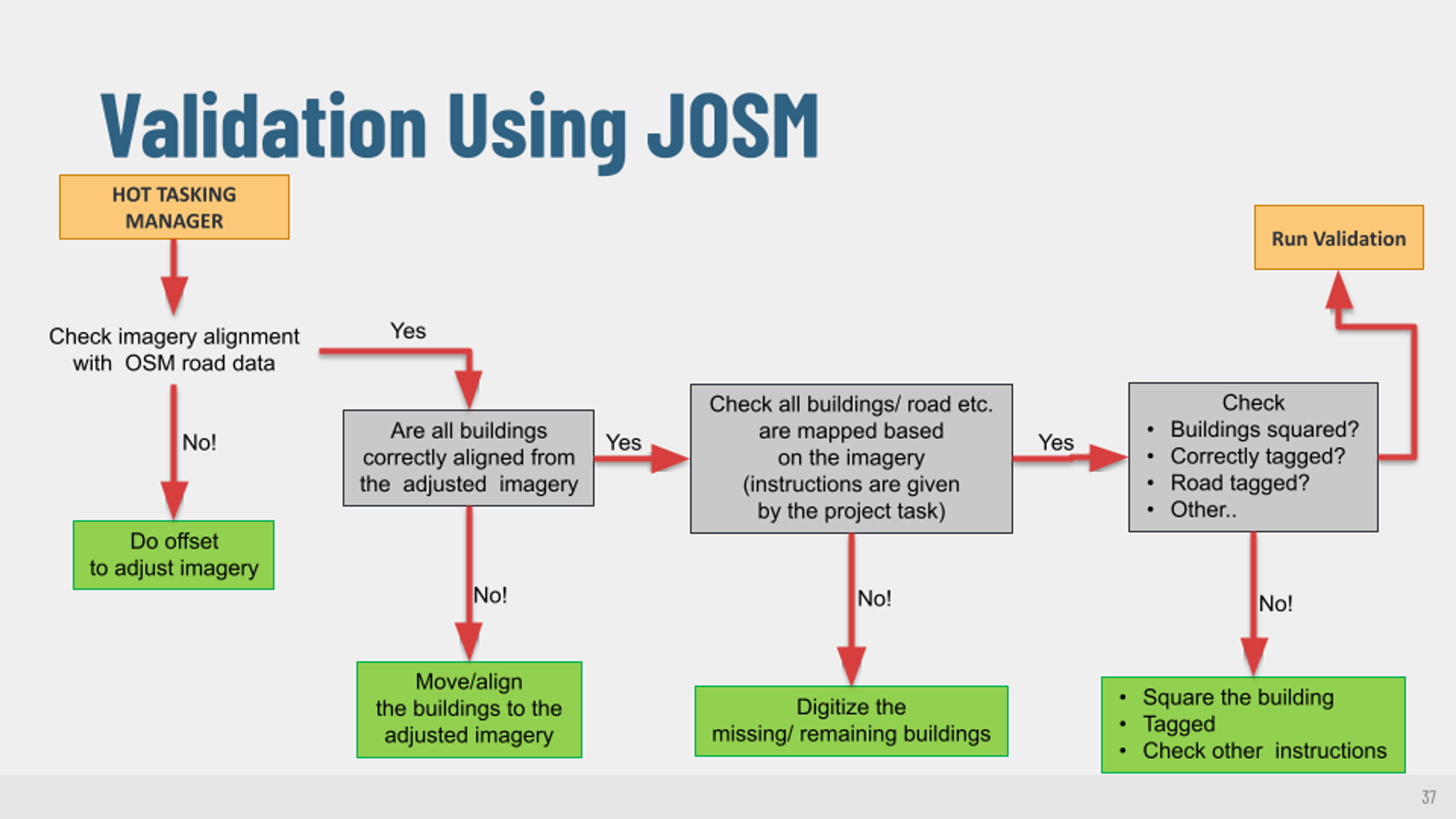
Mr. Anuradha Rajanayeke - Validation in JOSM
OSM is one of the major open data sources and a voluntarily contributed platform. Mappers contributed their local knowledge to make the wonderful platform, “OpenStreetMap”. However, the most common question is the accuracy level of the OSM data. The local knowledge and the standard map features help them make the OSMs up to the most accurate level of Geo-special content. Data validation is a required process of checking the work of previous mappers completed to maintain the quality of OSM data.
Data accuracy, consistency, completeness and anomaly are the core qualities covered under the validation process. The JOSM (Java OpenStreetMap) tool is the best for the validation process which consists of support plugin panels for data validators.
There are three important things to consider during the validation process to manage quality and consistent relationships between the mappers 1) respect for other mappers (respect for what they have completed) 2) review of the area mapped by users and 3) feedback to the mappers (constructive and encouraging way). Mappers’ experiences are another factor to succeed in the validation process.
The Hot Tasking Manager is a tool designed and developed for the collaborative mapping process in OpenStreetMap. The tool has the facility to make projects and can be divided into smaller tasks. The Hot Tasking Manager can be linked to JOSM and shown the validated area well.
Further, discussed how to start the validation stepwise, what are the common errors and warnings that need to be fixed and how? Giving constructive feedback to the mappers will inspire them to continue mapping.
Dr.Laxmi.N.Goparaju - OpenStreetMap - some use cases
It was an insightful session where some use cases were referred and discussed. OSM in practical application needs the effort and cooperation of the Government, Non-government and the Citizens of a particular country, region or state.
OSM in Gender problems - To combat Female Genital Mutilation in Africa (Initiative by Crowd2Map Tanzania). Mapping of remote, rural villages was done which were highly vulnerable areas and unsafe for girls. Maps helped in navigating and reaching places for rescuing and preventing social injustice. Other projects which are centered around women include mapping places which are safe for women around public places. Places where mothers can breastfeed their babies.
OSM in Environment Management - many environmental issues can be tackled with the help of OSM. Roads and buildings obtained from OSM can be used as a proxy to determine the traffic, air pollution, urban density and also places vulnerable to epidemics. Also health hazards caused by polluted atmosphere can also be addressed with the OSM data.
Few more areas where OSM data can be effectively used are 1) Waste management in cities 2) E-waste management - OSM data should help to locate places where bins should be placed for people to discard electronic waste,
OSM in transportation - For a local village or city, it is very helpful to use Open street maps. It will serve as an input to the local APPS for transportation. It can be updated at regular intervals and also convenient to use.
Chisom Okwuchi – Geospatial Analyst, Volunteer Mapper and Validator
As a facilitator in this group for the Mentorship Program, besides contributing to the general meetings and partaking in all trainings, I am also expected to;
- Facilitate and spark discussions during meetings and in the #mentorship_gis-osm slack channel
- Finalize meeting schedules and set up calendar invites.
- During meetings, take notes and document important links shared To the best of my ability, I was able to do these with the help of fellow peer mentors through the duration of this mentorship and I can say it really taught me a lot.
Charles Chilufya - Updating OSM based on Local Knowledge: I map my community project
Background
In order to have well-defined and updated OSM data, OSM encourages that the map should be based on local knowledge. OSM data updated by local knowledge is very sustainable because locals can change it anytime if there are new features or changes in the community.
Remote mappers have updated most communities in Africa, therefore, they lack local knowledge in most African communities. Since OSM is open to all communities and consists of open data, which is contributed by anyone, there is a need for more local mapping to address the under-represented community in Open mapping data.
Objective
- To have a well-updated local OSM map based on local knowledge. Specific objectives
- To introduce and train more local mappers (ID Editor tool, JOSM, StreetComplete, Everydoor app, and AI)
- Train more validators (JOSM, OMScha, etc)
- Train Mappers on how to add points of interest
If we train more local or community-based mappers and validators to update their own communities on OSM, it will be a vibrant Map with local-based knowledge and a true representation of people in open data.
This is a very big project that needs more collaboration on capacity building, materials, financial support, etc.
We shall collaborate with the Local OSM -Community, student youthMappers chapters, and any other interested international organization to ensure that more human resources have been capacitated especially the young people who are community-based.
We shall have a lot of Mapathon to test the local mappers and validators before starting our physical project of mapping the local community and updating points of interest. We shall share the skills and knowledge learned from the HOT community working group Pilot program with the rest of the team and ensure that we equip local mappers with the necessary skills and knowledge to improve their communities.
Materials
On this legacy project, Online material for pieces of training will be utilized. However, in ensuring that this project is successfully implemented, there is a need for a sustainable way in terms of providing Data to the participants, holding the training physical, and proved gadgets to local people. This project is aimed at empowering people from deep rural areas in mapping.
Expected Outcome
The Local people will actively participate in the project and acquire relevant knowledge about open mapping. Additionally, the community will be trained on all necessary open mapping tools to use as well as gained knowledge for sustainable mapping.
Local will be well trained as validators in order to map and validate their own locally created data as well as add their points of interest on OSM. New data will be significantly updated on the OSM based on local knowledge. Lastly, it is also expected that local people will understand the need and use of OSM data in decision-making and their daily life.
Benefits
This project will have more benefits from both sides, especially since we will take OSM closer to the community and give them a chance to generate their own data based on local pieces of knowledge. Further, having community-based data on OSM is a true representation of equality in open data and inclusion in decisions making.
Lastly, the sustainability of HOT depends on training more communities to freely participate in open mapping and see the need for it in their community. This step of taking the project to the community will be the best decision for the future of open data mapping.