News — 08 November, 2022
Why all this data? Using OSM data in HOT’s 5 Impact Areas
OpenStreetMap (OSM) was created to provide and enable the free and open creation of geospatial data, regardless of background, location or budget. And it works! Since its creation in 2005, OSM has grown to include ever expanding and deepening coverage of various base map layers and has now widely become a go-to spatial data platform for many users.
At Humanitarian OpenStreetMap Team (HOT), we believe OSM is a great solution for collecting, managing, and accessing spatial data, largely due to the community contribution model and openness of the data. The data can be freely used and redistributed by anyone, a model that works well in the humanitarian and development contexts that HOT works in, as these require platform-neutral and open data for optimal interoperability and collaboration across a multitude of actors.
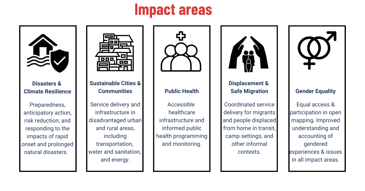
Are you wondering how OSM can fit into your work? As a humanitarian open mapping organization, we focus on five primary Impact Areas (above) that direct our work and promotion of OSM as a tool for real world humanitarian and development applications.
HOT’s Impact Areas connect open mapping to data needs and use in all aspects of the data life cycle: from creation and analysis, to visualizations and practical use. Each Impact Area provides resources and a framework for technical and subject matter expertise in open mapping work and links open mapping efforts to the achievement of several Sustainable Development Goals (SDGs).
Are you already working in one of these five Impact Areas? Consider how you can begin to (or increasingly) use OSM. To start, identify what data of interest can be sourced or created in OSM. Spatial layers that are considered the core of any reference or base map (types of buildings and roads, place names, etc.) fit well into OSM as this type of information has broad potential uses, and are the type of data a community of editors can easily agree on. Beyond a practical data platform for use and collecting, OSM methodology connects local mapping communities with organizational programming. When local information is needed on place names, business information, etc, OSM is a good place to check.
To learn more about how OSM can fit into your organization’s information needs, GIS activities, and more, see the details of our five Impact Areas for information on:
-
Expected outcomes of using OSM in mapping activities in each area
-
Suggested OSM data for each area
-
Sample spatial analyses by area
-
Examples of OSM data collections and use
Are you already working with OSM data in these areas or have any questions? Reach out to Jessie Pechmann, Global GIS Manager at jessie.pechmann@hotosm.org to:
-
Share examples of data use, methodologies, and impacted decisions to inspire and learn from others
-
Incorporate OSM into your workflows
-
Collaborate with our network, including actors in the open data and OSM ecosystem on your own mapping impact projects