
Nate Smith
Voting MemberBoardTreasurer
Bio
Nate is a product manager working to build mapping products that solve tough societal challenges. He has been a long time member of HOT and served as Director of Technology for HOT from 2017 to 2019. Currently, he is the Head of Product for maps at Gojek. He oversees business and product development for maps across Southeast Asia.
Nate has over ten years of expertise in building mapping products in emerging markets across Africa and Asia. His experience has focused on building solutions for humanitarian response and solving societal challenges with open source and open data. He has rich experience in OpenStreetMap and satellite imagery, and he has contributed to the development of OpenAerialMap, Tasking Manager, MapCampaigner, and many of HOT’s tools used today.
Posts
Bringing machine learning and open data to the Tasking Manager
Addressing the unmapped gap with higher quality and greater efficiency. Photo above from the Tasking Manager meeting held last month in Washington, DC.
Tasking Manager Update: New Version Released!
As December has started we’ve also released another update to the Tasking Manager. Head to tasks.hotosm.org and start mapping to check them out.
Hacktoberfest Update: Tasking Manager Improvements and More
Hacktoberfest has been a great success and has helped support many of our core open source projects. Check out the progress and continue to get involved during the last week of the month.
Hacktoberfest: A Call for Contributing to Social Impact Projects
Join in the celebration of open source software by contributing to the Tasking Manager or other open source projects maintained by HOT.
Getting to grips on tag quality with MapCampaigner
Last year at State of the Map in Boulder we announced a new tool called MapCampaigner. Today we're opening it up to anyone to create campaigns.
Open Imagery for Humanitarian Mapping
Analysis of imagery source use within the Tasking Manager
Integrating Machine Learning into the Tasking Manager: Notes on a Direction
We're moving towards how we leverage machine learning tools to improve data quality and help mappers map. Above is a shot from our design workshop we held at the HOT Summit in Dar es Salaam on August 31. Read more below about our ideas and a direction we'd like to see within the Tasking Manager.
Launching Visualize Change!
Today we’re launching Visualize Change, a new tool to see the change of OpenStreetMap over time. Anyone can automate the creation of embedded and...
HOT Conversations at State of the Map 2018
There has been a lot of activity lately within the HOT Community and we’re ready to share this at State of the Map 2018...
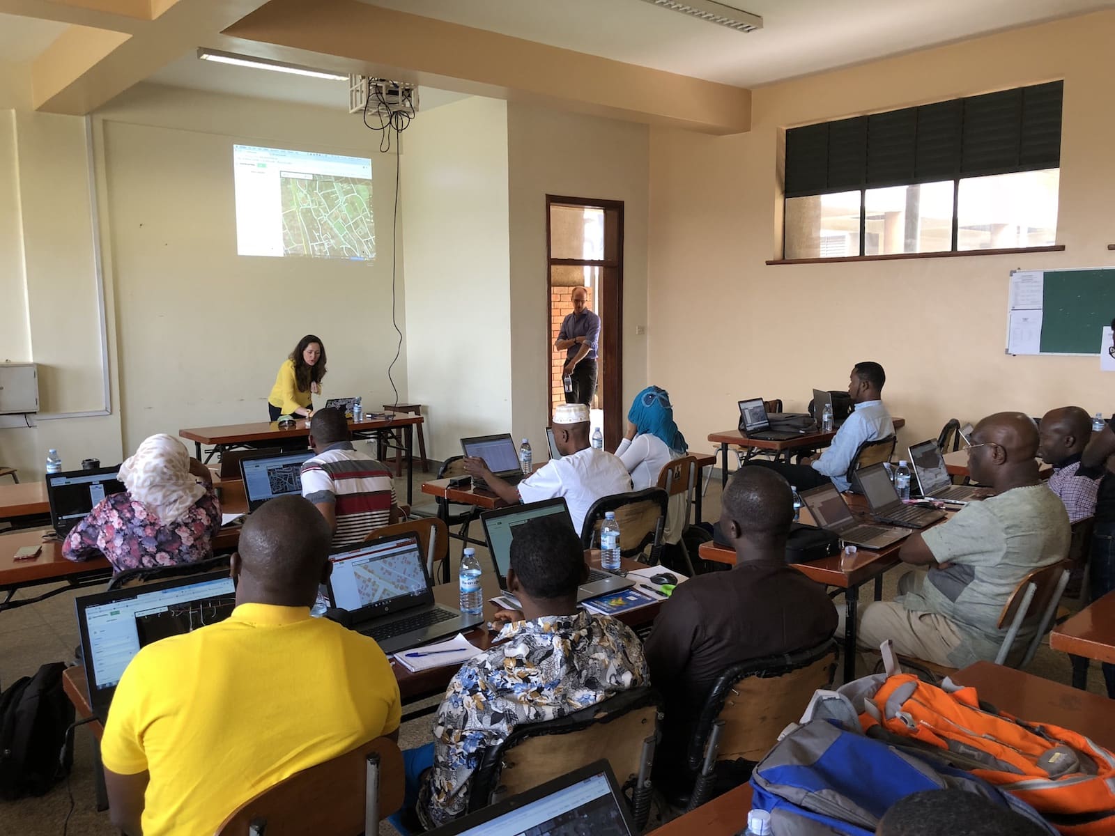
Open Cities Africa Kicks off in Kampala
The latest installment of the Open Cities project, Open Cities Africa, from the World Bank kicked off last week in Kampala. We were there...
A fresh look for hotosm.org
Today we flipped the switch on a new look for hotosm.org. The new design has updated information on projects, new ways of accessing information...
Welcoming summer work on open source tools through Outreachy and Google Summer of Code
Welcome to the new Google Summer of Code and Outreachy students! The HOT Community is getting a significant amount of support this summer on...
HOT Tech in 2018
This year has been a busy year for technology within the HOT community. We launched new versions of nearly all the core HOT tools...
Field mapping organizer reaches first major milestone
We've just finalized our first major milestone in the development of a new tool to improve how the HOT community organizes field mapping. Field...
Making HOT’s Design Experience Sizzle
Updates on our design strategy progress Over the past few months, we’ve started a process to analyze and review HOT’s look and feel across...
Collaborating with IOM, the UN Migration Agency, on OpenStreetMap
The Humanitarian OpenStreetMap Team (HOT) has recently signed a cooperation agreement with the International Organization for Migration (IOM), the UN's Migration Agency. This new...
Organized, distributed OpenStreetMap field mapping
One month ago we held a community chat about developing a new application to support OpenStreetMap field mapping. Our chat focused on getting input...
Uploading made easier: new options available for OpenAerialMap
Since OpenAerialMap launched we’ve required imagery to be stored in a publicly accessible place prior to upload. This enable us to focus more on...
Imagery released for Cyclone Enawo to support mapping activities
High-resolution satellite imagery from DigitalGlobe is now open and available for the Cyclone Enawo response. One week ago, the powerful cyclone made landfall on...
Growing OpenAerialMap with Responsible Imagery
HOT is working to grow OpenAerialMap to be a long-lasting open imagery resource to OpenStreetMap and humanitarian communities. With new funding from the Humanitarian Innovation...
Making open imagery accessible: OpenAerialMap comes out of beta
Open satellite and aerial imagery can be difficult to find, access and use. For HOT and our humanitarian partners, open imagery has been critical...
Analyzing OpenStreetMap for the fight against malaria
The fight against malaria with OpenStreetMap (OSM) gets a boost today. HOT won a grant from Grand Challenges Explorations, an initiative funded by the...
New Features for OpenAerialMap
OpenAerialMap is focused on creating a simple and easy experience for finding and publishing aerial imagery. This past week, we released three new features...
New Documentation and Design System for OpenAerialMap
We've just rolled out the start of a new documentation and design system for OpenAerialMap. Four main components make up the OAM ecosystem: an...