Drone Tasking Manager (DroneTM)
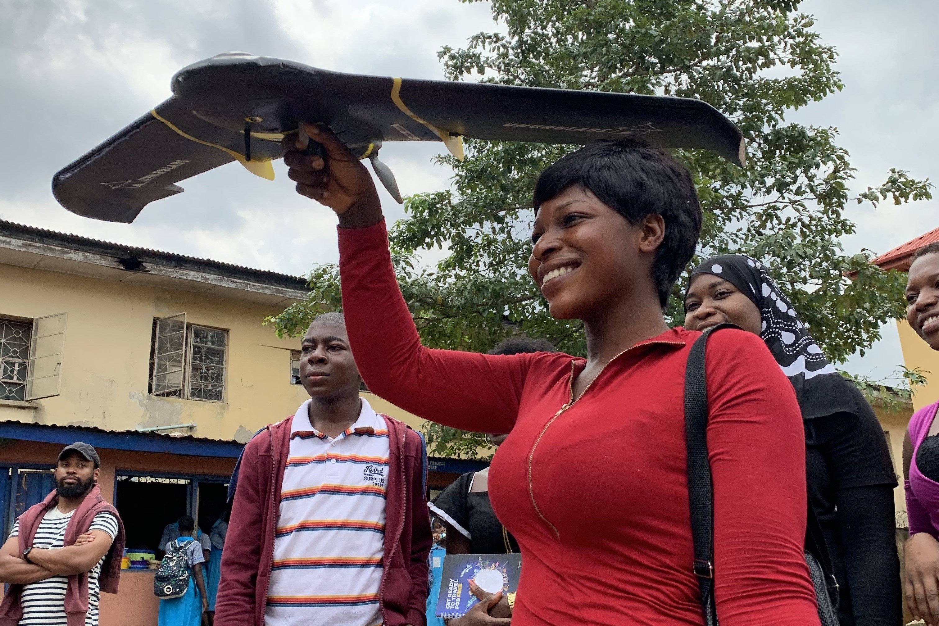
Drone Tasking Manager is an open source drone tasking platform that allows anyone with access to a drone — including low-cost consumer or DIY models- to contribute aerial imagery to a global, free, and open repository.
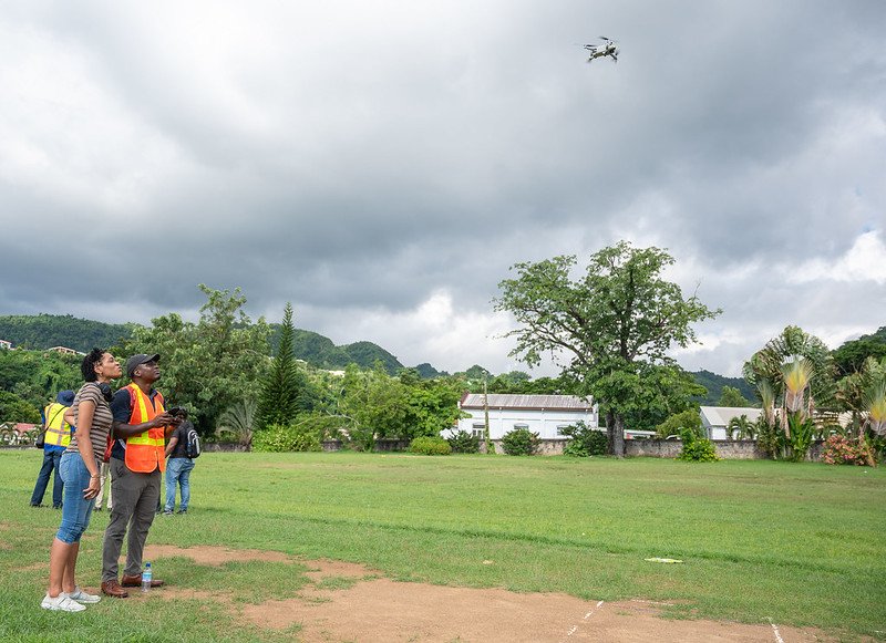
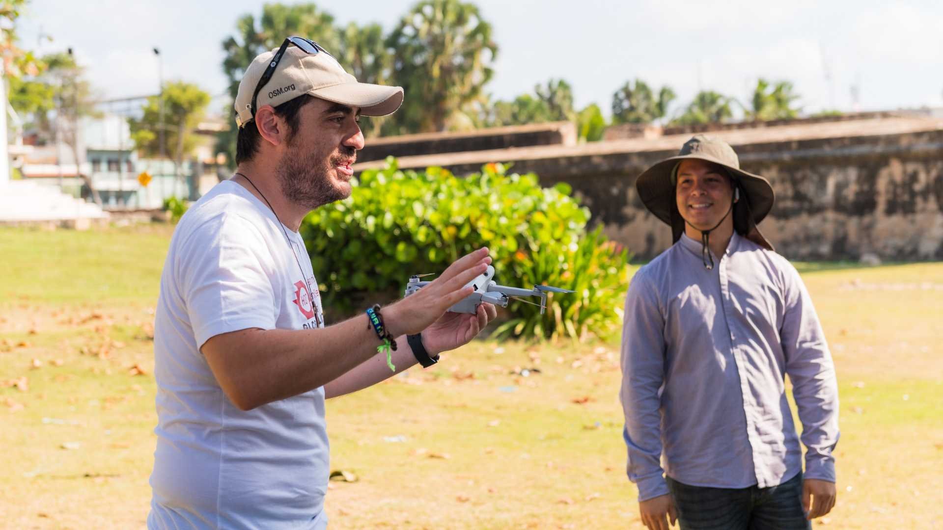
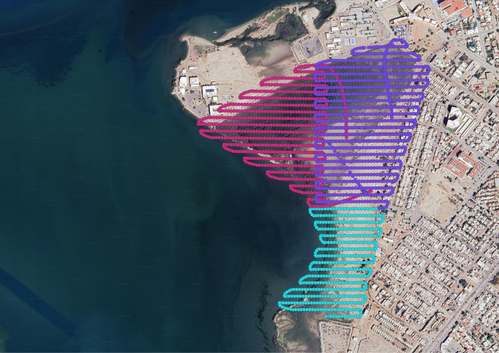
Local people with low-cost, consumer-type drones can choose areas to fly and receive flight plans that automate precision aerial imagery collection missions, seamlessly combining the efforts of multiple operators into high-quality coverage of 2D and 3D imagery.
Use Low-Cost Drones
DroneTM empowers local communities to produce their own aerial imagery by enabling local use of safe, affordable, lightly-regulated drones to create high-quality, high resolution 2D and 3D images and base layers
Coordinate Efforts
Current commercial drone platforms don’t enable multiple operators to collaborate to cover a large area. DroneTM empowers communities to work together to image their own environment seamlessly and at scale.
AI & Field Mapping
We’re all excited about the potential for Al and field mapping tools to power greater community mapping efforts. But Al and field mappers need imagery! DroneTM empowers communities to create those imagery inputs themselves.
Why DroneTM?
Aerial imagery is critical for mapping, but we have been dependent on satellites or expensive drones.
DroneTM empowers local communities to create high-quality aerial imagery by combining the efforts of multiple people with small, safe, accessible drones.
Social Impact:
- Collaboration: Communities work together to create local aerial imagery at scale.
- Independence: People generate their own data for use with Al and field mapping tools.
- Empowerment: Communities lead aerial imagery creation.
Links
DroneTM News
Sargassum Monitoring with Drones in Santo Domingo: Open Technologies to Tackle Environmental Challenges
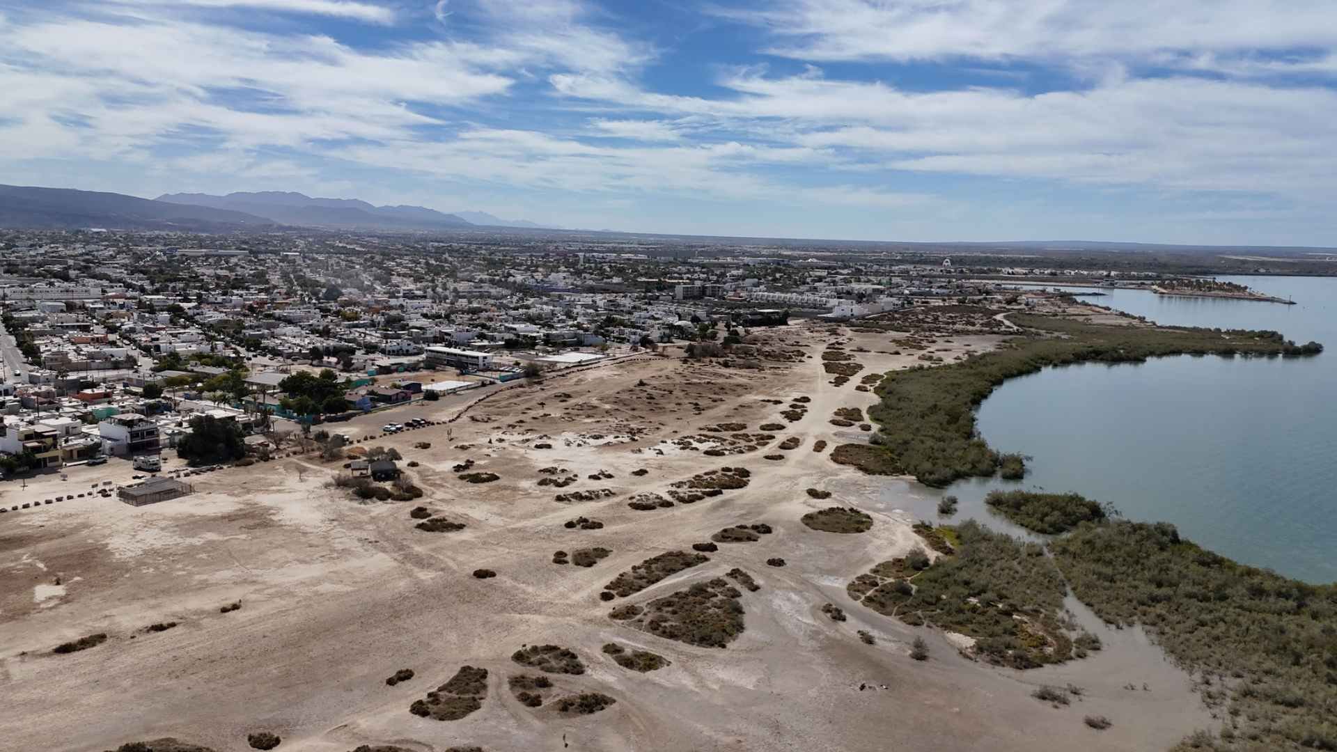
Can low-cost drones contribute to mangrove monitoring and conservation? Testing Drone Tasking Manager in La Paz, Mexico
Strengthening Communities in Mangrove Conservation: Drone Technology and Local Collaboration
Building DroneTM: A Digital Public Good Solution To Democratize Drone Mapping
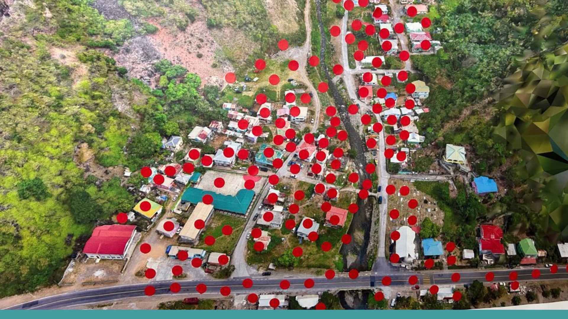
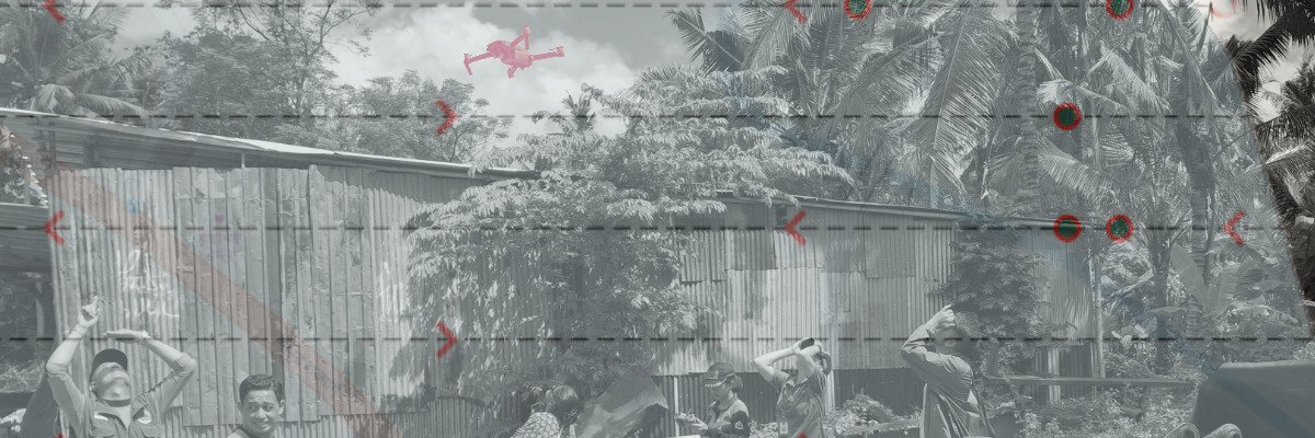
Boosting Caribbean Resilience: Collaborative Efforts using Drone Imagery in Coulibistrie, Dominica