Exposure Data and Models Shared with Disaster Management Stakeholders in Tanzania
Posted by Hawa Adinani • March 25, 2021
The METEOR project has been a three-year initiative supported by the UK Space Agency International Partnership Programme to generate disaster exposure data and models in two pilot countries — Tanzania and Nepal. The process has since been repeated in another 45 official development assistance countries.
We previously posted on the project’s goals and how we collected building datasets in Tanzania for developing exposure models. The consortium worked together to create hazard models for flooding, volcanic hazards (ash, lahars, and pyroclastic density currents), earthquakes, and landslides. The final outputs, data, and documentation are openly available on the project website.
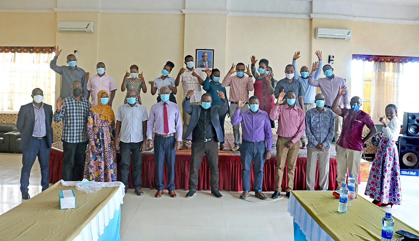
After data collection and the creation of models, the Tanzania Disaster Management Department under the Prime Minister’s Office, in collaboration with OpenMap Development Tanzania (OMDTZ), facilitated a two-day workshop with stakeholders involved in disaster management in Tanzania. The workshop’s goals were:: * Sharing data with relevant stakeholders, making them aware that exposure data was available and where it could be accessed * Strengthening engagement with stakeholders and fostering data use * Getting feedback from stakeholders on how they plan to use data and how the data can improve risk mitigation, preparedness, and response to disasters
The workshop was both virtual and in-person, and about 40 people attended. The in-person component followed best practices for events during the coronavirus pandemic and mandated masks, social distancing, and good hygiene. The invited participants were stakeholders in Tanzania who were relevant to Disaster Risk Reduction activities, including first responders, weather forecasters, academics, and environmental managers.
Why is this important?
Disasters are on the rise, both in terms of frequency and magnitude. From 2000-2019, disasters have claimed more than 1.23 million lives and affected a total of over 4 billion people, with women, children, and marginalized communities disproportionately affected. The total economic loss for this time period is estimated at $2.97 trillion. Disasters inordinately affect lower-income countries. Sub-Saharan Africa, where two-thirds of the world’s Least Developed Countries are located, is prone to recurring disasters, largely due to natural hazards and climate change.
 Image from an interactive Level 1 Exposure map for 33 countries in Africa plus Yemen, which provides an estimate of building exposure for loss estimation and catastrophe modeling.
Having disaster exposure models, such as in the visualization above, at the country level is an asset for building disaster resilience in countries through enabling measures to minimize risks and mitigation plans. Just as the Sendai Framework for Disaster Risk Reduction 2015-2030 emphasizes the need to manage risks rather than disasters and the need for strong stakeholders’ involvement from local to the international level to make this possible. Without a strong, unified database, it is almost impossible to invest in risk management. Rather, responders will concentrate on disaster response, which often results in more casualties. Using these datasets will bring positive results to disaster management in Tanzania by mitigating disaster risks and preventing loss of life.
What are stakeholders saying?
“We normally do not look at vulnerability or exposure, we directly jump to responses,” said Jonston Weston, Director of Organizational Development - Red Cross Tanzania. Data can fill this gap, and METEOR data will improve their work in reducing risks and mitigating the impacts on disasters.
Tanzania Meteorological Agency (TMA) representative, Elias Lipiki, explained how the data will be of great use to forecasters:
“Exposure maps will specifically help TMA to predict bad weather conditions in relation to the anticipated impacts. For now, we forecast bad weather conditions with few or no anticipated impacts depending on the database that we have, meaning the forecaster relies on his/her experience of specific locations to anticipate impacts of predicted disasters. At a country level, it is hard to predict impacts without a proper database—so if we can use the data provided here, we will be able to conduct an impact-based forecast for different hazards.”
 Aminiel Hillary Mshana, the Assistant Coordinator of the Dar es Salaam Multi-Agency Emergency Response Team (DarMAERT) making a comment during the workshop.
Stakeholders expressed their interest in using the data if they get the skills to use them. They wanted more capacity building, such as training on data use and incorporating models into their daily operations. This says a lot about the need that existed for data and how disaster risk reduction experts want to integrate data and technology into disaster management. Specifically, a representative from TMA asked for support from the British Geological Survey (BGS) on integrating the risk models into their database and analyzing scenarios at a country level.
Proposed way forward
The stakeholder training workshops in Tanzania and Nepal mark the conclusion of the METEOR project. All of the final outputs, data, protocols, and training materials can be accessed on the project website.
Though the project is at an end, we are still at the beginning of incorporating data and technology into our national and local strategies to deal with disasters. As the rise of climate-related disasters over the last twenty years shows us, there is a serious need for using all the tools at our disposal to build resilient communities.
Of particular importance is the engagement and capacity building of the same stakeholders who participated in the workshops. We know disaster risk reduction is closely linked to governance and that multiple actors must work together to effectively mitigate risk.
There were many ideas generated during the workshops, and we urge both the national stakeholders and international partners to continue talking about how we can work together to understand our exposure to natural hazards and improve risk mitigation.
Share
