Open Cities Africa: Bamako - Community Mapping for a Resilient Bamako
Posted by Shazmane Mandjee Rehamtula, Risham Habib • June 24, 2022
With ‘Community Mapping for a Resilient Bamako’, HOT was able to contribute to data sharing, raise awareness of flooding, and build the capacity of the community for the collection and use of flood risk data.
The Open Cities Africa project, ‘Community Mapping for a Resilient Bamako,’ originally launched in 2020, was completed as of May 2022. The purpose of this World Bank funded project was to highlight the need for information infrastructure to develop and strengthen urban resilience in Bamako, Mali.
Open Cities Africa is a collaborative mapping initiative to build open-data eco-systems to facilitate data driven urban planning and disaster risk management. Bamako is one of 11 cities in Sub-Saharan Africa to serve as a project site. The project engaged the local government, civil society, and the private sector in disaster response through PRUBA (Projet de Résilience Urbaine de Bamako).
The project was a collaboration between Humanitarian OpenStreetMap Team (HOT), OpenStreetMap Mali (OSM Mali) and Croix-Rouge Malienne (CRM). Stakeholders included Agence Dévelopment Régionale du Bamako (ADR), Mali Meteo, DoniLab, Institut Géographique du Mali and L’Urbanisme et l’habitat among others.
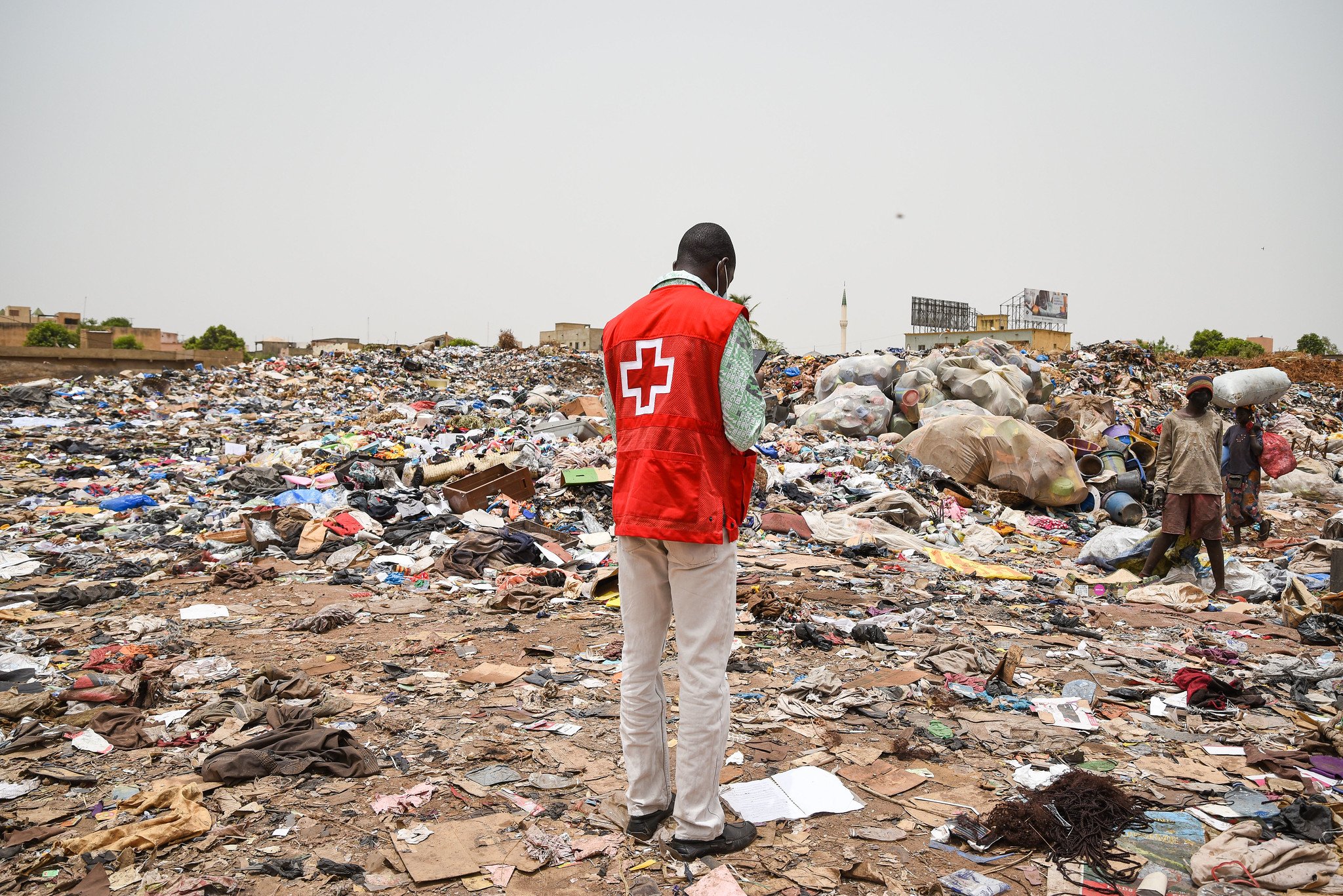
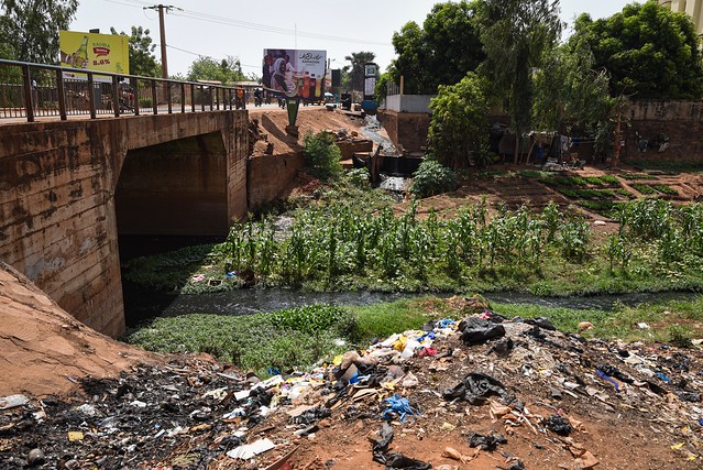
Due to the terrain and infrastructure, the biggest disaster risk in Bamako is flooding. This is further complicated by waste and drain blockages. OSM Mali, with the support of HOT, used community mapping to bridge the gap between waste, drains, and infrastructure, in order to reduce flooding and produce resilience data to inform decision-making.
MapSwipe was used for waste mapping and a method developed by OMDTZ was used to map the drains. Having this information made it easier to map the infrastructure. Using aerial imagery and a set of open mapping tools; data from target communities was collected, validated, mapped, and analyzed.
Through this initiative, and with the aid of the collected data and mapping, an Open Digital Platform for a Resilient Bamako (Final version will be published on July 10th, 2022) was created by GeOSM (an open source solution maintained by SOGEFI), to facilitate sharing data on flood risks and disaster management.
The creation of open spatial data about the built environment, important infrastructure, and natural hazards was crucial in developing visualization tools to assess and use risk information to inform various stakeholders. Working with different communities, stakeholders, and partners enabled OSM Mali, with the support of HOT, to produce data driven systems and promote urban resilience interventions.
Feature Photo Credit: Banko Productions and the World Bank, Bamako, Mali, May 2021.
Share
