Open Cities: Community Mapping for a Resilient Bamako

Mapping for informed decision making for disaster response and socioeconomic development
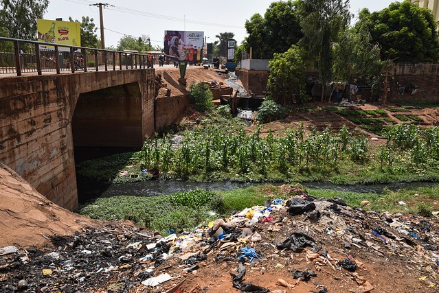
Bamako, the capital and largest city of Mali, is situated on the Niger River floodplain, which hampers development along the riverfront and the Niger’s tributaries. Bamako is relatively flat, except to the immediate north where an escarpment is found, what remains of an extinct volcano. The presidential palace and the main hospital are located there. Originally, the city was developed on the northern side of the Niger River but as it grew, bridges were built to connect the north with the south: the Pont de Martyrs, the King Fahd Bridge, and the Sotuba causeway, which is typically underwater from July to January.
The Open Cities Bamako Community Mapping for a Resilient Bamako project joins the Open Cities Africa cohort that was launched in 2018 and implemented in 11 cities in Sub-Saharan Africa to engage local government, civil society, and the private sector to develop the information infrastructures necessary to meet 21st century urban resilience challenges.
Community Mapping for a Resilient Bamako will focus on collecting the relevant datasets on flooding in AOI to support the Government of Mali in taking measures to increase access to resilience data for informed decision making for disaster response and socioeconomic development.
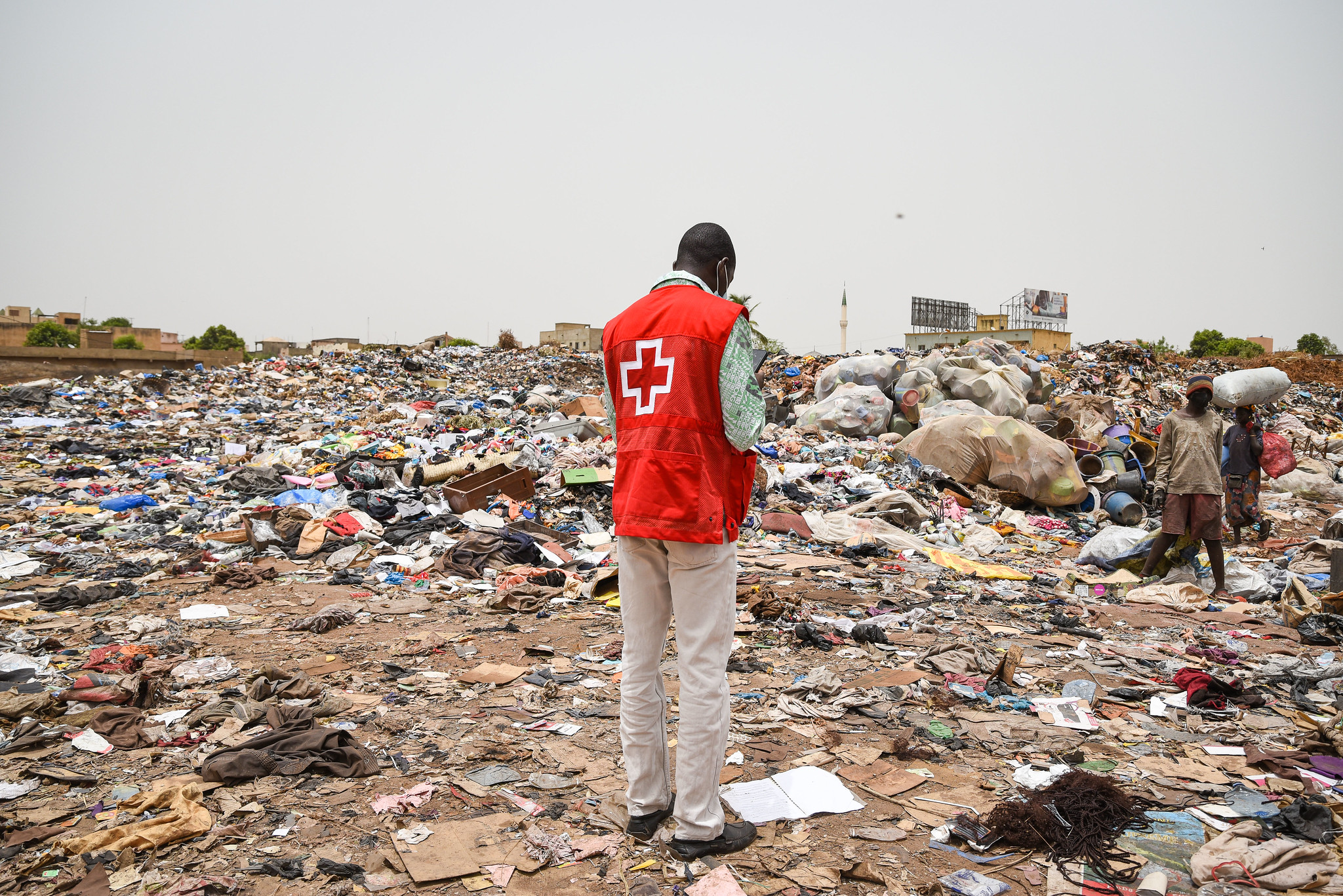
The project activities will focus on collecting identified baseline information on specific thematic layers such as public equipment, solid waste management, flood management in the entire district of Bamako, and detailed data of one targeted vulnerable neighborhood. This data collection and mapping exercise will lead to:
-
The creation of an Open Digital Platform for a Resilient Bamako, facilitating data sharing and an overall understanding of the flood risk in the city.
-
Raising awareness of flooding among city population, municipal staff, and institutions.
-
Building capacity for data collection and use of flood risk data by communities, universities, private and government institutions.
During the rainy season in Mali (May to October), Bamako receives more than 600mm of rainfall and flooding is common. The most recent flood was May 16, 2019, in which 25 people died and 575 more were affected.
The project will use high-resolution aerial imagery, OpenStreetMap (OSM) and a collection of open mapping tools including Java OpenStreetMap Editor (JOSM), the HOT Tasking Manager, OpenMapKit (OMK), Open Data Kit (ODK), Mapillary, and QGIS, to collect, validate, map, analyze and share accurate datasets from the target communities in order to achieve the following objectives:
-
Create and/or collate and release open spatial data about the built environment, critical infrastructure, and natural hazards;
-
Develop targeted products and/or tools (e.g., visualization tools, atlas or map series) to assist key stakeholders to use risk information to address natural disaster risk in the selected city;
-
Enhance the local capacity and institutional development necessary to support the design and implementation of evidence-driven urban resilience interventions; and
-
Promote peer mentorship and build regional networks across cities.
Community Mapping for a Resilient Bamako is led by the Humanitarian OpenStreetMap Team (HOT), OpenStreetMap Mali (OSM Mali), Croix-Rouge Malienne (CRM) and will work with stakeholders including Agence Development Regionale du Bamako (ADR), Mali Meteo, DoniLab, Institut Géographique du Mali and L’Urbanisme et l’habitat among others.
Feature Photo Credit: Banko Productions and the World Bank, Bamako, Mali, May 2021.
Recent news from Open Cities: Community Mapping for a Resilient Bamako (View all news)
Open Cities Africa: Bamako - Cartographie communautaire pour un Bamako résilient
Le projet Open Cities Africa, " Cartographie communautaire pour un Bamako résilient ", initié en 2020, s'est achevé en mai 2022. L'objectif de ce projet financé par la Banque mondiale consistait à mettre en évidence le besoin d'infrastructures d'information pour développer et renforcer la résilience urbaine à Bamako, au Mali.
Open Cities Africa: Bamako - Community Mapping for a Resilient Bamako
With ‘Community Mapping for a Resilient Bamako’, HOT was able to contribute to data sharing, raise awareness of flooding, and build the capacity of the community for the collection and use of flood risk data.