News
RightsCon 2023: buscando la intersección de los derechos humanos y los mapas

El pasado junio se realizó la RightsCon, el evento global que reúne a activistas y organizaciones que trabajan por los derechos humanos, y el Hub LAC se hizo presente en busca de mapas y mapeadores!
Staff Spotlight Series: Duncan Kebut
Each quarter, we’re featuring one of our all-star staff members in a Staff Spotlight Series. Staff featured in this Series have been peer-nominated for their superb performance and values-driven work. This quarter, we’re spotlighting: Duncan Kebut, a Senior Mapping Supervisor at the ESA Hub.

HOT and CDEMA sign agreement to enhance disaster management in the Caribbean with collaborative mapping
HOT and CDEMA -the Caribbean Disaster Emergency Management Agency- have signed a collaboration agreement to strengthen CDEMA's geospatial technological capabilities. Learn the details.

HOT et CDEMA signent un accord pour améliorer la gestion des catastrophes dans les Caraïbes grâce à la cartographie collaborative
HOT et CDEMA - l'Agence caribéenne de gestion des urgences en cas de catastrophe - ont signé un accord de collaboration pour renforcer les capacités technologiques géospatiales de CDEMA.Apprenez les détails.
HOT y CDEMA firman acuerdo para potenciar la gestión de desastres en el Caribe con cartografía colaborativa
HOT y CDEMA -la Agencia Caribeña para el Manejo de Emergencias por Desastres- han firmado un convenio de colaboración para fortalecer las capacidades tecnológicas geoespaciales de CDEMA. Entérese de los detalles.
URBE Latam Encontro Internacional
Neste Fevereiro, a URBE Latam promoveu o encontro da sua equipe internacional em Niterói, no Rio de Janeiro. A ideia central era trazer a equipe dos diferentes países em conjunto para trocar experiências, adquirir novos conhecimentos e refletir sobre os próximos passos na utilização dos dados produzidos e no seguimento do mapeamento.
URBE Latam International Meeting
In February, URBE Latam hosted the meeting of its international team in Niterói, Rio de janeiro. The main idea was to bring the team from different countries together to exchange experiences on the process of the mapping projects in Preventório and El Salvador, acquire new knowledge by dialoguing with community members and reflect upon next steps to use the data produced and keep mapping.
Impulsando el cambio a través de los datos: Explorando las iniciativas de investigación y análisis en mapeo humanitario
A medida que nos sumergimos en la segunda mitad de 2023, nos sentimos ilusionados de compartir los progresos realizados por HOT y el equipo de comunidad en el uso de los datos de OSM para la toma de decisiones bien informadas.
Driving Change through Data: Exploring Humanitarian Mapping Research and Analysis Initiatives
As we dive into the second half of 2023, we are thrilled to share the progress made by HOT and the Community Team in leveraging OSM data for informed decision making.
The AP Hub hosts Regional Dialogue on OpenStreetMap & Anticipatory Action at Anticipation Hub's 7th Asia-Pacific Dialogue Platform on Anticipatory Humanitarian Action
The Regional Anticipatory Action Dialogue offers a platform for humanitarian organizations, local governments, national and regional NGOs, and all various anticipatory actors to share their perspective on disaster management and anticipatory action.
How HOT is Supporting Climate Resilience Around the World
This post originally appeared on the blog of Virgin Unite.

Notes from the field: The Humanitarian OpenStreetMap Team
Fabrizio Scrollini, the new Director of the Open Mapping Hub for Latin America and the Caribbean, shares his impressions of the first days of work with the Hub team, what has been done and what is to come.

Notas de campo: Equipe Humanitária do OpenStreetMap
Fabrizio Scrollini, novo diretor do Hub de Mapeamento Aberto para a América Latina e o Caribe, compartilha suas impressões sobre os primeiros dias de trabalho com a equipe do Hub, o que foi feito e o que está por vir.
Notes de terrain : L'équipe Humanitaire d'OpenStreetMap
Fabrizio Scrollini, le nouveau directeur de l'Open Mapping Hub pour l'Amérique latine et les Caraïbes, partage ses impressions des premiers jours de travail avec l'équipe du Hub, ce qui a été fait et ce qui est à venir.
Notas desde el terreno: el Equipo Humanitario de OpenStreetMap
Fabrizio Scrollini, el nuevo Director del Hub de Mapeo Abierto para América Latina y el Caribe comparte sus impresiones de los primeros días de trabajo con el equipo del Hub, lo realizado y lo que está por venir.
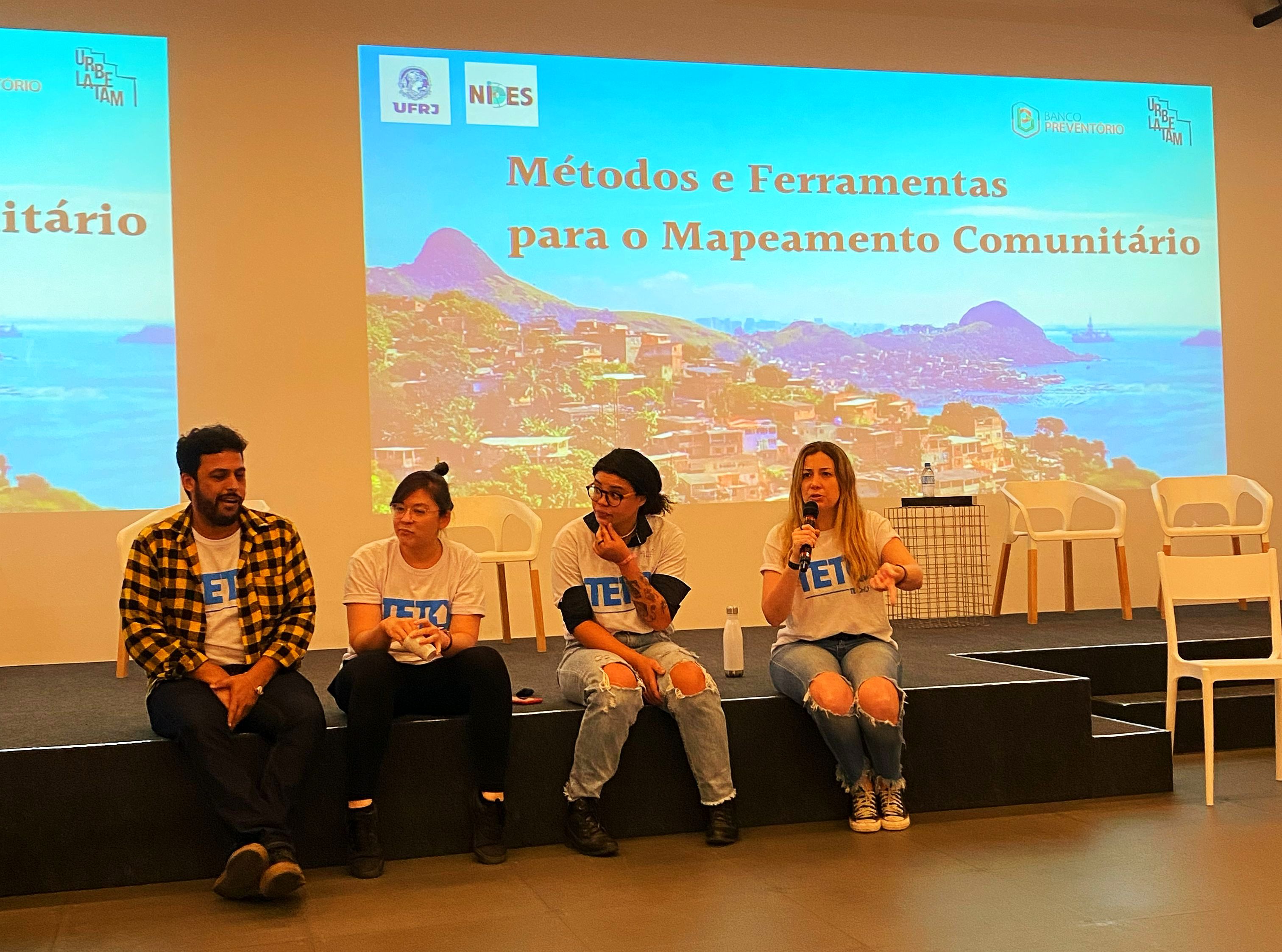
HOT and TETO: building emergency solutions to improve people’s lives
How a partnership in a local event in Brazil led HOT and TETO to work together towards building concrete emergency solutions to improve the living conditions of communities in situations of precarity and poverty.