News
OpenStreetMap y las cartografías oficiales

**¿Se puede integrar OpenStreetMap al trabajo de los Institutos Geográficos Nacionales? **Esta es una pregunta que ronda el imaginario del mapeo abierto desde hace mucho y aquí te contamos como se está respondiendo.
Data Quality Intern Applies Skills in the Turkey and Syria Earthquake Response
"My experience in the HOT Data Quality Internship program allowed me to contribute more effectively to the activation."

HOT's Approach to OSM Data Validation for Earthquake Response Mapping
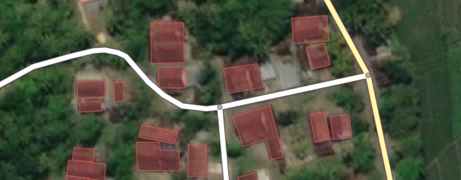
Because OpenStreetMap is a crowd-sourcing project where everyone can freely contribute to the map, the Humanitarian OpenStreetMap Team has devised measures to support high-quality crowd-sourced OSM data. We have a four step validation process to ensure that the data created for emergencies like the current Turkey and Syria earthquake response is fit for use.

Using OSM Data in the Turkey and Syria Earthquake Response
In the aftermath of the Syria-Turkey earthquake, OSM is allowing responders to quickly access up-to-date maps and geospatial data to aid in search and rescue efforts, access and contextualize damage assessments, and plan relief and recovery efforts. Here are the data sets available for response organizations and examples of how they are being used.

Women, maps and data: a conversation for International Women's Day
A group of brilliant Latin American women expose us to various projects and tell us about various experiences in the use of maps and data, and also about their absence.

Mujeres, mapas y datos: un conversatorio por el Día Internacional de la Mujer
Un grupo de brillantes mujeres latinoamericanas nos expone diversos proyectos y nos cuentan variadas experiencias en el uso de mapas y datos, y también sobre su ausencia.
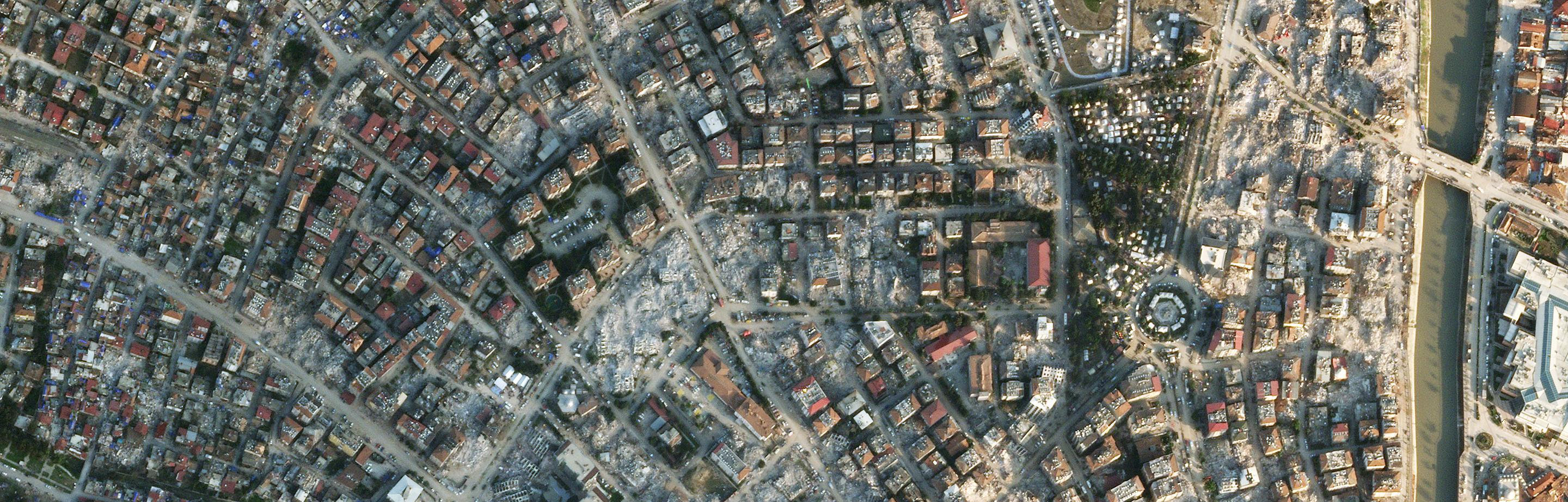
Turkey And Syria Response: A Month After The Earthquake
The mapping response to the Turkey and Syria earthquake has shown the power of OSM data to support disaster response.
Beyond the Map Fund Program
Through the program, organizations will be able to work closely with the Eastern and Southern Africa (ESA) hub team to improve access to open data sets, build partnerships with organizations and experts, and receive technical assistance, and support training.

HOT Data Quality Updates for March 2023
To support organizations that use OpenStreetMap data for disaster response, the HOT Data Team is strengthening our data quality and fitness measures.
Volunteerism in the 21st Century: The way to go
A panel discussion with panelists Sabrina Szeto, Juan Arellano and Laura Mugeha, moderated by Laxmi Goparaju

Generating and Promoting Open Data
In November 2022 the Open Mapping Community Working Group hosted the webinar: Generating and Promoting Open Data. Host Laxmi N. Goparaju shares the highlights of the conversation.

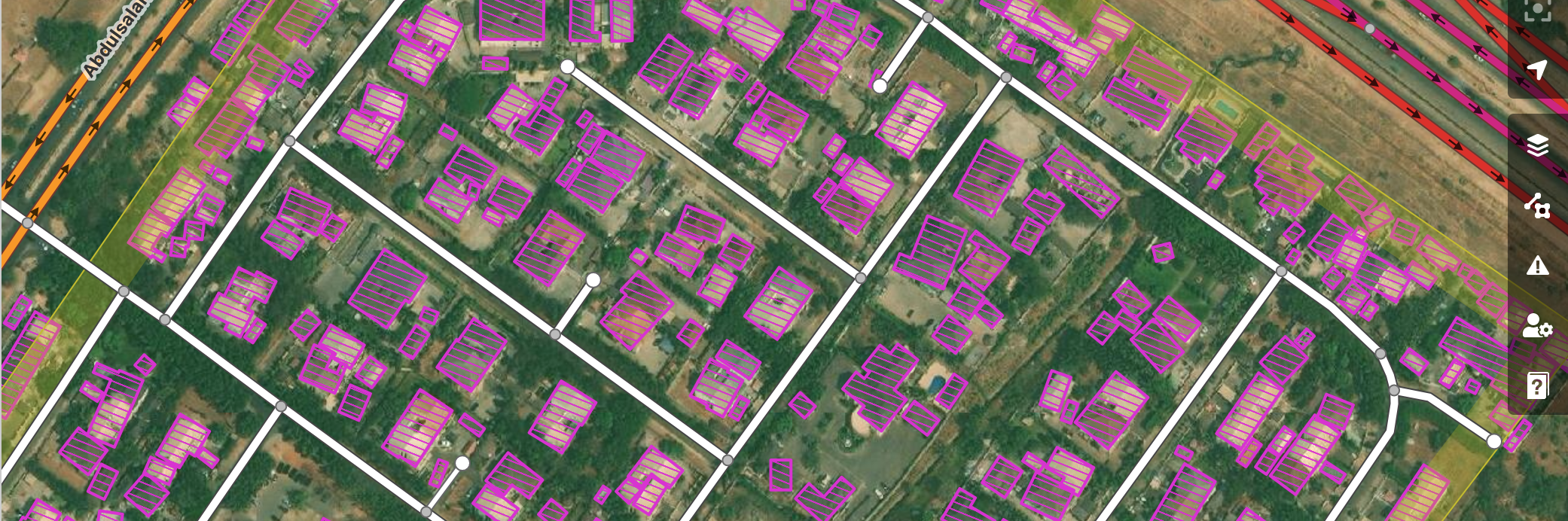
An Approach for Improving OpenStreetMap Data Quality in Asia-Pacific
Open Mapping Hub Asia-Pacific (AP Hub) aims to support OpenStreetMap (OSM) and open mapping initiatives in the region as part of our efforts to advance this movement. AP Hub also offers a method for enhancing the quality of data on OpenStreetMap when data quality review is a regular task.
GIRD+OSM Lima 2022: Creating a community around Risk Management and Open Mapping
Last November, the Grassroots Management of Disaster Risks and OpenStreetMap LATAM 2022 event was held in Lima, Peru. Let's learn a little more about what happened these days in Lima around open and community mapping.

GIRD+OSM Lima 2022: Creando comunidad alrededor de la gestión de riesgos y el mapeo abierto
El pasado mes de noviembre se realizó en Lima, Peru el evento Gestión popular de riesgos de desastres y OpenStreetMap LATAM 2022. Conozcamos un poco mas que pasó estos días en Lima alrededor del mapeo abierto y comunitario.
Announcement of HOT and Caribbean School of Data Partnership: Open Mapping Technical Training in the Caribbean Region
We are partnering with the Mona School of Business and Management's (MSBM) Caribbean School of Data (CSOD) project to launch an Open Mapping Technical Training program in the Caribbean.

Programme de mentorat cartographie collaborative
La communauté OpenStreetMap, une communauté de communautés, est composée de nombreux cartographes et autres contributeurs répartis dans les communautés locales du monde entier. Le programme de mentorat du groupe de travail de la communauté OpenStreetMap peut aider à combler les écarts de compétences entre les communautés.
