News
Examiner le potentiel et l'état de la communauté OSM en Haïti
.jpg)
Explorez le potentiel et l'état actuel de la communauté OpenStreetMap (OSM) en Haïti à travers ce rapport de 2024. Il met en lumière l'évolution des communautés OSM en Haïti et les défis significatifs auxquels elles sont confrontées. Les recommandations pour la durabilité soulignent la nécessité de partenariats solides et de conférences annuelles pour soutenir l'action humanitaire et la réponse aux crises en utilisant des données géospatiales ouvertes.
Examining the Potential and State of the OSM Community in Haiti
Explore the potential and current state of the OpenStreetMap (OSM) Community in Haiti through this 2024 report. It highlights the evolution of OSM communities in Haiti and the significant challenges they face. Recommendations for sustainability emphasize the need for strong partnerships and annual conferences to support humanitarian action and crisis response using open geospatial data.
Participa en el Concurso de Proyectos Educativos con Mapeo Abierto de América Latina
Únete a Open Mapping for All y descubre cómo captar la atención de tus estudiantes con herramientas de mapeo abierto. Aborda temas locales de manera creativa, interactiva y divertida. Participa en el concurso para recibir capacitaciones, acompañamiento y la oportunidad de ganar financiamiento para tu proyecto educativo.
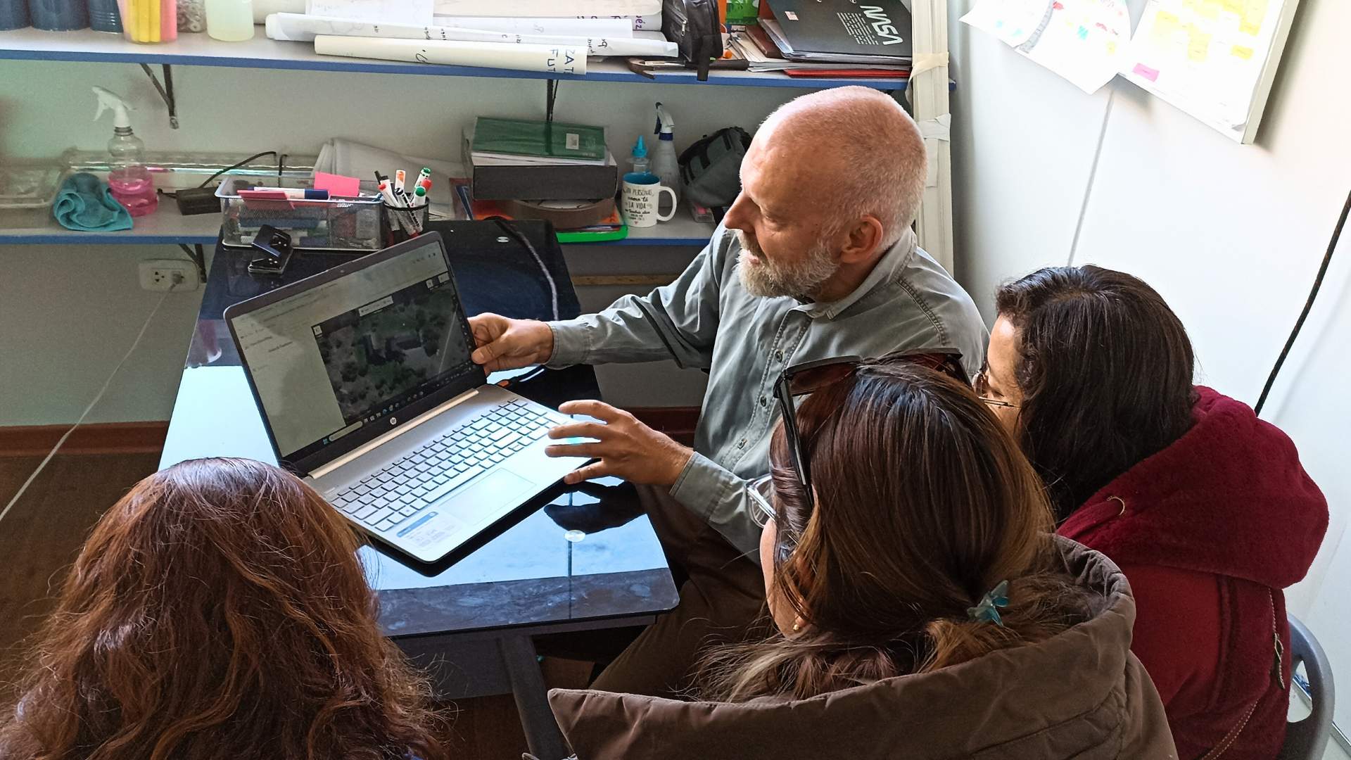
Experiências de Mapeamento Aberto no Centro de Educação Integral "San Ignacio"
Através do programa Open Mapping for All, docentes e estudantes de uma instituição educativa na Patagônia Argentina, empregam ferramentas de Mapeamento Aberto para documentar, reconhecer e melhorar a infraestrutura física escolar, ao mesmo tempo que se conectam com seu entorno e seus valores culturais.
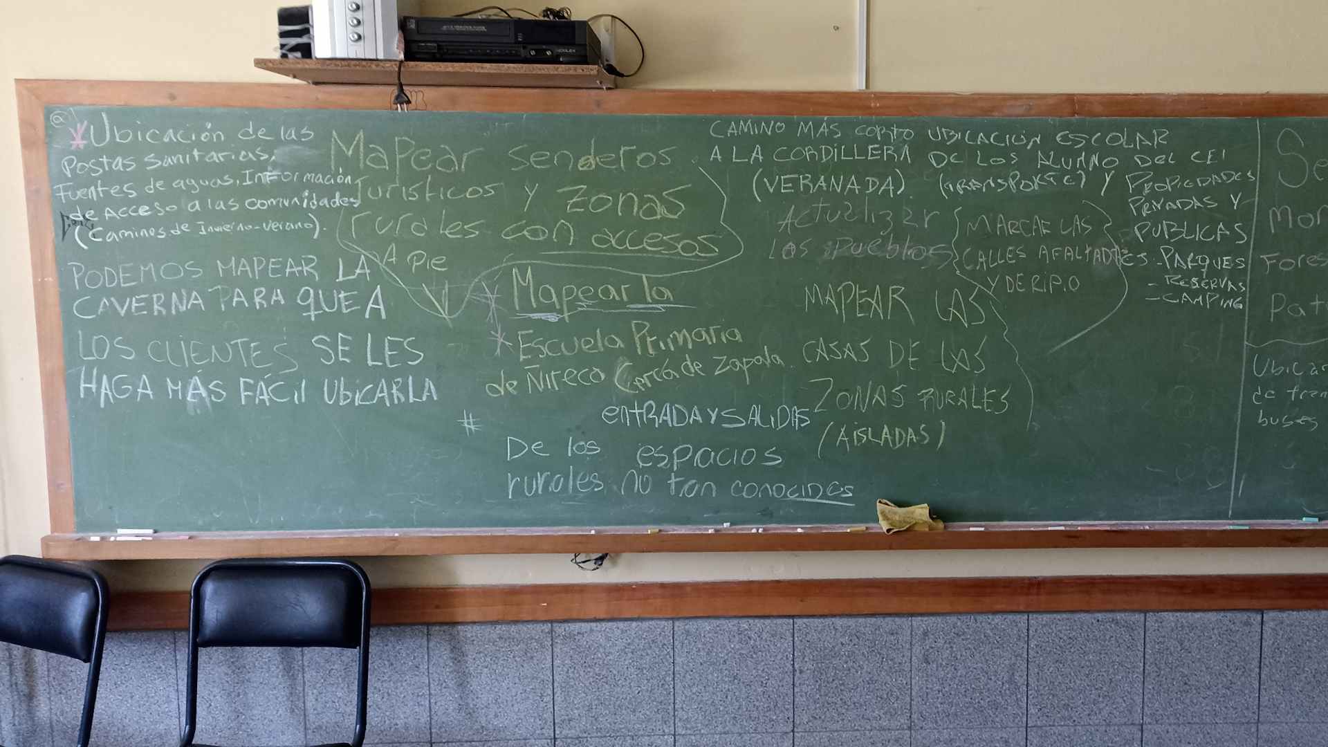
Experiencias de Mapeo Abierto en el Centro de Educación Integral “San Ignacio”
A través del programa Open Mapping for All, docentes y estudiantes de una institución educativa en la Patagonia Argentina, emplean herramientas de Mapeo Abierto para documentar, reconocer y mejorar la infraestructura física escolar, al tiempo que conectan con su entorno y sus valores culturales.
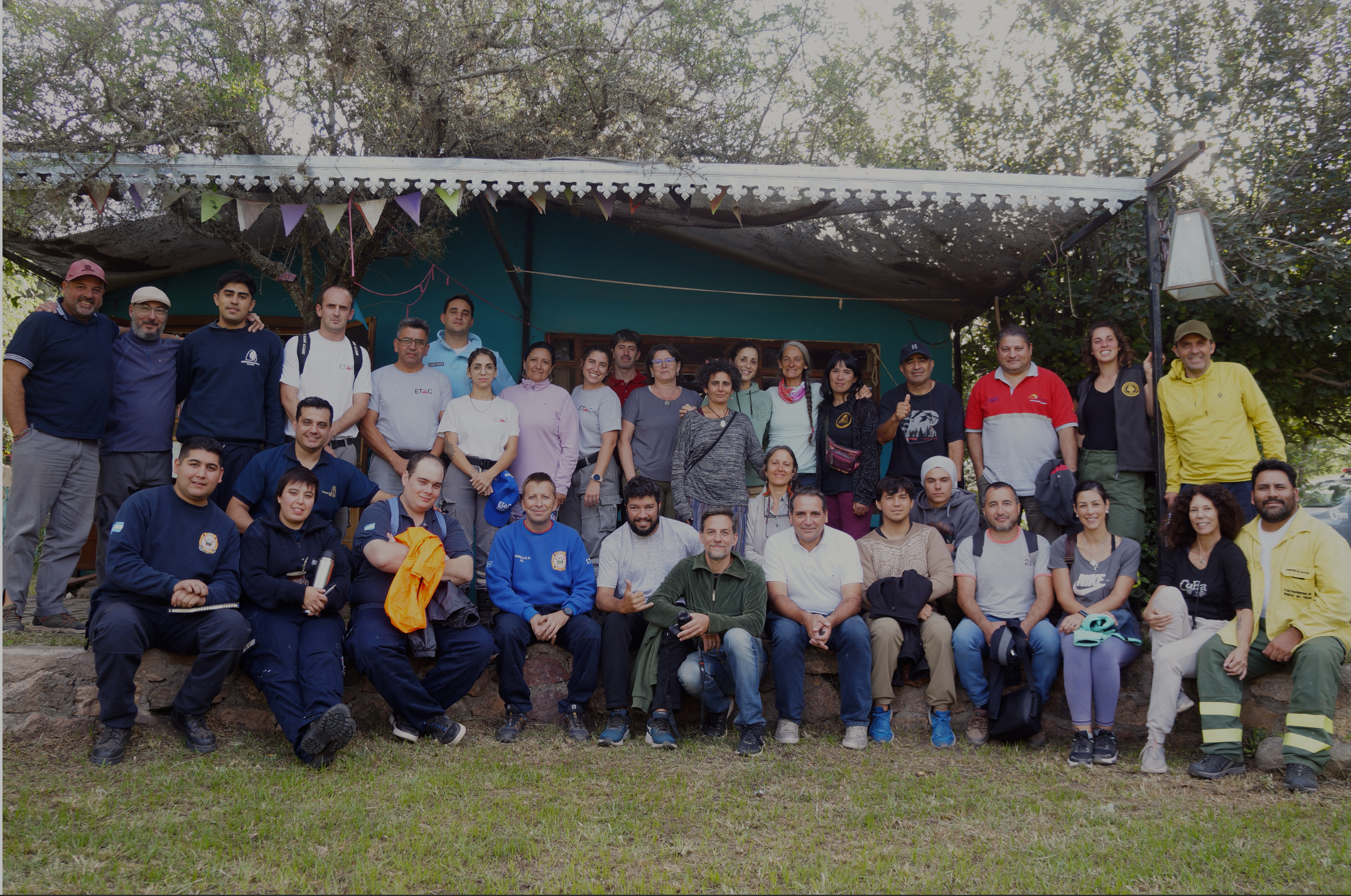
Training Open Mapping Tech for Wildfires in Córdoba, Argentina: Workshop in Unión de Los Ríos
On April 1 2024, we did a workshop called “Open Mapping for Inclusive and Sustainable Development. Mapping Tech in Wildland Areas: Forest Fires Edition” in Unión de Los Ríos, Córdoba, Argentina.
Community Cartography: Low-Cost GNSS Receiver in the Mapping of Medio Solimões
Explore how low-cost GNSS technology is revolutionizing mapping in the Medio Solimões, with support from HOT and the LAC Hub. This innovative project, conducted by the Federal University of São João del-Rei, promotes participatory cartography, improving resource management and resilience of riverside communities in the Brazilian Amazon.

Cartografía Comunitaria: Receptor de Bajo Costo en el Mapeo del Medio Solimões
Explora cómo la tecnología GNSS de bajo costo está revolucionando el mapeo en el Medio Solimões, con el apoyo de HOT y el LAC Hub. Este proyecto innovador, llevado a cabo por la Universidad Federal de São João del-Rei, promueve una cartografía participativa, mejorando la gestión de recursos y la resiliencia de las comunidades ribereñas en la Amazonía Brasileña.
Cartografia Comunitária: Receptor de baixo custo no mapeamento do Médio Solimões
Explore como a tecnologia GNSS de baixo custo está revolucionando o mapeamento no Médio Solimões, com apoio do HOT e do LAC Hub. Este projeto inovador, conduzido pela Universidade Federal de São João del-Rei, promove uma cartografia participativa, melhorando a gestão de recursos e a resiliência das comunidades ribeirinhas na Amazônia Brasileira.
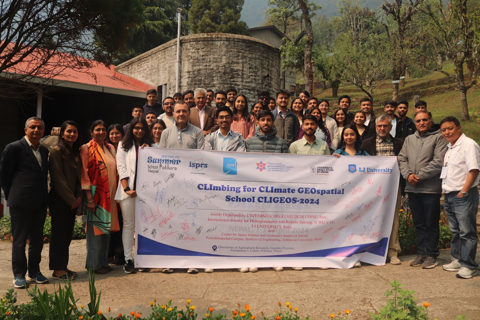
Our End-to-End Mapping Solution: Mapping exercise at CliGeos Summer School
In April 2024, we had the opportunity to demonstrate the power of open mapping tools and workflows at the CLImbing for CLImate GEOspatial School (CLIGEOS-2024) in Annapurna-3, Lumle-Pokhara, Nepal.
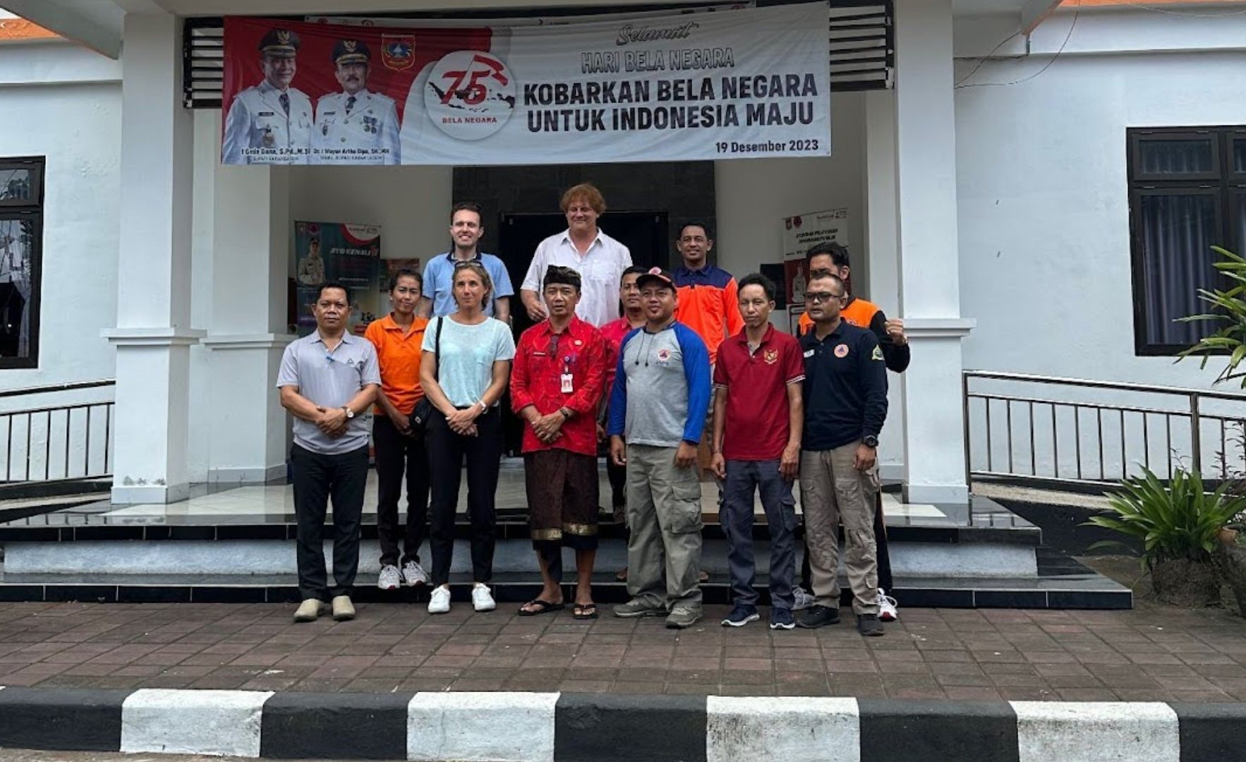
Our End-to-End Mapping Solution: Training the Balinese Disaster Response Team in Karangasem
HOT envisions an ecosystem of open mapping technology that enables everyone, and in particular vulnerable communities, to make the right open map data available in order to use that to make a positive impact on people’s lives.
Climate Mapping Campaign: Help map Eastern & Southern Africa to fight climate change!
The devastating impacts of climate change, from intense cyclones to prolonged droughts, are threatening the lives and livelihoods of millions in Eastern and Southern Africa. At HOT's Open Mapping Hub (OMH-ESA), we are dedicated to advancing open mapping solutions for community development and social impact.
.jpg)
HOT's statement on the one-year anniversary of the war in Sudan
Today marks the one-year anniversary of the start of the war in Sudan. The conflict has resulted in more than 14,000 lost lives, 8...
.jpg)
Coordenação e Ação: A Articulação da Resposta de Mapeamento Humanitário após o Furacão Otis
Após o furacão Otis em outubro de 2023, o Hub LAC liderou um mapeamento digital humanitário em Acapulco, identificando estruturas danificadas e necessidades prioritárias em colaboração com a comunidade nacional e organizações internacionais, destacando a importância da cartografia participativa e estabelecendo bases para futuras ações de mitigação por meio da colaboração interinstitucional na construção de resiliência comunitária.
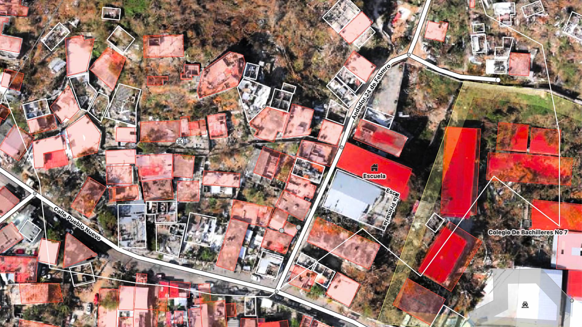
Coordination and Action: The Articulation of Humanitarian Mapping Response after Hurricane Otis
After Hurricane Otis in October 2023, the Hub LAC led a digital humanitarian mapping effort in Acapulco, identifying damaged structures and priority needs in collaboration with the national community and international organizations, highlighting the importance of participatory mapping and laying the groundwork for future mitigation actions through interinstitutional collaboration in building community resilience.
Coordinación y Acción: La Articulación de la Respuesta de Mapeo Humanitario tras el Huracán Otis
Tras el huracán Otis en octubre de 2023, el Hub LAC lideró un mapeo digital humanitario en Acapulco, identificando estructuras dañadas y necesidades prioritarias en colaboración con la comunidad nacional y organizaciones internacionales, resaltando la importancia de la cartografía participativa y sentando bases para futuras acciones de mitigación mediante la colaboración interinstitucional en la construcción de resiliencia comunitaria.