Tech HOT Spot Archive
On the Front Line of Climate Change: End-to-End Open Mapping Tech for Wildfires
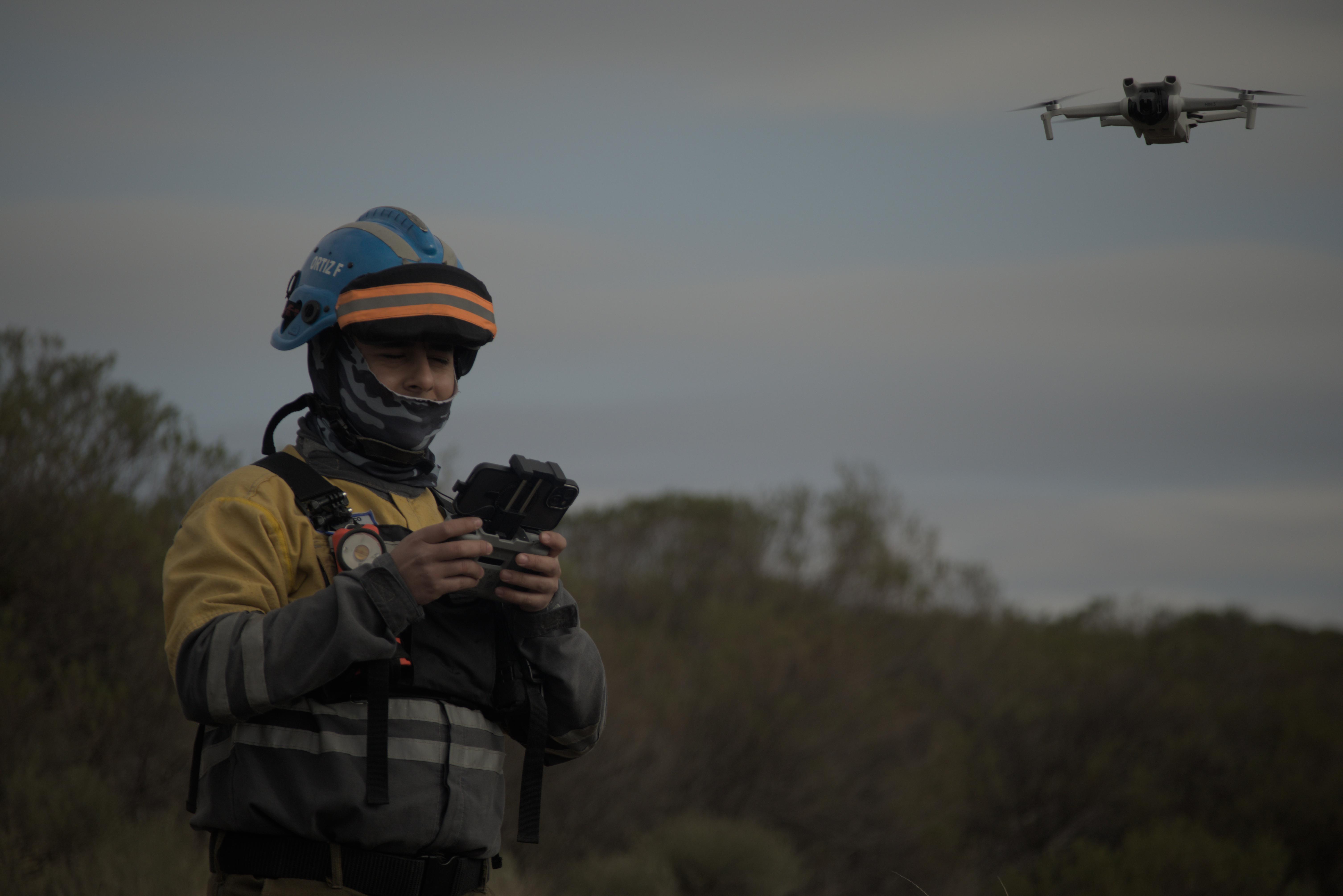
Climate change has led to an increase in wildfire season length, wildfire frequency, and burned areas around the world. The wildfire season has lengthened in many areas due to factors including warmer springs, longer summer dry seasons, and drier soils and vegetation. Given this context, people from the Alpa Corral region in Córdoba, Argentina, who want to protect our native forests and towns, met from July 26 to 28 to see how the Humanitarian OpenStreetMap Team’s End-to-End Open Mapping Tech can help people prepare themselves to face disasters together.
Juntos mapeamos para o bem: construindo o Open Drone Aerial Tasking Manager
Aproveitando drones e crowdsourcing, a DroneTM equipa pilotos locais e comunidades propensas a desastres com ferramentas para criar mapas aéreos de alta resolução, melhorando a resposta a desastres e a resiliência comunitária.

fAIr in Production is Available for Everyone
We are nearly halfway through 2024 and are excited to share some updates on HOT's AI-assisted mapping service (fAIr) - specifically the successful fAIr production release on 31 May 2024!

Training Open Mapping Tech for Wildfires in Córdoba, Argentina: Workshop in Unión de Los Ríos
On April 1 2024, we did a workshop called “Open Mapping for Inclusive and Sustainable Development. Mapping Tech in Wildland Areas: Forest Fires Edition” in Unión de Los Ríos, Córdoba, Argentina.

Our End-to-End Mapping Solution: Mapping exercise at CliGeos Summer School
In April 2024, we had the opportunity to demonstrate the power of open mapping tools and workflows at the CLImbing for CLImate GEOspatial School (CLIGEOS-2024) in Annapurna-3, Lumle-Pokhara, Nepal.

Our End-to-End Mapping Solution: Training the Balinese Disaster Response Team in Karangasem
HOT envisions an ecosystem of open mapping technology that enables everyone, and in particular vulnerable communities, to make the right open map data available in order to use that to make a positive impact on people’s lives.

Field Tasking Manager (Field-TM)
Collaboration and communication among key players are critical to a successful field mapping campaign and data collection effort. Leveraging the right tools, such as the Field Tasking Manager (Field-TM), can significantly enhance coordination and streamline communication among team members, improving field survey efforts and making them more efficient and accurate.

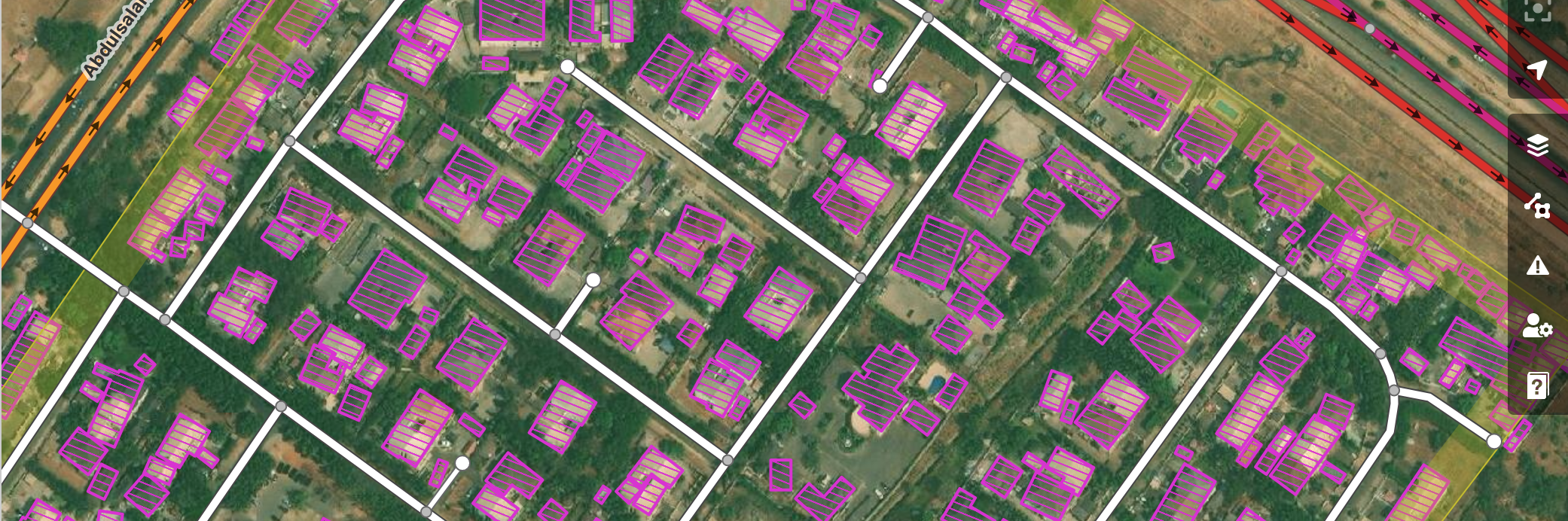
HOT Export Tool: try out the new features!
OpenStreetMap (OSM) is more than the basemap you see on osm.org or in other geospatial services. The database behind the map is full of crowdsourced spatial data with systemized tagging that translates into attributes in GIS systems. For data analysts and cartographers who want to access datasets from OSM for use in QGIS or other similar applications, HOT’s export tool just got much more helpful!

Tasking Manager: Insights from the NET Promoter Score Survey
Tasking Manager stands as a key solution in the realm of collaborative mapping, empowering users to contribute to meaningful projects on OpenStreetMap. As part of our commitment to continuous improvement of the tool, we conducted a Net Promoter Score (NPS) survey at the end of December 2023 to delve into the sentiments and experiences of our Tasking Manager users. The invaluable feedback, received from 59 users globally, has opened a window into user satisfaction, areas of strength, and opportunities for enhancement.

HOT CommunityWG x Tech&InnovationWG Communications Skillshare Series - what a blast to start the year!
THANK YOU FOR JOINING our Communications Skillshare Series!

fAIr - what to expect in 2024!
Learn about the most recent updates on HOT’s AI-assisted mapping service (fAIr) and what to expect in 2024!

Data for sustainable development: The Data Festival 2023
The Data Festival recently held in Uruguay was the opportunity for the Open Mapping Hub to introduce to organizations and institutions open cartography applications and its humanitarian approach.

Launching HOT’s responsible and ethical data framework
At the Humanitarian OpenStreetMap Team, we promote open and accessible data. What happens, though, when open data inadvertently brings attention to the location of something that could cause harm to the people in that area?

HOT Tasking Manager - Welcome to NAXA
We are very excited to announce that we will be working with NAXA, who will provide software development support for the evolution of the HOT Tasking Manager.

HOT and CDEMA sign agreement to enhance disaster management in the Caribbean with collaborative mapping
HOT and CDEMA -the Caribbean Disaster Emergency Management Agency- have signed a collaboration agreement to strengthen CDEMA's geospatial technological capabilities. Learn the details.

Changing Data Needs Through the Disaster Management Lifecycle
We’re now about a month and a half after the initial 7.7 magnitude earthquake hit Turkey and Syria on Monday, 6 February. Even though it is an ongoing emergency with vast humanitarian needs, we are now moving into a phase of continuing support to the affected communities and the start of rebuilding and reconstruction efforts where it is feasible to do. As the phase of disaster response changes, so do the data needs and data and quality requirements.

hot_tech_talk | Takeaways from our open AI challenge
Over the past few years, HOT has taken a leadership role in experimenting with, and facilitating for, the application of open-source and fair artificial intelligence in mapping. What is the status? Well, let me tell you: we are only a few months away now from launching our open AI-mapping service - fAIr. As we speak, around 50 AI engineers from the Omdena community are crunching code with us to narrow down which of the models will give the most optimal AI-assisted mapping for our communities.

hot_tech_talk | fAIr: AI-assisted mapping
Here is all you need to know about HOT’s open AI-assisted mapping service: fAIr.

Field Mapping is the Future: A Tasking Manager Workflow Using ODK (available in English, Spanish, Portuguese & French)
Field mapping by local people is key to the future of open mapping. However, the tools available for field mapping—despite many being of high quality—do not form a coherent ecosystem to unleash the potential of community field mapping. Something is missing! Could it be a Tasking Manager for Field Mapping?
.png)
Data Principles
At HOT, open mapping communities and program teams face unique challenges in how we work with data:
hot_tech_talk | Jan 22
Tldr;
Exposure Data and Models Shared with Disaster Management Stakeholders in Tanzania
The METEOR project has been a three-year initiative supported by the UK Space Agency International Partnership Programme to generate disaster exposure data and models in two pilot countries — Tanzania and Nepal. The process has since been repeated in another 45 official development assistance countries.

Mapping Makoko Using Drones and Canoes
A floating inner-city slum is in the process of being mapped to make a case for improved public services and land ownership.

GSoC 20 - Automatized support for Organised Editing Guidelines
Here is a summary from the GSoC' 20 project that adds automatized support for Organised Editing Guidelines in Tasking Manager.

Latest Tasking Manager updates
HOT released Tasking Manager 4.0 in April 2020 and since then the Tech Team is constantly improving it with new features, performance improvements and bug fixes.

How we measure the effects of AI-assisted mapping
Over the past two years, HOT has taken a leadership role in exploring and facilitating the application of the latest advances in artificial intelligence.

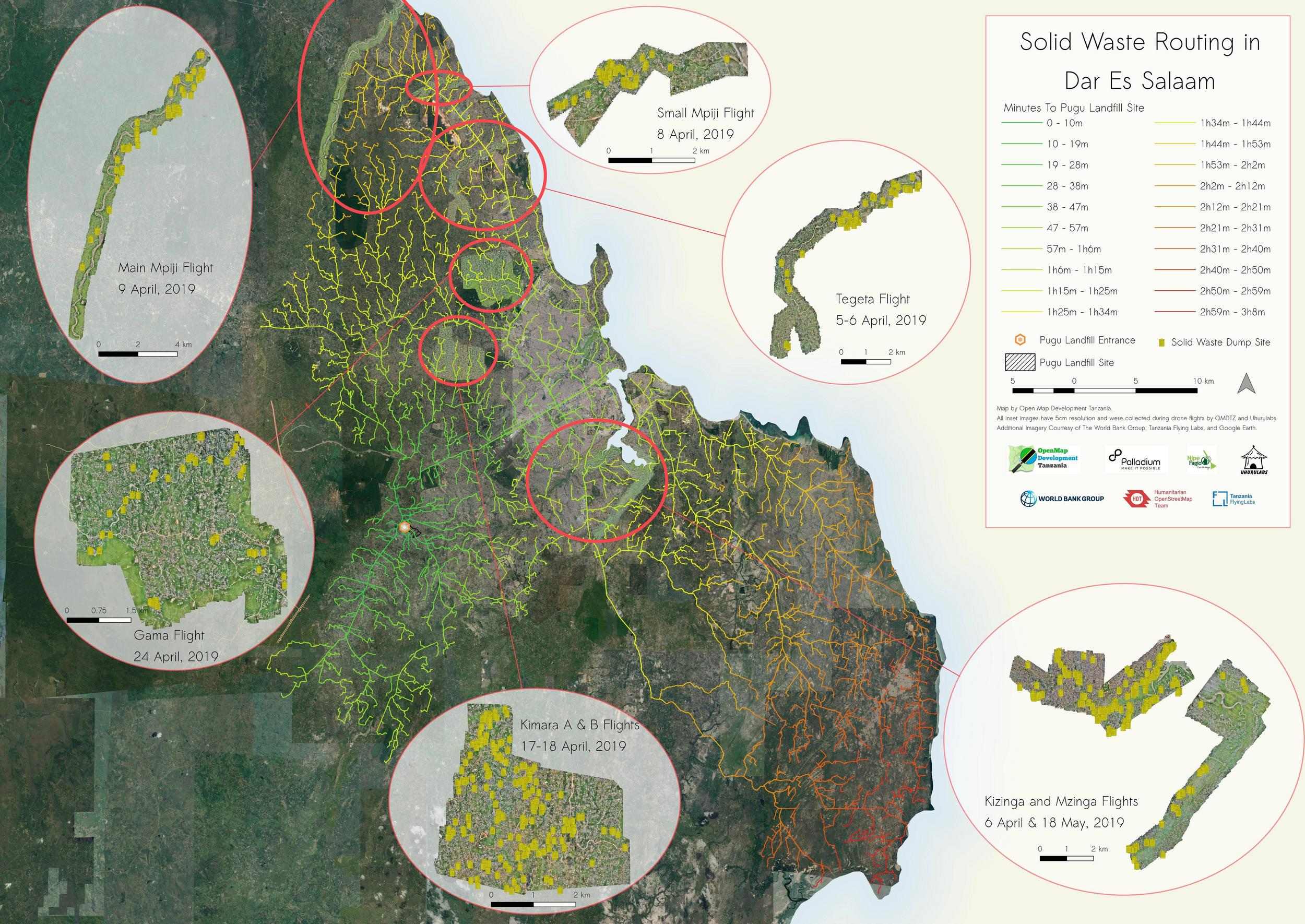
Using Open Source Tools to Solve Routing Issues for Solid Waste Collection in Dar Es Salaam
One of the biggest difficulties in establishing an effective and efficient waste management collection and transportation system in Dar es Salaam is how long it takes to travel to Pugu dumpsite, the only officially designated solid waste dump in the city, and the best route to use.
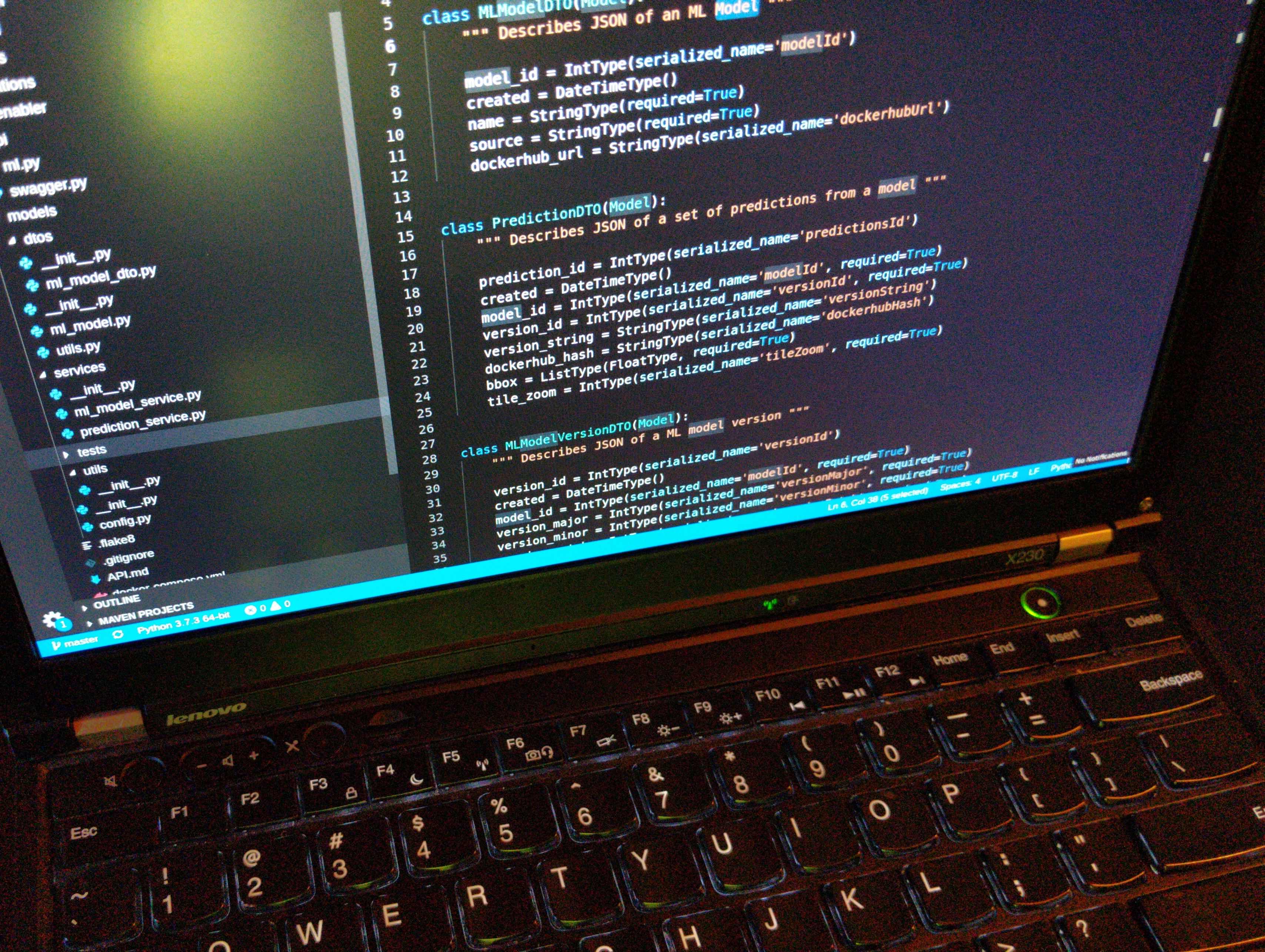
The Machine Learning Enabler
The Humanitarian OpenStreetMap Team is partnering with Development Seed, Facebook, and Microsoft to build AI-based mapping tools to empower mappers around the world. We...
Collecting building data sets for exposure data in Tanzania
Since 2018, HOT-Tanzania has been carrying out the METEOR project, a project that uses Earth Observation (EO) data to assess the level of exposure...

How #Map2020 Mappers Use Street-Level Imagery to Tackle Humanitarian Challenges
From Ghana to Zambia to the Philippines, we take a look at some of the 33 mapping projects that are taking part in #map2020 to build better maps in undermapped regions. The mapping participants are collecting street-level imagery to improve things like waste management, natural disaster response, and damaged roads, addressing some of the most pressing issues in undermapped regions.

An approach to field data collection in Kathmandu
Guest blog by Gaurav Thapa from Kathmandu Living Labs. Covering the collection process carried out by the team for surveying exposure data in Kathmandu Valley, Nepal as part of the METEOR project.

Why is it important for youth to create data and manage information?
Guest blog by Abril Gomez, student at GAL School Cusco, Peru. Aged 15.

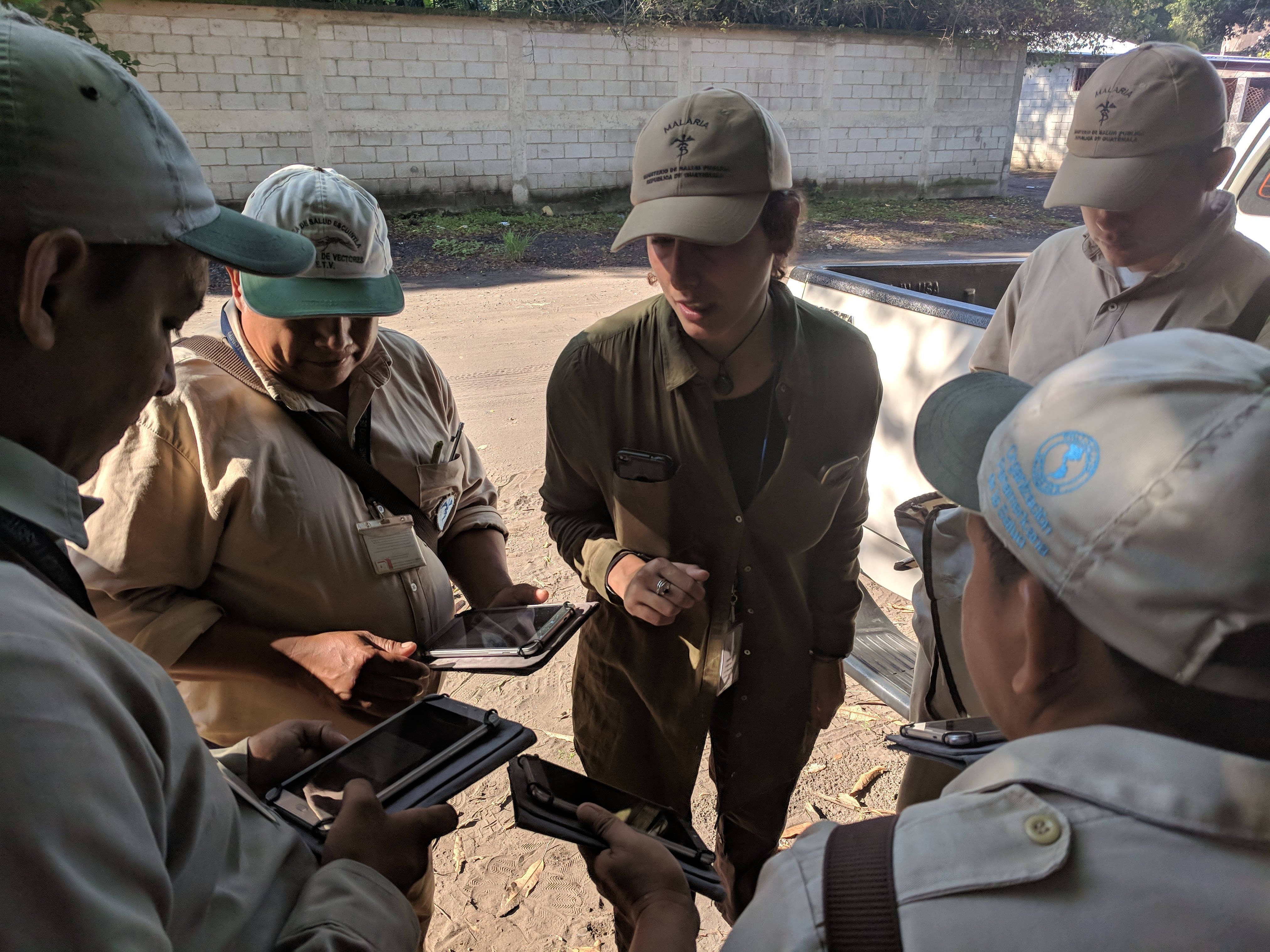
Using open source tools to eliminate Malaria in Guatemala
HOT is supporting the Clinton Health Access Initiative and the Guatemala Ministry of Health to assist local technicians who are in the field fighting Malaria in the area of Escuintla. Guatemala has provided a unique opportunity for HOT to leverage open source tools for use during indoor residual spraying to monitor progress and activities as they occur.
HOT Summit at FOSS4G 2018- Combining Communities in Dar es Salaam
This year’s HOT Summit was unique for many reasons, it was the first held in Africa and the first to be integrated into and...

HOT InAWARE Project Relocates to Mapping Lifeline Infrastructures in Semarang
By the end of 2017, HOT concluded the mapping of lifeline infrastructure in Indonesia’s capital, Jakarta. Our data entry specialists swept through 44 subdistricts...
